Toerisme Provincie Antwerpen
Dessel, Belgium
The Pond Path
5.6 km
"The earlier conversion that took place here from marshland (where peat was repeatedly cut) to meadows proved unsuccessf... read more
© Stadia Maps © OpenStreetMap contributors, © NodeMapp
Put on your hiking shoes and discover the most beautiful hiking routes in Donk (Mol)! You will also see all places where hiking nodes are currently available.
Below you will find the latest hiking trails in Donk (Mol) offered by official tourism organisations or by verified users of our platform.
Pathfinders are hikers who share their hiking adventures in Donk (Mol) with you.
Looking for an adventure? Try our 'Surprise Me' feature! Enter your preferences below, and we will suggest a number of hikes using the hiking nodes in Donk (Mol). The routes are calculated in real-time using the hiking node network.
5.6 km
"The earlier conversion that took place here from marshland (where peat was repeatedly cut) to meadows proved unsuccessf... read more
10.5 km
"The Groesgoorpad" is a walk of +/- 10.5 km in the natural east corner of Dessel. Once you cross the canal, you are in t... read more
3.3 km
The walk recreates the beautiful trail around the Mol Heath. This hill was originally a landfill "t Oud Stort" which was... read more
5.5 km
Poplar plantings and sprite pits currently define the look of The Maat. With any luck, you may encounter Scottish highla... read more
7.8 km
This walk goes along the canal from Bocholt to Herentals and along the Vercammen ponds. Dessel can rightly be called a n... read more
8.9 km
Dessel is best known for the Graspop Metal Meeting (also simply called Graspop or GMM(xx)). It is an annual multi-day me... read more
6.9 km
We did this walk on 02-20-2025. This route was offered in February 2025 by VisitMol.be as a Valentine's walk with an add... read more
15.9 km 4/5
Beautiful varied loop walk that starts at the 'Mol' station. During this walk, which alternates between paved and unpave... read more
8 km
Achterbos, a picturesque hamlet in the Belgian municipality of Mol, offers a beautiful and diverse hiking experience. In... read more
6.6 km 3.5/5
We have called this beautiful varied walk 'Mol Zuiderring - Molse Nete' because it takes the hiker quite a distance alon... read more
7.6 km
We parked the car on Kanaalstraat in Mol Ginderbuiten and immediately entered the beautiful forest to take a detour to M... read more
8.6 km
This route starts at the church of Witgoor. It takes the walker past the Pinken Quarry to the Dessel-Schoten Canal. In 2... read more
10.7 km 4/5
This route is partly "not" signposted! You can park along the N103 in Ezaart. The walk begins with a short stretch along... read more
7.9 km 4/5
Heidehuizen offers a wonderful and varied hiking experience. It is one of the twelve hamlets of Mol, located in a wooded... read more
8.9 km 5/5
We took this hike on 15/02/2026 (12,898 steps). This wooded route partially goes through the 'Oude Bleken' area. The nam... read more
7 km
Beautiful nature walk that mainly takes place through the forest. Millegem is one of the twelve hamlets of the Belgian m... read more
12.4 km
The route starts at the Zanddijk cemetery in Dessel, but it mainly runs over the territory of Retie. Retie is known as t... read more
11.9 km 4/5
This is a surprisingly beautiful and varied walk. We parked the car in the large parking lot of the Dessel Boshoek cemet... read more
The Route Planner Pro has changed a bit on our new website. The ability to plan routes that deviate from the hiking network is now integrated into our node planner (continue reading below image):
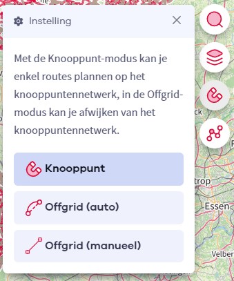
If you open our route planner, you can press the magnet symbol in the upper right corner. If you then choose Offgrid (auto) (automatic route planning) or Offgrid (manual) (connecting places manually), you can select places on the map and plan a route that deviates (partially or completely) from the hiking network.
You can switch between Node and Offgrid mode to create a route that runs partly along nodes and partly away from the node network.
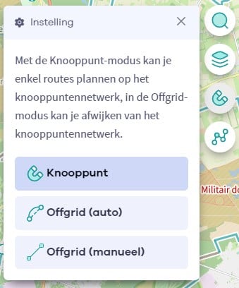
The Route Planner Pro has changed a bit on our new website. The ability to plan routes that deviate from the bicycle network is now integrated into our node planner (read more below image):

If you surf to our route planner, you can press the magnet symbol in the upper right corner. If you then choose Offgrid (auto) (automatic route planning) or Offgrid (manual) (connecting places manually), you can select places on the map and plan a route that deviates (partially or completely) from the biking network.
You can switch between Node and Offgrid mode to create a route that runs partly along nodes and partly away from the node network.
Are you sure you want to log out?
With this QR-code or text code you can login to our app. Open the login screen of the NodeMapp Hike app or NodeMapp Bike app and press the button with the QR-code. In the same screen, you can also enter the text code (case sensitive!) if you prefer.
Time remaining to log in with this code:
01:00