Visit Limburg
Hechtel-Eksel, Belgium
Cycling through the Trees in Woodland
38 km 4/5
This flat bike ride through the largest continuous forest area in Flanders, shows you the best of Bosland. In the shade ... read more
© Stadia Maps © OpenStreetMap contributors, © NodeMapp
Below is a list of biking routes in Bosveld (Hechtel-Eksel). You will also see all the places where there are currently bike nodes available. Hop on your bike and discover the most beautiful cycling routes!
Below are the latest cycling routes in Bosveld (Hechtel-Eksel) offered by official tourism organisations or by verified users of our platform.
Pathfinders are cyclists who share their cycling adventures in Bosveld (Hechtel-Eksel) with you.
Looking for an adventure? Try our 'Surprise Me' feature! Enter your preferences below, and we will suggest a number of cycling routes using the cycling nodes in Bosveld (Hechtel-Eksel). The routes are calculated in real-time using the cycling node network.
38 km 4/5
This flat bike ride through the largest continuous forest area in Flanders, shows you the best of Bosland. In the shade ... read more
80 km 2.5/5
This route takes you from Bosland National Park to the green Limburg mining region in the middle of the province. After ... read more
54.2 km
This mostly flat bike loop takes you along canals and sand, through rural villages and shady forests.
52.7 km 5/5
From Lommel today you cycle through the fragrant pine forests. You will discover Bosland, a mighty nature reserve that g... read more
62.5 km 4.5/5
This flat cycling loop takes you along canals and sand, over the flat countryside with a variety of views, and through t... read more
43.6 km 3.9/5
You start at the station of Neerpelt for a flat bike route and cycle through the center of Overpelt to Hechtel-Eksel. On... read more
60.2 km 4.2/5
Discover the impressive mining heritage and child-friendly domains of De Wijers. Along the way you pass woods, moorlands... read more
49.7 km 5/5
The monumental be-MINE is your starting point for a trip through the mining past. From the coal laundry, you go along th... read more
60.5 km
From green slag heaps to forest cathedrals: this route lets you discover how the mining industry, nature, and history ha... read more
36.5 km 4.8/5
From Balen go cycling through the trees! 'Cycling through the trees' in Bosland is a unique cycling experience where you... read more
134.4 km
Two days? Two top experiences! Day one takes you to 'Cycling through Water' in Bokrijk. You start at junction 91 where y... read more
121 km
The Kempen Route connects Terhills, gateway to Hoge Kempen National Park, with the city of Antwerp. Along the former Lim... read more
80 km
Stage 5 of 6: past De Spaanjerd marina and the Maasplassen lakes, we warm our legs again. The longest stage takes us thr... read more
211.9 km
The Kempen Route connects the city of Antwerp with Terhills, the gateway to Hoge Kempen National Park. In the province o... read more
52.2 km 5/5
This bike ride starts near Beverlo station, where you will find ample parking. The ride takes you through Gerhees, Schoo... read more
78.5 km
My enthusiasm for cycling started in Limburg, full of forests, heathland, and cycle paths. We set off from the station t... read more
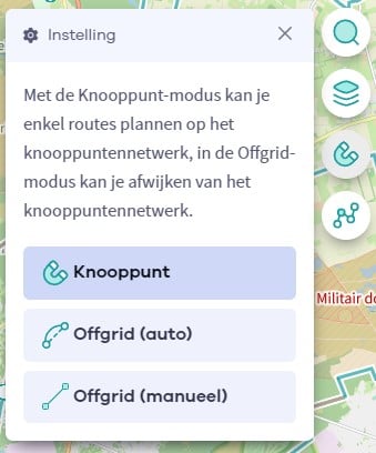
The Route Planner Pro has changed a bit on our new website. The ability to plan routes that deviate from the hiking network is now integrated into our node planner (continue reading below image):
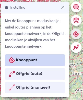
If you open our route planner, you can press the magnet symbol in the upper right corner. If you then choose Offgrid (auto) (automatic route planning) or Offgrid (manual) (connecting places manually), you can select places on the map and plan a route that deviates (partially or completely) from the hiking network.
You can switch between Node and Offgrid mode to create a route that runs partly along nodes and partly away from the node network.
The Route Planner Pro has changed a bit on our new website. The ability to plan routes that deviate from the bicycle network is now integrated into our node planner (read more below image):

If you surf to our route planner, you can press the magnet symbol in the upper right corner. If you then choose Offgrid (auto) (automatic route planning) or Offgrid (manual) (connecting places manually), you can select places on the map and plan a route that deviates (partially or completely) from the biking network.
You can switch between Node and Offgrid mode to create a route that runs partly along nodes and partly away from the node network.
Are you sure you want to log out?
With this QR-code or text code you can login to our app. Open the login screen of the NodeMapp Hike app or NodeMapp Bike app and press the button with the QR-code. In the same screen, you can also enter the text code (case sensitive!) if you prefer.
Time remaining to log in with this code:
01:00