Biking
 Login
Login
 More
More
 EN
EN
 Premium
Cycling through the woods from be-MINE
automatic translation
60.5 km • beMINE Beringen
 official route
35.48143 0 0/5
route offered by

 Addresse starting point (approximate)
Koolmijnlaan 201 Beringen
 signage
The route is fully signposted with nodes.
 Description
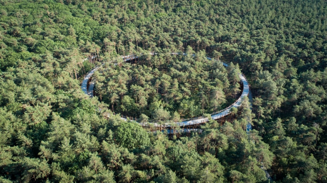
From green slag heaps to forest cathedrals: this route lets you discover how the mining industry, nature, and history have been inextricably linked for over a century. You’ll set off from the impressive be-MINE mining site and cycle past slag heaps, quiet stream valleys, and vast pine forests that once provided the timber for the underground mines. In Bosland National Park, you’ll experience nature at its finest, with “Cycling Through the Trees” as the highlight. Along the way, you’ll also delve into Leopoldsburg’s military past and the story of Europe’s liberation at Liberation Garden. Mining heritage, migration, war, and biodiversity blend seamlessly together, making this tour much more than just a scenic bike ride. Here, you’ll discover how the past is still visible in today’s landscape.
automatic translation
 nodes to follow
0 km
2.3 km
9.2 km
11.6 km
16.1 km
18.3 km
18.3 km
19.7 km
21.2 km
27.2 km
27.3 km
27.6 km
28 km
28.1 km
31.4 km
35.3 km
38.4 km
38.6 km
39.3 km
43.5 km
48.7 km
49.2 km
52.2 km
52.3 km
58.1 km
58.6 km
60.5 km



 Upgrade to Premium Plus