 Biking
 Login
Login
 More
More
 EN
EN
 Premium
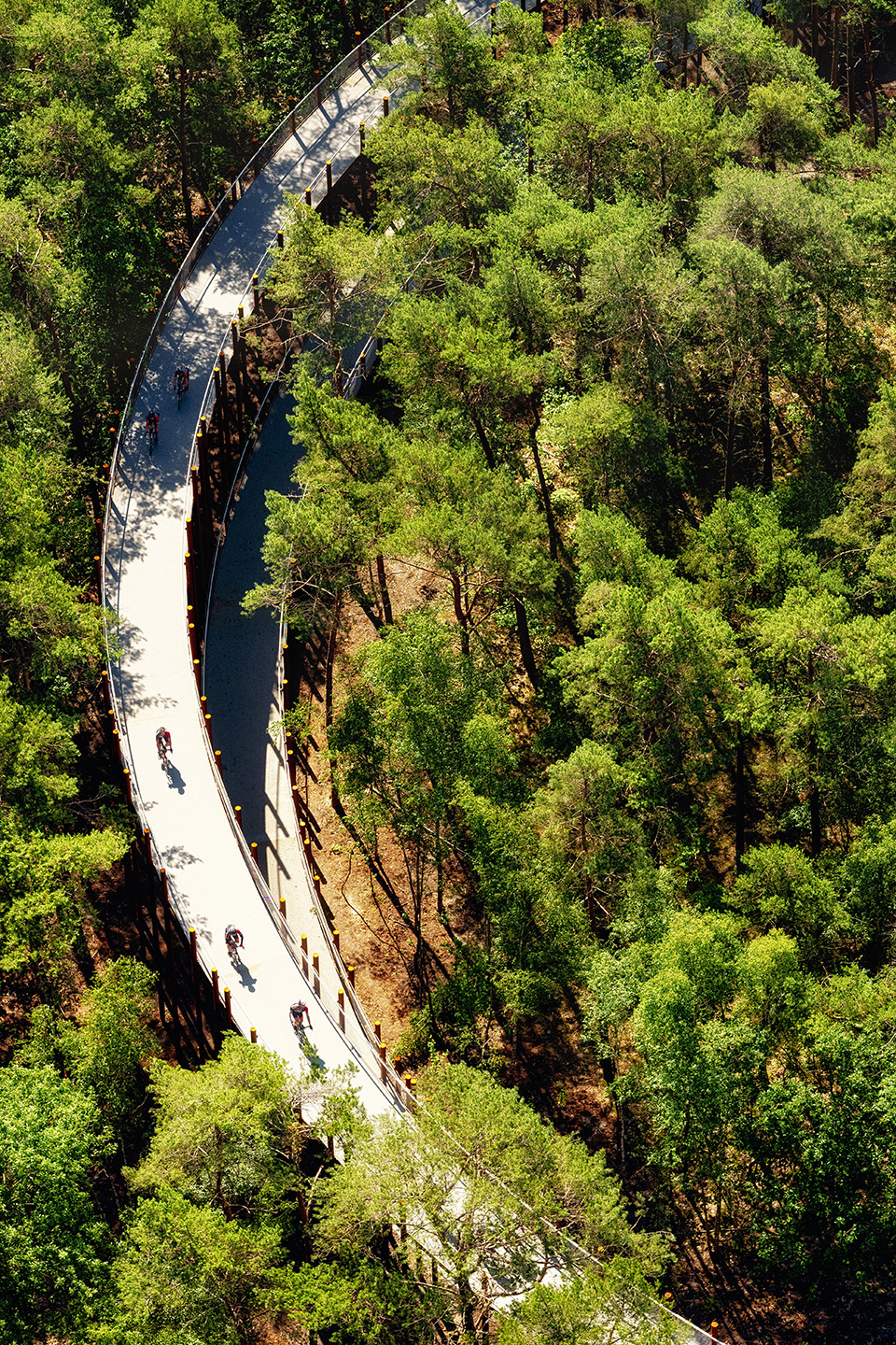
Across the treetops of Woodland
automatic translation
62.5 km • Hechtel-Eksel
 official route
5.62926 1 4.5/5
 Addresse starting point (approximate)
Kiefhoekstraat 16, 3940 Hechtel-Eksel
 signage
The route is fully signposted with nodes.
 Description
This flat cycling loop takes you along canals and sand, over the flat countryside with a variety of views, and through the many forests that provide a refreshing bit of green in the summer and beautiful colours in the autumn. You cycle through the rural landscape of the far north of Limburg; the Dutch border even pops up here and there. Bosland is the largest contiguous woodland area in Flanders. Here, you can cycle for hours through endless forests or get off your bike for a walk. You cycle right through the treetops at junction 272!
automatic translation
 nodes to follow
0 km
1.8 km
3.6 km
5.1 km
8.4 km
13.2 km
14 km
15.3 km
15.4 km
15.9 km
16 km
16.5 km
16.6 km
18.7 km
23.6 km
25.6 km
27.3 km
30.3 km
35.6 km
41 km
47 km
47.1 km
47.4 km
47.7 km
47.9 km
51.2 km
55 km
57.3 km
58.7 km
59.1 km
62.2 km
62.5 km


 Upgrade to Premium Plus
