 Hiking
 Login
Login
 More
More
 EN
EN
 Premium
No man's land hiking trail
automatic translation
11.2 km • Sint-Gillis-Waas
 official route
10.33126 7 4.4/5
 Addresse starting point (approximate)
Bareel 37, 9170 Sint-Gillis-Waas
 signage
The route is fully signposted with nodes.
 Description
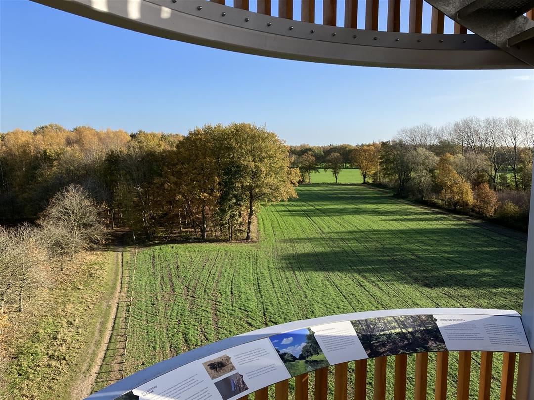
Right on the Belgian-Dutch border in Waasland, a watchtower rises twenty meters high above a historic strip of "no man's land. Add to that the Waterwinbossen, the Stropersbos and a touch of war history, and you get an absolute top hike.
The Niemandsland walking route is offered to you by Routen, an initiative of Tourism East Flanders.
automatic translation
 nodes to follow
0 km
0.1 km
0.7 km
1.3 km
2.2 km
2.5 km
2.9 km
3.2 km
3.7 km
4.8 km
5.7 km
6.3 km
7 km
7.3 km
8 km
8.3 km
10.1 km
10.5 km
11.2 km
Sunday, February 8, 2026 by Christophe Van VaerenberghVery nice walk, mainly on Dutch territory. Two minor drawbacks: the start of the walk is difficult to find; go to the sports field near a bike path (leave Bareel 37 on your right and walk through the green posts). On the bike path, turn right until you reach the edge of the forest at no. 78. The signage in the Netherlands is not ideal; bring your cell phone!
automatic translation
Saturday, May 17, 2025 by kathy van der haeghenVery nice hike, the kids enjoyed it. Beautiful nature and huge view from the tower 🥰.
automatic translation
Thursday, May 8, 2025 by Dave CamusBeautiful hike. Keep in mind loose sand. No drinking establishments on the route.
automatic translation
Sunday, February 2, 2025 by Herman Van den ReeckA very nice walk in the border region around Hulst with lots of forest, creeks and mainly unpaved trails. Nice café 'de oude statie' near the starting point. A bit difficult to find parking on a sunny Sunday. The cyclist is king here.
automatic translation
Friday, December 27, 2024 by Sven Van Landeghem Very nice walk! Departure and end near "the old station" where you can eat or drink something. The watchtower is a must!
automatic translation
Saturday, May 27, 2023 by E.P.I did not walk the whole route, from 70 I walked to 96. This is a beautiful route, going through the woods a lot, highly recommended! I will also definitely walk the whole route again. 2 tips: 1) Between 92 and 62 is still junction 91. 2) You often pass the border between NL and B. That's why the signs change (B red white, NL much smaller green yellow).
automatic translation
Sunday, February 26, 2023 by C.P.Very nice hike on the Belgian-Dutch border! Beautiful piece of nature; very peaceful hiking! The watchtower is a plus, especially in nice weather.
automatic translation


 Upgrade to Premium Plus
