 Hiking
 Login
Login
 More
More
 EN
EN
 Premium
Balen Sand Dunes
automatic translation
15.7 km • Balen
2.8724 5 4.5/5
route offered by
Toerisme Provincie Antwerpen
 Addresse starting point (approximate)
Keiheuvel, 17e Escadrille Licht-Vliegwezenlaan 14, 2490 Balen
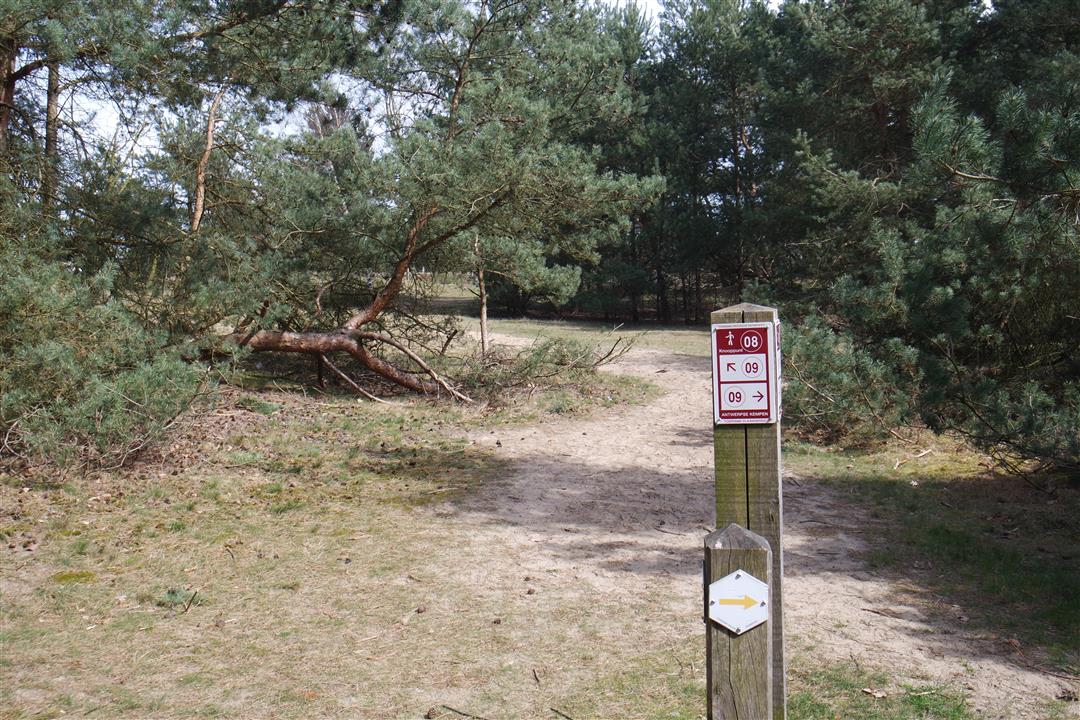
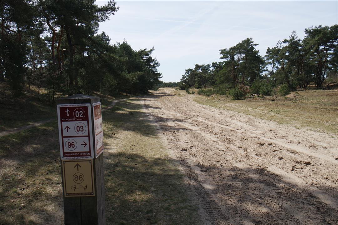
 signage
The route is fully signposted with nodes.
 Description
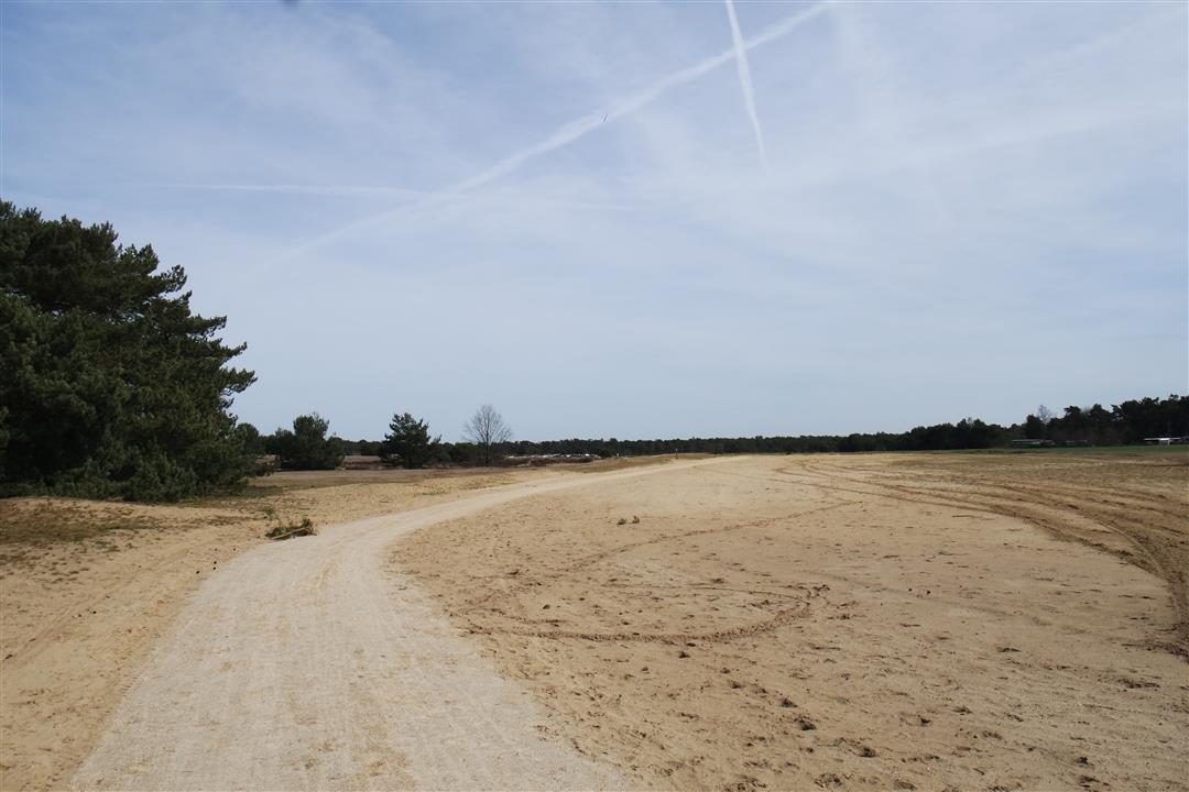
The start of this route is located at Recreation and Nature Park Keiheuvel in Balen. The name of the hiking network (Kempense Landduinen) says it all: dunes appear here and there in the landscape, remnants of ancient drift dunes. You pass beautiful stretches of nature and surprisingly quiet spots.
Here you will discover the Antwerp Kempen at its best: you will see that dunes are not only to be found by the sea. The first part of the hike runs through the Keiheuvel nature reserve, where you will see the occasional glider launching or landing over the beautiful landscape. This protected area contains valuable plants and animals in a beautiful landscape. A few miles further on you'll hike through De Most, a wet valley area that contrasts with the dry land dunes you've just discovered. In wet weather it can be swampy here; we did the hike on a dry day and this was quite doable.
Adapted footwear, especially after a wet period, is recommended. After about 7 km of walking you come to Kerkhoven where you can deviate briefly from the route and cross the bridge over the canal to Beverlo, surrounded by peace and quiet. On the other side of this canal is an extremely cozy resting place: Restaurant Taverne de Waterkant. Then you walk back along the canal and past meadows and forests towards Keiheuvel.
automatic translation
 nodes to follow
0 km
0.5 km
1.3 km
1.6 km
2 km
2.6 km
3.2 km
4.3 km
5.2 km
6.1 km
7.5 km
7.6 km
8.4 km
9.3 km
9.8 km
12.5 km
13.7 km
14 km
14 km
14.7 km
15.1 km
15.9 km
Sunday, April 18, 2021 by Ilse CornelissensLovely walk! Beautiful area, we made them a little longer, up to 23km. Definitely recommended to do once.
automatic translation
Sunday, December 13, 2020 by Ludo BelmansBeautiful nature hike with lots of variety. Definitely recommended. First 5 km bit heavier due to the loose dune sand.
automatic translation
Sunday, November 29, 2020 by I.V.A beautiful walk. Only a tip node 162 does not exist because it is node 13.
automatic translation
Sunday, September 27, 2020 by I.C.nice hike, just a little searching at the beginning for the signs or the right direction.
automatic translation
Wednesday, September 16, 2020 by Peter BreugelmansFantastic hike with lots of variety. Absolutely recommended
automatic translation


 Upgrade to Premium Plus
