 Hiking
 Login
Login
 More
More
 EN
EN
 Premium
Ypres Arch
automatic translation
12.8 km • Ypres
 official route
9.87315 11 4.5/5
route offered by
 Addresse starting point (approximate)
Palingbeekstraat 18, 8902 Ieper
 signage
The route is fully signposted with nodes.
 Description
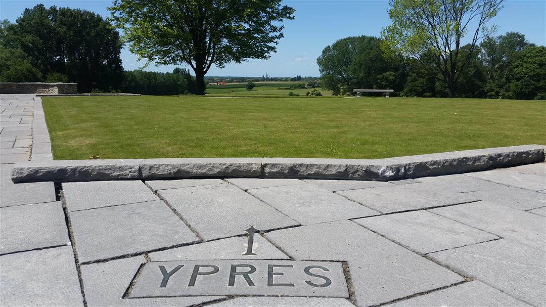
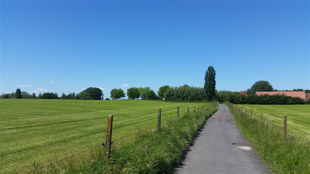
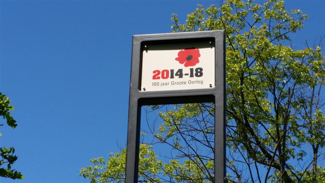
There is a unique atmosphere during this route: the Great War is never far away here. The landscape is still marked by this catastrophic event more than 100 years ago. You will come across a number of places that will make you spontaneously quiet, it is a beautiful and varied walk. The route starts at hiking node 15 on the Palingbeek. There is ample parking here. The route winds its way through a culturally and historically rich, green landscape south of Ypres.
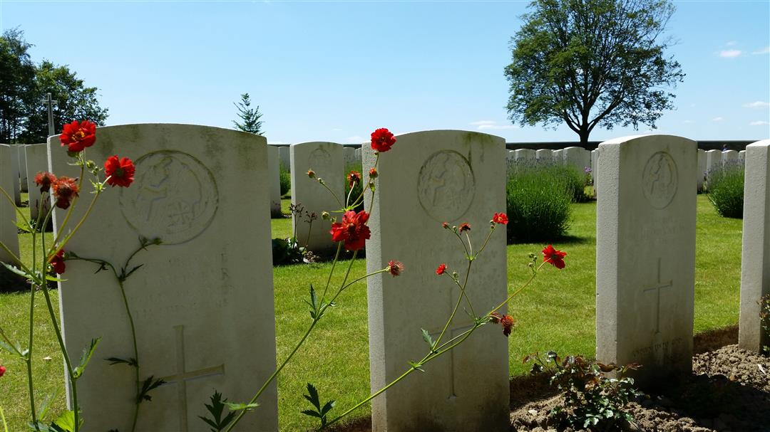
You start at junction 15 where you take the first part of the route through a beautiful provincial domain: De Palingbeek. During World War I, the Palingbeek was at the front of Ypres Arch. In the first kilometers of the route you walk along beautiful roads with wide views. Through the Groeneburg forest you arrive after 5.5 kilometers of walking at Hill 62: a 62 meter high hill where the Canadians lost many men during WW1. It is a beautiful place where you also have a nice view of Ypres. A little further along the route you will come to the "Sanctuary Wood Museum. You can visit the museum and have a drink. Then you will find the 'Sanctuary Wood Cemetery,' a British military cemetery.
The route winds further along the beautiful landscape, and you even walk through a meadow with cows. After 10 km you walk past Hill 60. This 60-meter-high hill was the scene of some heavy battles during World War I. At the foot of Hill 60 is the eponymous restaurant - tearoom where you can relax with a snack and a drink. Then you step the last 2 km of this beautiful route and arrive back at provincial domain De Palingbeek.
automatic translation
 nodes to follow
0 km
0.5 km
1.7 km
1.8 km
2 km
2.6 km
4.4 km
4.5 km
5.3 km
5.5 km
5.6 km
6.9 km
7.2 km
8.4 km
9.6 km
10.6 km
11.6 km
12.1 km
12.4 km
12.5 km
12.7 km
Thursday, May 29, 2025 by Jan De visHighly recommended, also fun to do the other way around, some junctions have been added so update required
automatic translation
Monday, April 15, 2024 by H.C.Super nice hike with lots of variety. Some places were real mud pools due to the heavy rainfall of the past period. So it was slogging but despite that we thoroughly enjoyed the beautiful views and peaceful surroundings!
automatic translation
Monday, August 16, 2021 by Michel GallettiVery nice walk ! A bit shortened because of the kids but worth it. Free parking next to Hill 60 and hiked from there to Hill 62. Good to do in summer with normal shoes but in autumn and winter walking shoes or boots will be necessary. Beautiful scenery, bits of forest, fields...highly recommended !
automatic translation
Saturday, July 31, 2021 by bert rouckhoutbeautiful no more or less
automatic translation
Sunday, June 13, 2021 by Alain SchauvaertsLarge parking lot at the Palingbeek domain.
Beautiful walk through woods and fields and an ideal alternation between paved and unpaved.
WW1 is never far away and makes you think (highly recommended with young children).
automatic translation
Tuesday, April 27, 2021 by Rudi VanhoorenStart/stop provided with ample parking. Hike is a mix of terrain, sometimes a bit along the road, but not disturbing. Joris Van den Bossche's tip to extend the route definitely recommended. (24-23-22-21-19-20-1-2-75-15). A little longer but worth it.
automatic translation
Monday, April 5, 2021 by Karen De ClercqVery nice hike, ideal alternation between paved and unpaved. Everything very clearly marked.
automatic translation
Saturday, February 27, 2021 by William KlinkenbergAmple parking. Nice variety of landscapes (forest and rolling fields). Pity about some busy or built-up sections : 70-44 halfway on dangerous winding 2-lane road and a stretch to 28 through built-up areas) but difficult to avoid. One idea is to do the route in reverse order and " save the best for last "!
automatic translation
Saturday, January 23, 2021 by C.V.wonderful walk, lots of variety mixed with historical aspects, also nice for the children, they see here what the soldiers, often no more than children, had to go through in their young lives. We did the hike in January on a very cloudy day. Certain parts are very muddy but actually everything is not too bad.
automatic translation
Sunday, November 22, 2020 by S.V.Beautiful walk through forests and fields. History is never far away with poignant relics of the 1st WW.
automatic translation
Monday, October 12, 2020 by Joris Van den BosscheSpacious parking at the Palingbeek domain, ideal start/stop. Route goes through forest, field and on roads (with some traffic). A tip is towards the end to weld in the junction 20 to 1 (e.g. 24-23-22-21-19-20-1) and then via 1-2-75 back to 15. More miles but 20 to 1 is nice.
automatic translation


 Upgrade to Premium Plus
