 Hiking
 Login
Login
 More
More
 EN
EN
 Premium
Four-brook walk (long)
automatic translation
9.7 km • Dilbeek
5.5708 6 4.4/5
route offered by
Toerisme Dilbeek
 Addresse starting point (approximate)
Dorpsplein 5, 1700 Sint-Martens-Bodegem (Dilbeek)
 signage
The route is signposted with thematic signs (no nodes). You can use a GPS device or our app to follow the route through the virtual nodes.
 Description
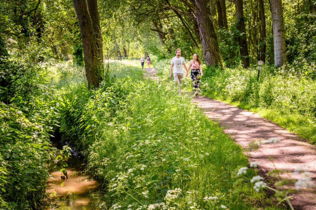
This beautiful nature walk starts at the authentic Huisje Mostinckx and leads you almost exclusively along slow roads. The walk owes its name to the Zierbeek, the Zibbeek, the Plankenbeek and the Doornbeek which spring from the hillside between Schepdaal and Sint-Martens-Bodegem and flow into the Molenbeek. They are often hidden in the greenery of trees and abundant riparian vegetation, but the stream valleys are cherished as green corridors for fauna and flora and for hikers.
Mainly unpaved roads and sometimes narrow trails, but accessible to "all terrain" - strollers.
The walk is signposted with the white, hexagonal signs.
The walk can also be shortened to 4.6 km. The shortening is also signposted.
This walk is offered by the municipality of Dilbeek
automatic translation
 nodes to follow
0 km
1.4 km
1.9 km
2.7 km
3.5 km
3.9 km
4.8 km
5.9 km
6.2 km
7.9 km
8.1 km
8.8 km
9 km
9.7 km
9.8 km
Alternative versions
Sunday, March 22, 2026 by Vanessa ThienpontA lovely walk through the fields—anyone looking for some peace and quiet should definitely give it a try.
The signage is excellent.
automatic translation
Monday, August 15, 2022 by Yasmin VdCFine hike! Clearly marked with possibility of shortening (Short loop) if you get tired along the way. Approximately 50-50 paved-not paved. In heat beware because little shade!
automatic translation
Monday, May 23, 2022 by Luc VanderkelenVery nice hike, quiet, train disturbs a little but they must be there too. Hiking trails well maintained. Well signposted. Good parking at the starting place. Definitely recommended.
automatic translation
Monday, December 13, 2021 by P.G.Wonderful hike , especially with a larger group .
automatic translation
Sunday, June 20, 2021 by Hilde VdVAfter last night's downpour, this hike was a muddy course which makes sense with many streams in the lower sections. Nevertheless, this is recommended with varying vegetation of forests, fields and meadows. Proximity and noise of busy railroad is not a disadvantage for us but an adventure. Excellent signage.
automatic translation
Friday, April 9, 2021 by J.D.very nice, quiet walk in a beautiful region,definitely recommended
automatic translation


 Upgrade to Premium Plus
