 Hiking
 Login
Login
 More
More
 EN
EN
 Premium
Steenbergse Bossen hiking trail
automatic translation
5.9 km • Zottegem
 official route
9.91518 12 3.9/5
 Addresse starting point (approximate)
Kruiswaterplein 1, 9620 Sint-Goriks-Oudenhove
 signage
The route is fully signposted with nodes.
 Description
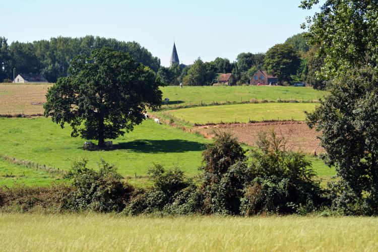
Depart from the picturesque Sint-Goriks-Oudenhove towards the Steenbergse Bossen nature reserve. A varied walk with numerous unpaved exclusive hiking trails. Also stop at coffee roaster Hoorens in Sint-Maria-Oudenhove.
TheSteenbergse Bossen walking routeis offered to you byRouten, an initiative of Tourism East Flanders.
automatic translation
 nodes to follow
0 km
0.2 km
0.6 km
2.6 km
3.3 km
3.6 km
4.8 km
5.6 km
5.7 km
5.8 km
Saturday, April 25, 2026 by M.B.A beautiful route. A few narrower paths with nettles. There are also some elevation changes.
automatic translation
Wednesday, June 25, 2025 by Twan van Valkengoedlovely walk. don't assume it's a city walk. narrow path with with nettles. but if you don't hold that back, it's a lovely 6km we this i walked about 2utes.
automatic translation
Saturday, June 21, 2025 by Herman Van den ReeckVery nice route with little asphalt, but still for the experienced hiker. What you should definitely have : good walking shoes, good balance and in summer rub in against mosquitoes and gnats. Even in dry periods, the stretch between kn. 35 and kn. 53 is humid (springs area) (N.B. we did the hike in the opposite direction).
automatic translation
Thursday, February 29, 2024 by N.D.Hiking after rain = not recommended. Very muddy and dangerous ! Got stuck in a pit up to the knee myself - scary. Had to walk on a field several times - crawl through barbed wire.... So start this hike only after a long dry period !
automatic translation
Monday, August 15, 2022 by Henri Van de slijke"Very nice varied hike, lots of unpaved roads. Through a picturesque forest varied with beautiful views. Highly recommended" someone wrote...We can certainly agree with that. Just after point 53 the little road was not passable but we could walk on the stubble field.
automatic translation
Saturday, May 21, 2022 by B.C.05/2022 Very nice varied hike, many unpaved roads. Through a picturesque forest alternating with beautiful views. Highly recommended !
automatic translation
Monday, May 10, 2021 by Archibald HaddockA hike that offered a lot of great views. Even after a week of rain, the mud was not too bad. We had to watch out for the 200 meters after junction 53. There you walk on a narrow and very uneven path between two fields. The path is fenced off on both sides with barbed wire. Best not to stumble, it will certainly cost you a few scratches!
automatic translation
Saturday, December 26, 2020 by Caroline De CockQuiet environment and good alternation between quiet and paved roads. But indeed firm shoes with grip needed, because can be slippery
automatic translation
Saturday, December 19, 2020 by D.D.short but undulating hike..quietly stepping among green landscapes...hiking boots definitely recommended as muddy patches along the way
automatic translation
Wednesday, December 2, 2020 by Lena FaictVery nice hike, many small paths with the accompanying bogs. Here and there it is better to move up 1 meter and step through the meadow.
automatic translation
Wednesday, November 11, 2020 by B.N.Beautiful route but muddy and slippery in the fall, especially from node 35. A stick and shoes with good grip are needed here. Quiet between fields. Sloping at times though.
automatic translation
Friday, October 23, 2020 by D.V.Wonderful nature hike. Lots of variety, mainly "slow roads", beautiful landscapes. Due to the ascending and descending you can still count on an hour and a half.
automatic translation


 Upgrade to Premium Plus
