 Hiking
 Login
Login
 More
More
 EN
EN
 Premium
Brakel forest hiking trail
automatic translation
10.9 km • Brakel
 official route
8.26510 10 4.1/5
 Addresse starting point (approximate)
Sint-Martensstraat 6, 9660 Brakel
 signage
The route is fully signposted with nodes.
 Description
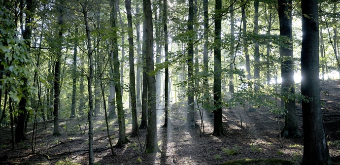
Quiet walk in the hiking community par excellence: Brakel. Close to the language border, here you can discover the famous Brakel forest. The sources of the Zwalm are never far away and provide a real gem of nature.
TheBrakelbos hiking trailis offered to you byRouten, an initiative of Tourism East Flanders.
automatic translation
 nodes to follow
0 km
0.5 km
1.4 km
2.1 km
3.4 km
4.2 km
7.1 km
7.5 km
9.1 km
10.8 km
Saturday, October 18, 2025 by Sarah VanhackeNice hiking trail for those who want to combine views and forest. Best to put on good walking shoes. It can be very muddy at times. Very pleasant during autumn with the beautiful colors and scents!
automatic translation
Monday, April 11, 2022 by Brigitte Nottenice walking route, bit through the beautiful Brakel forest, although this time I went for the wood hyacinths. These were not to be seen on this route. We walked -when I checked later with the nodes- completely away from them. After node 51 you should also be able to insert node 6 into your route, then you do pass it. Here you go from 51 to 33.
automatic translation
Sunday, October 10, 2021 by A.T.Nice walk in rolling and beautiful landscape. No problems with the signposting but be careful : junction 30 is difficult to see from the street, I passed it but quickly realized it. However, it is on the left of the corner café. Highly recommended.
automatic translation
Monday, June 21, 2021 by Gabrielle Van Der VoordeNice walk but went wrong 3x and far ... I still found that the signage was not optimal .... also I never entered the Brakelbos .... did cover 3 km more than long walk ...
automatic translation
Saturday, March 27, 2021 by J.V.super nice trail, beautiful panoramas and super weather. only a lot of mud and wet feet, although we had very good goretex hiking boots. But we will definitely go back that way. Jos and Rita 27/3/21
automatic translation
Sunday, February 28, 2021 by D.D.Wonderful of a varied beautiful hike! Best not after heavy rain. Indeed as mentioned in previous reviews, best to provide waterproof, mud-resistant footwear. Even if only for short stretches.
automatic translation
Sunday, January 3, 2021 by Wim De donckerVery nice route with beautiful views. Approx 75 % of the route is unpaved, often very muddy, best to walk if it has been dry for a few days.
automatic translation
Tuesday, November 17, 2020 by F.L.beautiful landscape with nice views, car-free streets, only I recommend everyone to postpone this walk until after the winter. Just past node 29 I had to cling to wooden posts and barbed wire to avoid having to go through the mud puddle. Beyond pt 31 I even had to turn back because I didn't have swimming trunks with me!
automatic translation
Sunday, August 23, 2020 by G.M.Those seeking the coolness of a forest are in for a treat. Max. 2 km of the walk goes through the forest. Nevertheless, a wonderful walk with beautiful views, through fields and meadows and picturesque streets. Car-free. Spicy at times. Well signposted. 1st junction, no.28, is at the church.
automatic translation
Sunday, May 17, 2020 by M.C.Very nice walk.When you come out of the brakelbos,on the stone road to Ronse, you have to cross this lane.The peil stands to go down again.
automatic translation


 Upgrade to Premium Plus
