Loading...

Peerdsbos and Domain Vordenstein

automatic translation

17.9 km • Antwerp (City)

1220 0 0/5

17.9 km 0.0 km 0.0 km

route offered by

Jan Theunis

Icon starting point Addresse starting point (approximate)

Fortsteenweg 115A, 2170 Ekeren, BE

Icon type signage of route signage

The route is partially signposted with nodes. Use a GPS device or our app to follow the route.

5m 5m 5m 5m
Atmosphere image 1 of route Peerdsbos and Domain Vordenstein Atmosphere image 2 of route Peerdsbos and Domain Vordenstein Atmosphere image 3 of route Peerdsbos and Domain Vordenstein
© Jan Theunis

Icon description route Description

Walked on 6/7/2026

Parking: Parking at the Fort of Merksem, Fortsteenweg Merksem.

Distance walked according to GPS: 18 km

Signage: Junction points/GPS/Hiking App.

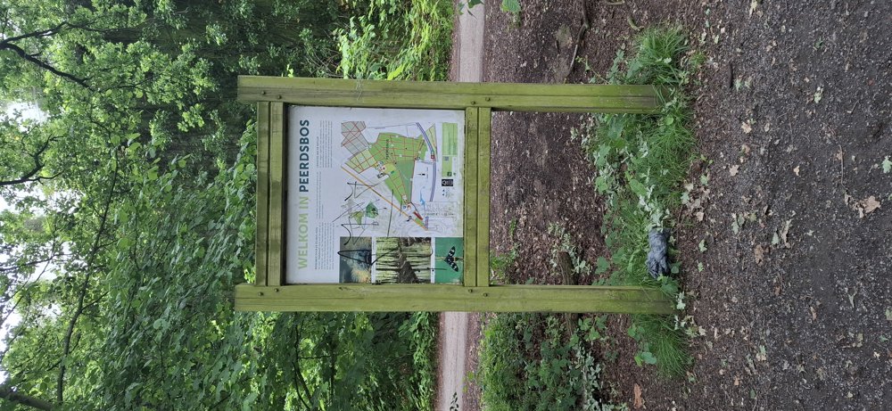
Walking through the beautiful Peerdsbos and the Domain Vordenstein where you also walk through the Orangerie Vordenstein with its beautiful garden. This walk is not accessible for dogs; dogs are not allowed, even on a lead, in Domain Vordenstein.

At the end, you walk through the quiet neighborhood "De List".

Bench(es): 3/5/9.8/11.2/12.6 and 13.1 km.

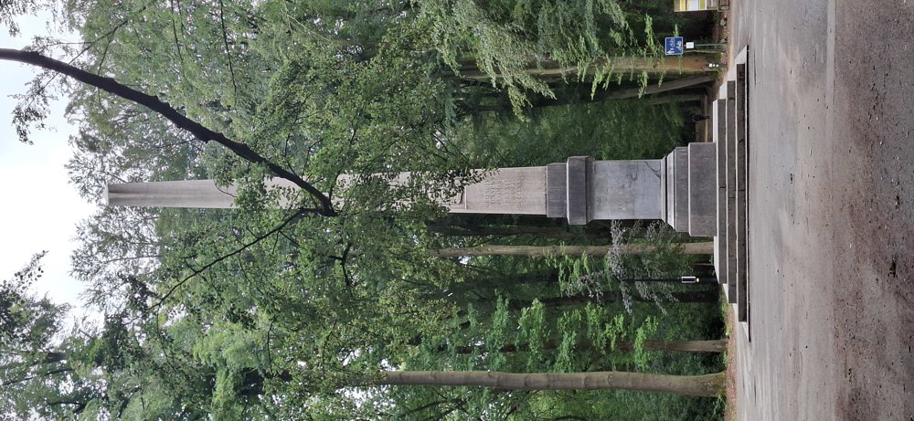
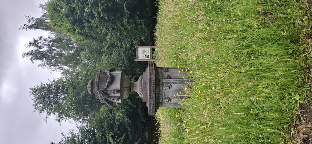
Attractions: including Obelisk/Orangerie Garden

automatic translation

Icon nodes to follow nodes to follow

Icon start route
0 km
Image node 4
0.1 km
Image node 5
0.2 km
Image node 6
0.8 km
Image node 7
0.9 km
Image node 8
1.6 km
Icon deviation route
2.2 km
Icon deviation route
3 km
Image node 65
3.3 km
Image node TP
3.5 km
Icon deviation route
3.7 km
Icon deviation route
3.8 km
Image node 66
4.1 km
Icon deviation route
4.4 km
Icon deviation route
4.6 km
Icon deviation route
4.8 km
Icon deviation route
5 km
Icon deviation route
5.2 km
Icon deviation route
5.4 km
Icon deviation route
5.6 km
Icon deviation route
6 km
Icon deviation route
6.3 km
Icon deviation route
6.5 km
Icon deviation route
7 km
Icon deviation route
7.3 km
Icon deviation route
7.4 km
Icon deviation route
7.8 km
Image node 4
8 km
Icon deviation route
8.4 km
Icon deviation route
8.9 km
Icon deviation route
9.3 km
Icon deviation route
9.9 km
Icon deviation route
10.1 km
Icon deviation route
10.3 km
Icon deviation route
10.5 km
Icon deviation route
10.8 km
Icon deviation route
11 km
Icon deviation route
11.2 km
Icon deviation route
11.4 km
Icon deviation route
11.8 km
Icon deviation route
12.1 km
Icon deviation route
12.6 km
Icon deviation route
12.8 km
Icon deviation route
13 km
Icon deviation route
13.1 km
Icon deviation route
13.6 km
Icon deviation route
14.3 km
Icon deviation route
14.8 km
Icon deviation route
15 km
Icon deviation route
15.3 km
Icon deviation route
15.5 km
Icon deviation route
15.7 km
Icon deviation route
15.8 km
Icon deviation route
16.2 km
Icon deviation route
16.5 km
Icon deviation route
16.7 km
Icon deviation route
17 km
Icon deviation route
17.3 km
Icon deviation route
17.8 km
Icon stop route
17.9 km
This route does not have any reviews yet. Be the first!
Rate route!

Which POI do you want to show on the map?

Experimental hiking network
Unsigned icon

The route you have chosen runs (partly) along an experimental virtual hiking node network (the blue-coloured nodes and sections on the map).

You must be logged in to plan routes here.

Experimental hiking network
Unsigned icon

The route you have chosen runs (partly) along an experimental virtual hiking node network (the blue-coloured nodes and sections on the map).

These routes are not controlled in the field. Before you start hiking here, take a minute to read what an experimental hiking node network is and what rules you should follow when hiking here.