 Hiking
 Login
Login More
More EN
EN Premium
Dyle and Lane Walk
automatic translation
7.5 km • Huldenberg
 official route
1.6450 4 4.4/5
route offered by
 Addresse starting point (approximate)
Sint-Agathakerk, Sint-Agathastraat, 3040 Sint-Agatha-Rode (Huldenberg)
 signage
The route is fully signposted with nodes.
 Description
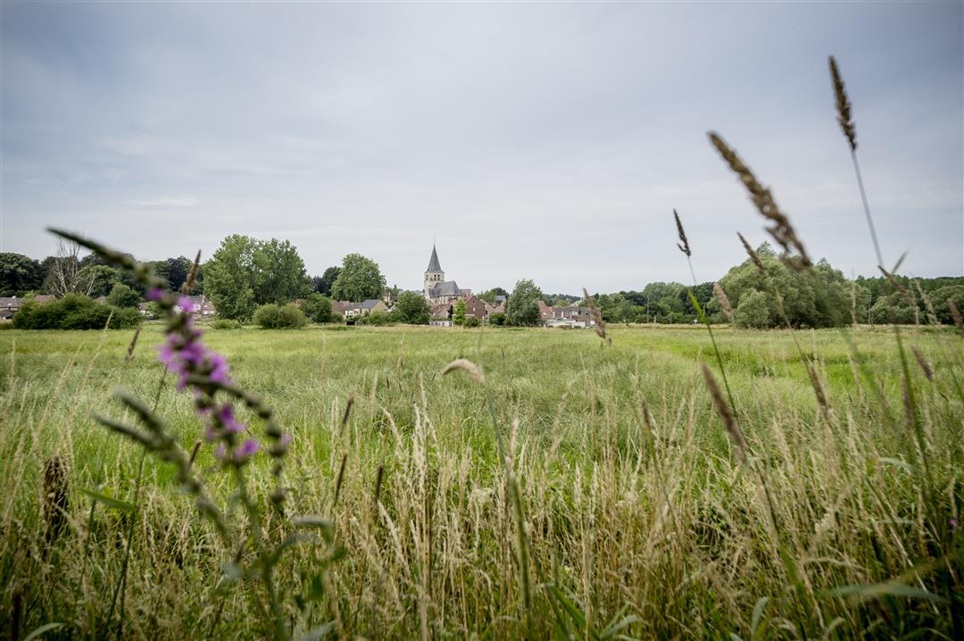
Departure at the Sint-Agatha church which is somewhat hidden behind a giant plantain planted as a liberty tree in 1830 on the occasion of the Belgian independence. Meanwhile, the tree is over 30 m tall and has a trunk circumference of more than 4.60 m. This walk leads you through the greenery of the Dijle and Lane valleys in Sint-Agatha-Rode. You will cross forest roads and follow the banks of both rivers almost to the point of their confluence. Pass beautiful flora, grazing cows and vast landscapes. Pass by the Grootbroek, which consists mainly of a large pond that was dug out of the marshy basin of the Dijle valley.
This walk is offered by Tourism Flemish Brabant.
TIP: From node 229, follow the plank path 600 meters in the direction of node 105 and climb the watchtower. Enjoy the view over the Grootbroek, for many birds an exquisite residence or necessary resting place during their annual migrations.
automatic translation
 nodes to follow
0 km
0 km
0.5 km
1.8 km
2.2 km
2.7 km
3.4 km
4.6 km
4.7 km
4.9 km
5.7 km
6.6 km
7.2 km
7.6 km
Saturday, May 7, 2022 by Yasmin VdCVery enjoyable hike! Me and my faithful four-legged friends thoroughly enjoyed the meadow lanes, forest trails and streams. Hardly met anyone. Between 232 and 230 a bit difficult because some posts were gone due to road works. With the app we got on smoothly. Highly recommended!
automatic translation
Sunday, November 14, 2021 by Erik KuijpersBeautiful walk through forests and past fields and meadows. Hardly any asphalt and no traffic. Need sturdy walking shoes though because muddy in places.
automatic translation
Sunday, August 1, 2021 by Carla JanssenBeautiful, varied hike. After all the rain in recent weeks, of course, mud and especially mosquitoes! We are going to do this hike sometime in the winter too. We went wrong for a while after junction 231 (on the way to 230) but then we came across a terrace.
automatic translation
Wednesday, April 14, 2021 by F.V.Nice varied walk along the watercourses and through the forest.
automatic translation


 Upgrade to Premium Plus
