 Hiking
 Login
Login
 More
More
 EN
EN
 Premium
Serristenwandeling
11.8 km • Tervuren
 official route
3.0854 2 3.2/5
route offered by
 Addresse starting point (approximate)
Pachthof Stroykens, Merenstraat 19, 3080 Duisburg
 signage
The route is fully signposted with nodes.
 Description
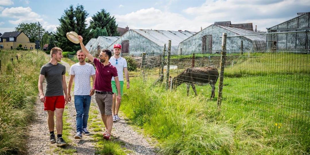
Explore the slow roads of Eizer and Duisburg past some authentic serrist homes. You can start from Duisburg (Pachthof Stroykens, at node 404), perched high on a wide ridge surrounded by fields. Or from Eizer (Mary Magdalene Church, at node 322), this hamlet was also known at the time for its peach cultivation. From the authentic "snapped" greenhouses to super-modern and computerized farms. The greenhouses vary, but behind each glass house is a serrist who grows his table grapes with heart and soul.
automatic translation
 nodes to follow
0 km
0.4 km
0.7 km
0.7 km
1.5 km
2.9 km
3.6 km
4.2 km
5.6 km
5.6 km
6.8 km
7.3 km
8.3 km
9.1 km
10.5 km
10.6 km
11.2 km
11.5 km
11.8 km
Tuesday, April 13, 2021 by B.V.Mediocre. Many greenhouses seen, but only from afar. Photo does not match experience. Other than that, nice environment
automatic translation
Sunday, June 21, 2020 by J.H.Beautiful route. Clearly marked, lots of slow roads, mix between cobblestone, asphalt and unpaved. Good access for strollers if dry. Stumbled upon a bench and ate picnic and fed baby there. We enjoyed it!
automatic translation


 Upgrade to Premium Plus
