Loading...

Reindeer Hunters' Path

automatic translation

3 km • Zonhoven

2.0304 0 0/5

3 km 0.0 km 0.0 km

route offered by

Jan Theunis

Icon starting point Addresse starting point (approximate)

Hengelhoefseweg 3, 3520 Zonhoven, BE
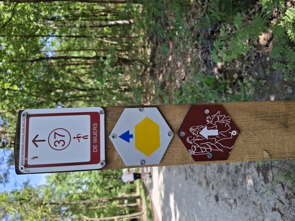
Icon type signage of route signage

The route is fully signposted with thematic signs (no nodes).

5m 5m 5m 5m
Atmosphere image 1 of route Reindeer Hunters' Path Atmosphere image 2 of route Reindeer Hunters' Path Atmosphere image 3 of route Reindeer Hunters' Path
© Jan Theunis

Icon description route Description

Parking: Parking Holsteen, Holsteenweg Zonhoven.

Signage: Hexagonal brown sign with 3 small figures on it.

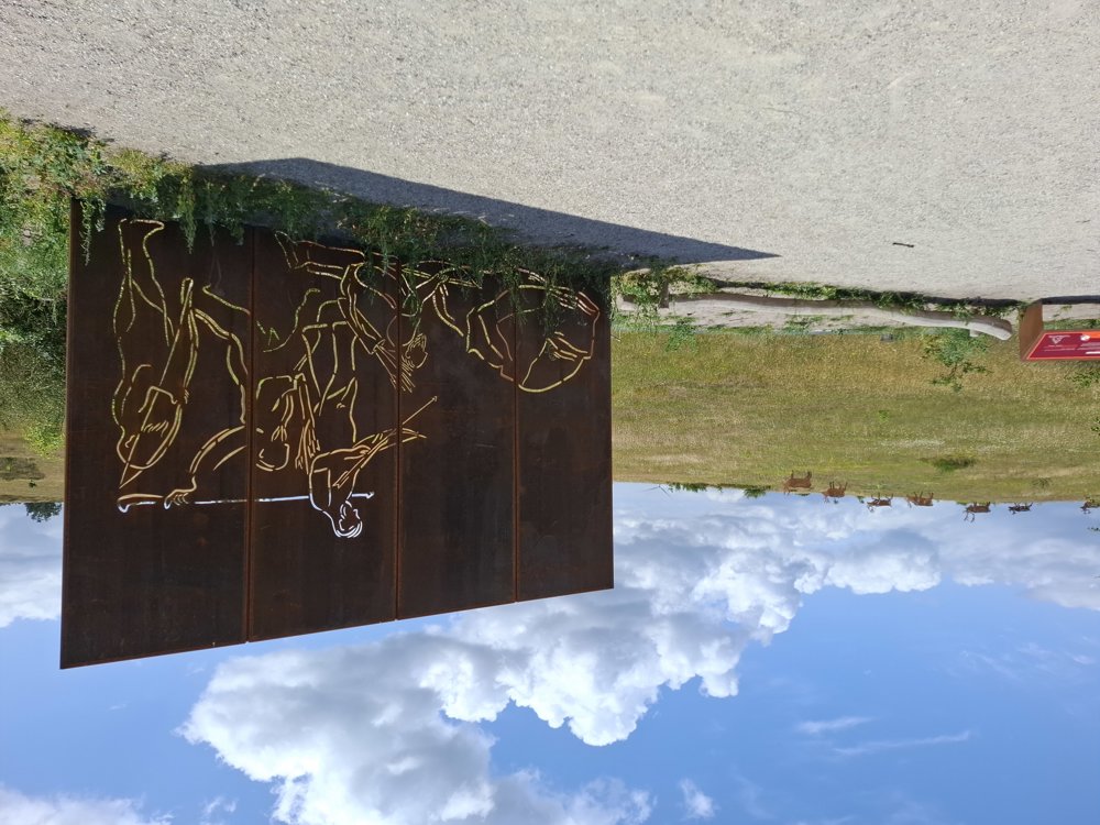
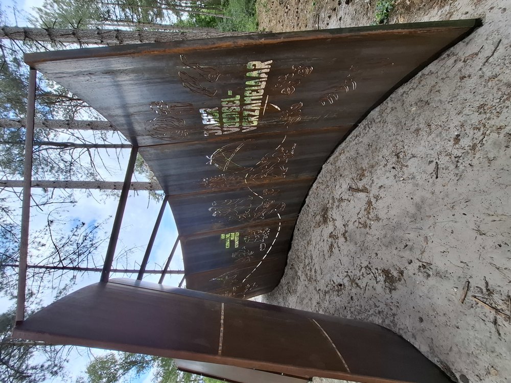
This loop is the "Reindeer Hunters' Path", a very beautiful short walk. Perfectly signposted. Definitely worth doing with children. Along the way, there are sights from antiquity.

Bench(es): e.g., after 0.9/1.5 and 2.5 km.

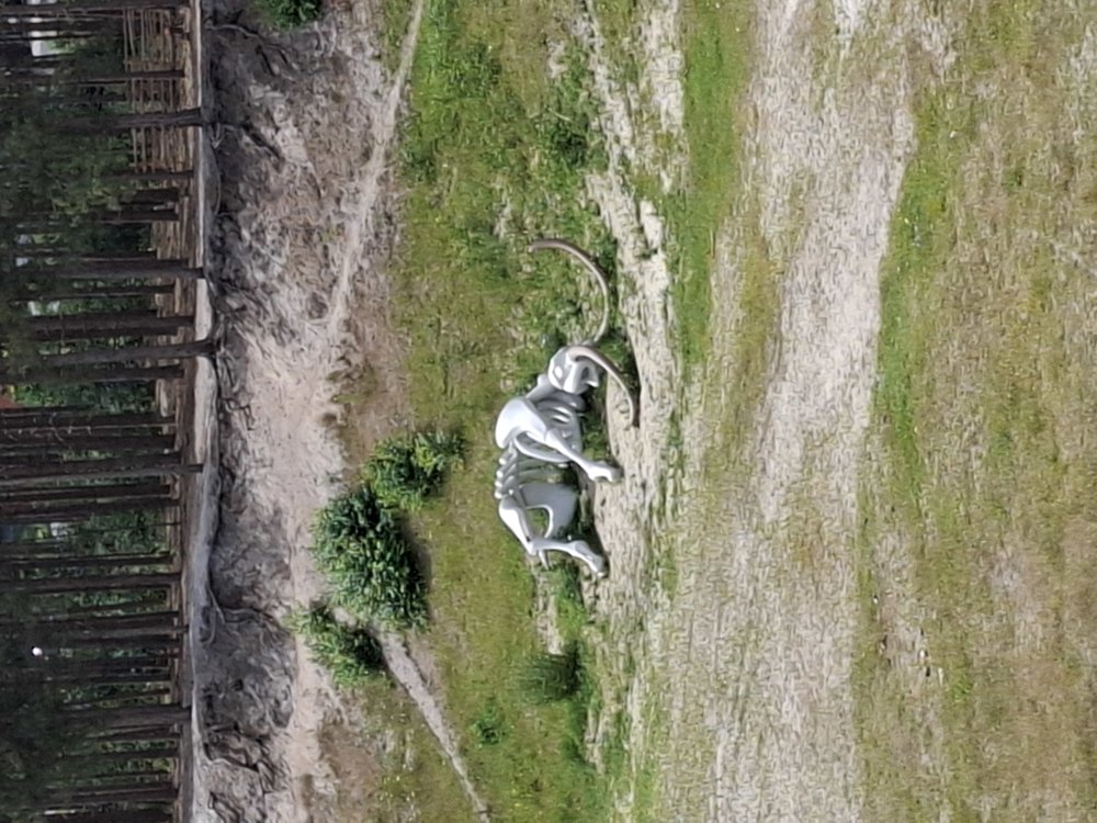
Sights: Mammoth skeleton in the pit.

Catering: Cafeteria Holsteenbron

automatic translation

Icon nodes to follow nodes to follow

Icon start route
0 km
Icon deviation route
0.2 km
Icon deviation route
0.3 km
Icon deviation route
0.4 km
Icon deviation route
0.7 km
Icon deviation route
0.8 km
Icon deviation route
1.1 km
Icon deviation route
1.5 km
Icon deviation route
1.7 km
Icon deviation route
1.8 km
Icon deviation route
2 km
Icon deviation route
2 km
Icon deviation route
2.1 km
Icon deviation route
2.2 km
Icon deviation route
2.4 km
Icon deviation route
2.5 km
Icon deviation route
2.6 km
Image node 36
2.9 km
Icon stop route
3.1 km
This route does not have any reviews yet. Be the first!
Rate route!

Which POI do you want to show on the map?

Experimental hiking network
Unsigned icon

The route you have chosen runs (partly) along an experimental virtual hiking node network (the blue-coloured nodes and sections on the map).

You must be logged in to plan routes here.

Experimental hiking network
Unsigned icon

The route you have chosen runs (partly) along an experimental virtual hiking node network (the blue-coloured nodes and sections on the map).

These routes are not controlled in the field. Before you start hiking here, take a minute to read what an experimental hiking node network is and what rules you should follow when hiking here.