 Hiking
 Login
Login More
More EN
EN Premium
Seven Springs Walk
automatic translation
10.3 km • Landen
 official route
8480 4 3.8/5
route offered by
 Addresse starting point (approximate)
Sint-Jan-De-Doperkerk, Wezerenstraat, 3401 Walsbets (Landen)
 signage
The route is not signposted. Use a GPS device or our app to follow the route through the virtual nodes.
 Description
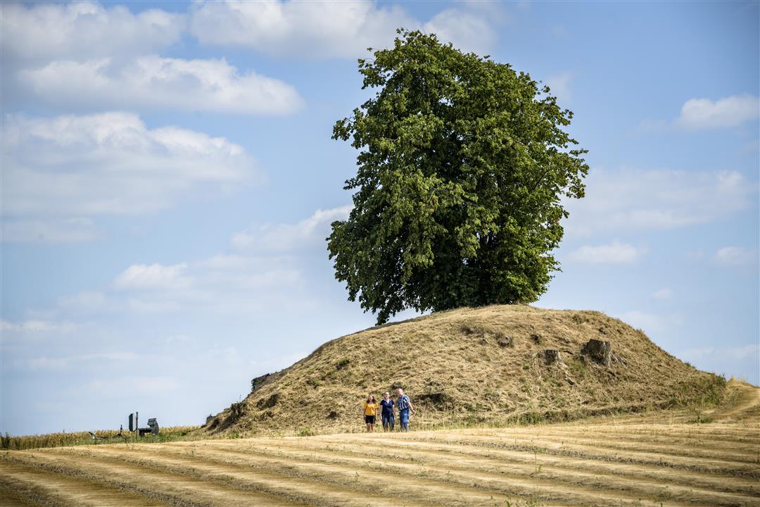
This hike connects the villages of Walsbets, Wezeren and Walshoutem. You walk for the most part through the valley of the Zevenbronnen, a beautiful source area containing some beautiful farms such as the Hoeve Coppejans and Janshoven. Also admire the Bortombe, a burial mound from the 2nd century.
NOTE: This is a hike on a virtual hiking network. The nodes are not signposted on the property. Follow the 6-sided red and white signs with the name of the hike.
This hike is offered by Tourism Flemish Brabant.
automatic translation
 nodes to follow
0 km
0.3 km
0.7 km
3.6 km
4.6 km
5.7 km
6.5 km
7.5 km
7.9 km
9.3 km
9.7 km
10.1 km
10.3 km
Thursday, August 3, 2023 by D.B.Quiet walk, ideal to do with our young, over-excitable dog with severe heart defect, precisely because of the many paved roads and no steep inclines. We walked this one at our pace. According to google fit 11.08 km, but that's a big plus!!! Definitely worth repeating!!! 1 minus point: not enough trash cans for the poop bags.
automatic translation
Friday, July 9, 2021 by V.S.Nice hike for those who like to hike on concrete, did not see seven springs.
automatic translation
Wednesday, April 28, 2021 by Dirk FlorquinNice hike, but with little variation. Always walking on asphalt roads might be better suited for cyclists. The walk is well marked with small red signposts though, not with the numbers of the nodes. Also the start is a bit removed from the actual start #616.
automatic translation
Saturday, August 22, 2020 by Peter WilsNice hike at a reasonable elevation which then gives you views of the vast surroundings, beautiful vistas. You walk near a tumulus, definitely go take a look. Then you go from one village to another, with beautiful square farms, churches and chapels. The hike is entirely on paved roads.
automatic translation


 Upgrade to Premium Plus
