 Hiking
 Login
Login
 More
More
 EN
EN
 Premium
Solre Dungeon Route
automatic translation
14.8 km • Erquelinnes
9231 0 0/5
route offered by
 Addresse starting point (approximate)
Rue Emile Vandervelde 1, 6560 Erquelinnes, België
 signage
The route is not signposted. Use a GPS device or our app to follow the route through the virtual nodes.
 Description
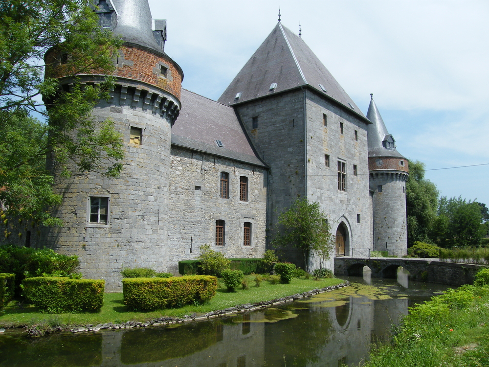
This walking tour starts and ends at the breathtaking Solre-sur-Sambre Castle. A gem of Hainaut military architecture, it dates back to the 14th century and is situated in an idyllic location where the Sambre and Thure rivers meet. Although the castle is privately owned and not open to the public, it offers an impressive sight that transports you back to bygone times. The current owner, the de Merode family, takes great care of this heritage. You will discover the green, surrounding countryside by going through the Solre and Bersillies forest.
automatic translation
 nodes to follow
0 km
0.3 km
3.8 km
8.4 km

8.9 km
9.2 km
11.1 km
14.5 km
14.8 km


 Upgrade to Premium Plus
