 Hiking
 Login
Login More
More EN
EN Premium
Along the Mark
automatic translation
17.9 km • Galmaarden
 official route
9970 7 3/5
route offered by
 Addresse starting point (approximate)
Marktplein 10, 1570 Galmaarden
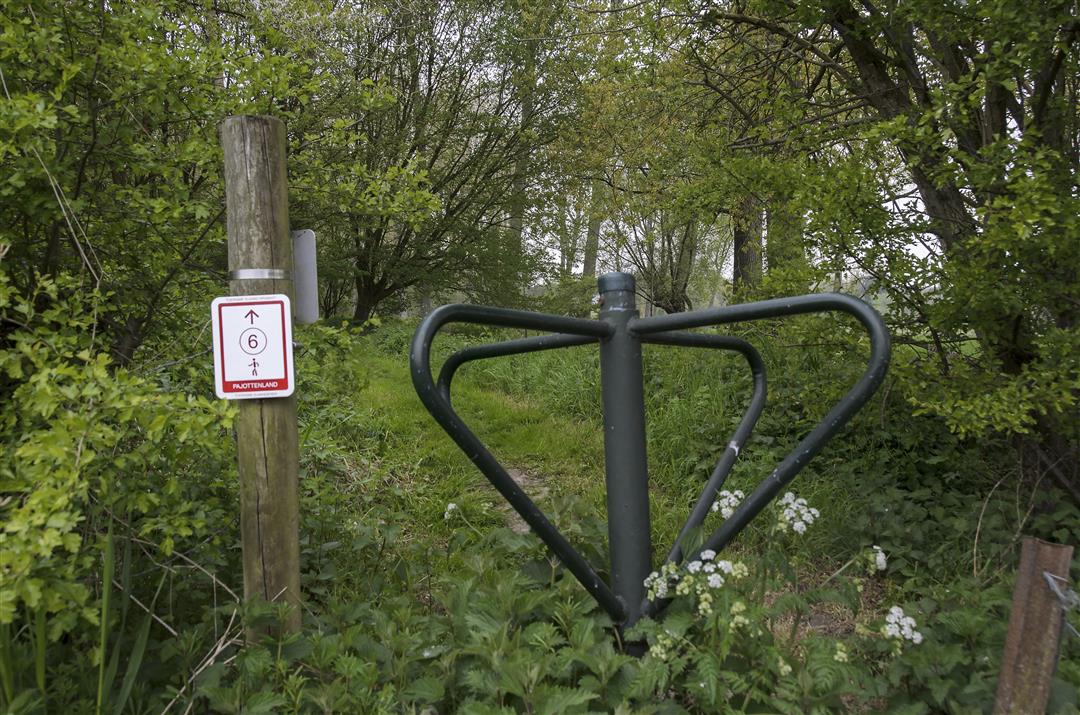
 signage
The route is fully signposted with nodes.
 Description
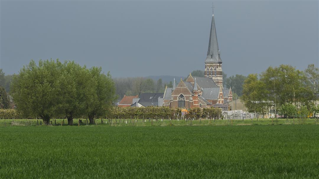
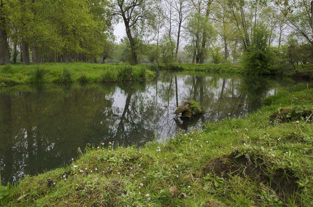
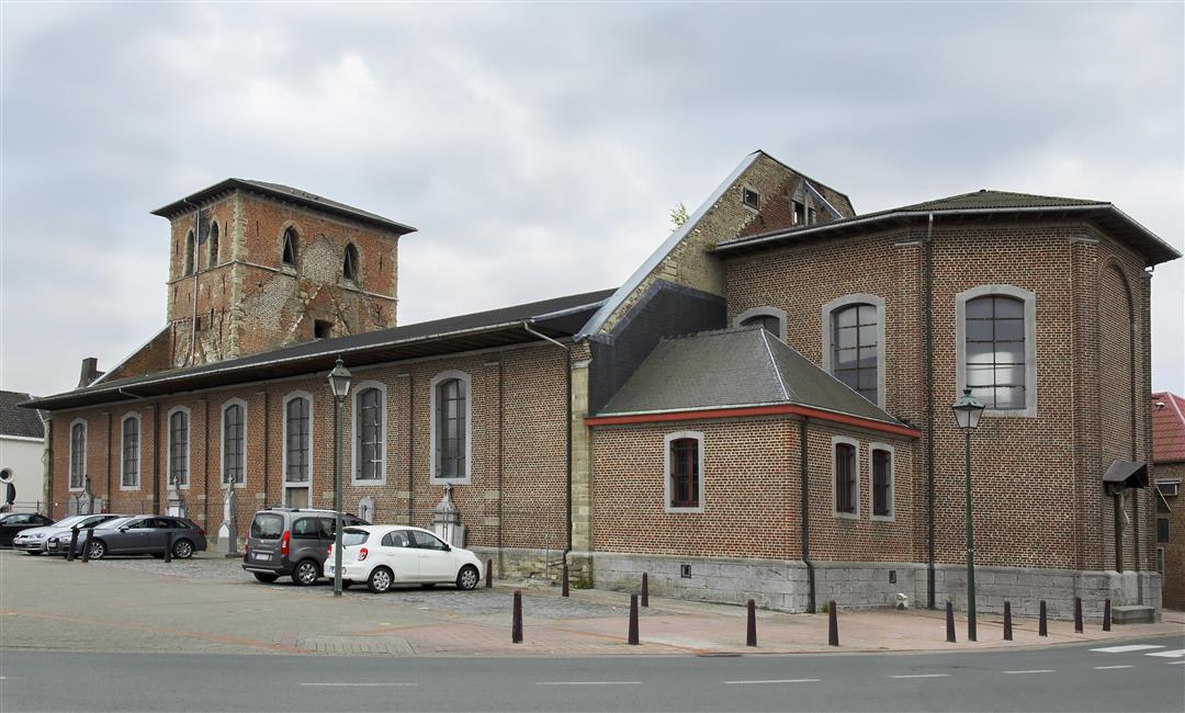
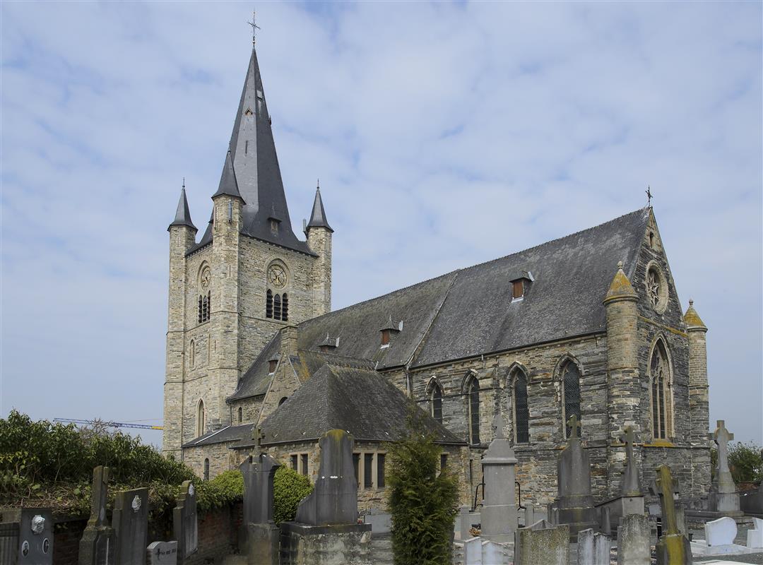
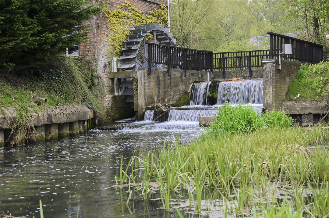
This hike starts at the marketplace of Galmaarden deep in the Pajottenland. The Mark (Marcq in French) is a tributary of the Dender, and rises in the forest on the border between the Hainaut municipality of Opzullik and Enghien.During the first part of this long hike, you will follow this little river for quite a while. Along the way you pass the Heetveldemolen on the Mark, which has been grinding grain since 1440. The current water mill came in 1949 when the old building was thoroughly rebuilt. It was still being milled professionally until 1996; the Heetveldemolen is still milling today. It is the only active water mill in the region.You also walk past Tollembeek. Fans of Urbanus certainly know the name of this village.This route was sent in by Riet Lenaert.
automatic translation
 nodes to follow
0 km
0.7 km
1 km
1.2 km
2 km
3.4 km
3.6 km
4.2 km
5.2 km
6 km
7.4 km
8.1 km
8.6 km
9.3 km
10.4 km
10.8 km
11.9 km
12.5 km
14 km
14.8 km
15.4 km
16.9 km
17.8 km
Sunday, February 7, 2021 by werner knopThe first 9 km are beautiful. Leaving from the nice market square you are 5 minutes afterwards in beautiful nature. Following the Mark in the beautiful nature. The turning point is at the station in Herne. From then on it is disappointing. One residential area after another, a pity. 18 km is handsome though so definitely enjoy a deserved mat pie.
automatic translation
Monday, June 8, 2020 by Nathalie De WandelerFirst part of the walk along the Mark (kingfisher spotted!) really top, afterwards a flop (from number 4 through residential areas, boring county lanes, station neighborhoods, along railroad tracks, etc.). Just returning to our passes would have been much better.
automatic translation
Thursday, May 21, 2020 by I.C.it is recommended to do this hike on a not too warm day. But it is certainly worthwhile to get to know the Mark, only the part through the allotment of the Flierekouter is very disappointing. Here and there you do have to look carefully for the signs. The last water mill is a gem.
automatic translation
Saturday, May 9, 2020 by B.L.This is a very nice walk, thanks Riet! Especially the stretch along the Mark is highly recommended. The roads and junctions are well maintained.
For the rest, definitely do it !
automatic translation
Monday, February 3, 2020 by Riet Lenaerti forwarded this hike to hikenooppunten.be in 2017 ;
walked the hike again in 01/2020 :
to my surprise noticed that the area has since been thoroughly 'cleaned up', in particular the bed of the Mark was addressed, but also the nodes are clearer to follow. The hike has really been upgraded, and highly recommended. The river Mark meanders its way through the wide open nature reserve, and the 4 watermills you'll pass along the way, are a bonus !
automatic translation
Tuesday, March 6, 2018 by P.V.Very Beautiful route but between node 600,643 only problem Not following plan on route lans de Mark
automatic translation
Tuesday, December 26, 2017 by R.L.For the photo story of the hike, follow the link :
https://goo.gl/photos/1MrYso81UA4Cwy6H9
comments welcome !
have fun hiking !
automatic translation


 Upgrade to Premium Plus
