 Biking
 Login
Login
 More
More
 EN
EN
 Premium
Heron bike route
automatic translation
53 km • Lievegem
 official route
4.83715 5 3.4/5
 Addresse starting point (approximate)
Waarschootdorp Lievegem
 signage
The route is fully signposted with nodes.
 Description
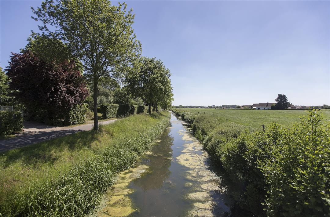
It is great biking along the water in the flat Meetjesland. Along the Lieve, it is virtually impossible not to encounter herons. So be sure to put your camera in your bike bag!
automatic translation
 nodes to follow
0 km
3.6 km
4.7 km
7.8 km
10.6 km
13.1 km
14.3 km
15.1 km
17.2 km
18.2 km
20.2 km
22.2 km
22.8 km
23 km
24.1 km
25.3 km
26.3 km
27.1 km
31.8 km
32.5 km
33.9 km
34.5 km
35.4 km
35.4 km
37.6 km
39.4 km
42 km
42.5 km
45.7 km
46.2 km
48.4 km
51.8 km
52.9 km
Monday, August 25, 2025 by Luc Van DaelSuper nice route, definitely do it.
automatic translation
Wednesday, April 2, 2025 by Wietse verstraetevery nice bike route!!!
automatic translation
Tuesday, September 1, 2020 by Karina CockaertsVery nice route, especially the first part to 34 is beautiful. Why junction 3 was chosen as the starting point is beyond me. You can't park your car anywhere near there. Junction 31 was closed was repeatedly indicated. Unfortunately, nowhere was there a detour. If you don't know the neighborhood, not an obvious situation.
automatic translation
Sunday, April 26, 2020 by L.L.trying to download this route in the app fails!!!
automatic translation
Tuesday, April 7, 2020 by bernard bekaertDear
A remark about the herons route .At sign 37 in Belzele you normally have to go to nr31 but on the sign there are two numbers in the 40?
Please a mail back please
automatic translation


 Upgrade to Premium Plus
