 Biking
 Login
Login
 More
More
 EN
EN
 Premium
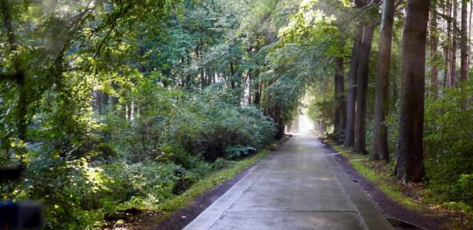
Along forests and lakes cycling route
automatic translation
45.7 km • Merelbeke-Melle
 official route
5.1889 10 3/5
 Addresse starting point (approximate)
Munteplein 6, 9820 Merelbeke-Melle
 signage
The route is fully signposted with nodes.
 Description
You start at the presbytery of Munte, where the tourist information point is also located. You cycle through a slightly sloping landscape east of the river Scheldt. Along the way you pass some nurseries and flower shops with home sales.
automatic translation
 nodes to follow
0 km
3.3 km
6.9 km
8.7 km
11.7 km
12.4 km
14.6 km
14.9 km
16.2 km
16.6 km
19.2 km
21.1 km
21.9 km
25.7 km
31.7 km
35.8 km
37.2 km
37.9 km
40.2 km
45.7 km
Tuesday, July 21, 2026 by Lien AumanWe had expected more forests and marshes.
automatic translation
Monday, September 8, 2025 by Patrick De vylderbeautiful varied route, only there is a sign No. 49 is wrong you are pointed to a farmyard and you should go straight to No. 48
automatic translation
Tuesday, August 26, 2025 by Wim Rogiersnice varied route.
automatic translation
Monday, July 21, 2025 by Walter MulsYesterday I drove the whole route in one go. A bit of everything: forests, fields, industries, residential areas, gravel, cobblestones, forest roads, asphalt. Very varied and easy to follow with the app.
automatic translation
Saturday, July 30, 2022 by Eric Van AckerAs avid cyclists, we did this route the day before yesterday, we wonder if the person who devised this route has cycled it himself ... never have we ridden such bad bike paths, the many gravel paths, the bike paths along the Scheldt which were downright dangerous, uneven and poorly maintained ... please delete this route ...
automatic translation
Friday, November 26, 2021 by Lutgard DobbelaereNice course along quiet roads, completely separate bike paths, kouter lanes through forests and meadows. You pass several village centers with catering establishments. Indicated starting point is not ideal (no parking), better choose a village center
automatic translation
Monday, July 12, 2021 by R.D.1) Sometimes bad signposting, but we rode with the navigation tool of the Vlaanderen-Fietsland app. In 2 places the navigation does not match the signposting. 2) There are numerous possible departure points with parking facilities. Munte is not ideal. 3) Few forests and lakes. 4) Rather boring route.
automatic translation
Sunday, August 9, 2020 by A.L.Dear, was a big setback for us ! Took the route yesterday, August 8, 2020, expecting to encounter many forests and lakes and be cool during this very hot day. Very bad roads, even a really long "heir track" in full sun and several roads in bad condition. Few forests and lakes seen. Too bad
automatic translation
Wednesday, August 5, 2020 by L.V.The problem is located at the exit of the Leonce Volckaert dreef to the Gijs van Rhodewegel. The entrance to the road is difficult to see and the road is too narrow....( "this is my property"....) . The best thing to do is to take the Winvijverstraat and then turn left at the end of the street to continue along the same road.
automatic translation
Monday, June 29, 2020 by H.L.This is a beautiful route in warm weather(in green)there is a problem from #82 to 98 is hard to align tis in a neighborhood and at the intersection there should be a sign to the left for 98 otherwise you won't find it
automatic translation


 Upgrade to Premium Plus
