 Biking
 Login
Login
 More
More
 EN
EN
 Premium
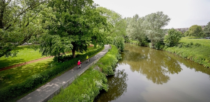
Geraardsbergen cycling route
automatic translation
42.8 km • Geraardsbergen
 official route
3.8776 2 3.2/5
 Addresse starting point (approximate)
Kaai, 9500 Geraardsbergen
 signage
The route is fully signposted with nodes.
 Description
Stop in one of the most authentic village squares in the country in Hemelveerdegem. Explore the beautiful Dendervallei Linkeroever nature reserve. Cycle from the provincial domain De Gavers towards Geraardsbergen.
TheGeraardsbergen cycling routeis offered to you byRouten, an initiative of Tourism East Flanders.
automatic translation
 nodes to follow
0 km
0 km
3.8 km
7 km
10.4 km
12.3 km
14.1 km
16.3 km
17 km
17.6 km
18.9 km
23.3 km
27.8 km
30.5 km
31.9 km
33.7 km
35 km
38.9 km
39.2 km
42.7 km
Saturday, July 23, 2022 by P.D.I think this person cycled a different route. Almost always climbing and descending, except along the Dender. Junction signs 44 and 90 have disappeared. Towards node 90, you have to go along a forest path overgrown with nettles, with crumbled concrete edges (the forest path, not the nettles). Unpleasant and sometimes downright dangerous.
automatic translation
Tuesday, July 27, 2021 by W.D.Very nice bike route, junctions are well marked. Route is mostly flat, with 1 real cobblestone. Very quiet roads, also passes close to Provincial Domain De Gavers.
automatic translation


 Upgrade to Premium Plus
