 Biking
 Login
Login
 More
More
 EN
EN
 Premium
Ath cycle route
automatic translation
47.6 km • Geraardsbergen
 official route
3.2215 2 5/5
 Addresse starting point (approximate)
Majoor van Lierdelaan 50, 9500 Geraardsbergen
 signage
The route is fully signposted with nodes.
 Description
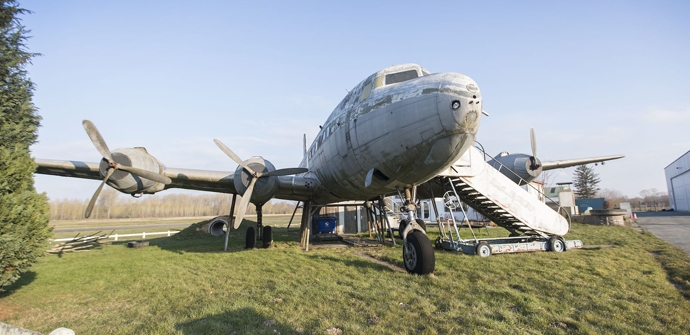
The Boelarebos is a forest area to the south of the Dender and in cycling circles a notorious cobbled slope. De Rietbeemd is the only nature reserve in our country that stretches over both Flemish and Walloon territory. At the entrance to Overboelare Airfield, a Douglas C-54A Skymaster serves as the clubhouse. The first weekend of August you can catch a spectacular air show with demonstrations of gliders and flying oldtimers.
automatic translation
 nodes to follow
0 km
2.6 km
4.2 km
4.6 km
8 km
9.5 km
12.4 km
13.9 km
14 km
16.5 km
19.7 km
20.2 km
21.6 km
22.2 km
24.1 km
26.6 km
27.8 km
28 km
28.4 km
28.7 km
30.9 km
33.4 km
35.8 km
39.8 km
40 km
41.7 km
42.9 km
44.3 km
47.5 km
Monday, July 27, 2026 by F.W.A beautiful and peaceful route. A hike with varied scenery. Just do it!
automatic translation
Tuesday, April 7, 2026 by Bart CoppéA lovely, peaceful route. A slightly hilly course on roads with little traffic. The flat section winds along the beautiful waterfront. Highly recommended!
automatic translation


 Upgrade to Premium Plus
