 Biking
 Login
Login
 More
More
 EN
EN
 Premium
Bluebird bike route
automatic translation
40.2 km • Dendermonde
 official route
5.16212 4 4.1/5
 Addresse starting point (approximate)
De Bruynlaan, 9200 Dendermonde
 signage
The route is fully signposted with nodes.
 Description
Dendermonde owes its name and origins to the confluence of Dender and Scheldt. This made the city sensitive not only to military conflicts, but also to floods. Today, the estuary is a long way away and the proximity of two rivers is an asset for the city, which we gratefully make use of.
automatic translation
 nodes to follow
0 km
0.8 km
1.1 km
3 km
4.3 km
4.6 km
7.1 km
13 km
15.9 km
16 km
16.2 km
16.4 km
19.1 km
20.3 km
24.7 km
27.1 km
28.5 km
31.1 km
31.4 km
31.5 km
38.2 km
38.3 km
40.1 km
Thursday, April 9, 2026 by Linda Daghuytbeautiful route
automatic translation
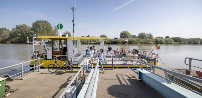
Sunday, September 7, 2025 by Louise Hilditchvery well signposted. thanks to the people above who explained the ferried - saved us a lot of time
Saturday, August 14, 2021 by I.V.We rode the route to the left, just too late for the ferry at Appels, lunch break. But not to worry, we continued to the bridge of Schoonaarde, very nice new bike path on the dike, with possibly even better views than the lesser path on the other side. After the bridge 3x right, junction 67 is indicated again. Not much to go around.
automatic translation
Tuesday, June 22, 2021 by E.U.Beautiful route. Pay attention at the ferries. These only sail over on the 1/2h and on the hour. Lunch break from 12.30h to 13.00h.
automatic translation


 Upgrade to Premium Plus
