 Biking
 Login
Login
 More
More
 EN
EN
 Premium
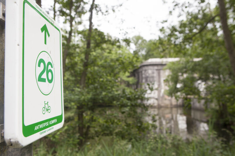
Antitank Canal Route
automatic translation
48.5 km • Brasschaat
13.35320 10 4.4/5
route offered by
Toerisme Provincie Antwerpen
 Addresse starting point (approximate)
Gemeentedomein De Mik, Mikhof 1, 2930 Brasschaat
 signage
The route is fully signposted with nodes.
 Description
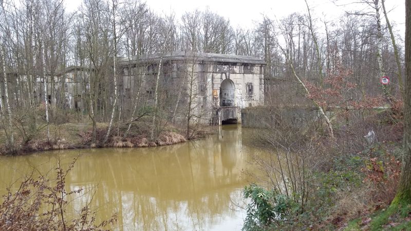
What once began as a military structure is now an attractive ribbon of nature that invites walking, biking, relaxing and exploring. The Antitank ditch dates back to just before World War II. It was once part of an entire network of defensive lines, forts and bunkers around Antwerp. It had to stop enemy tanks and slow down troops. After the war, nature took over from the military. Very special places emerged with a great diversity of plants and animals. Many species that found their permanent home here have often become rare in other places in Flanders. The Antitankgracht is a real animal highway that allows animals to move from one nature reserve to another. Besides the beautiful nature, there is of course also the impressive military heritage in the immediate vicinity of the moat: forts, bunkers and all sorts of structures that served a military purpose at the time, but have long since ceased to be used for that purpose. Thanks to Joseph de Hasque, the pioneer of the Flemish Fortification Center Simon Stevin, the Antitank moat and the surrounding military heritage were extensively inventoried and protected. Finally, you will also see many beautiful old castle estates along the route. Both starting points are already a good example of this.
automatic translation
 nodes to follow
0 km
0.8 km
6.3 km
9.3 km
9.6 km
9.7 km
10 km
13.2 km
14.7 km
16.1 km
17.6 km
21.6 km
22.1 km
23.5 km
24.8 km
26.8 km
27.8 km
30.8 km
32.9 km
34.6 km
34.6 km
35.8 km
36.9 km
38 km
39.7 km
42.3 km
42.3 km
45 km
45.4 km
48.6 km
Wednesday, April 22, 2026 by Els Van HeckeA really beautiful route!
automatic translation
Thursday, May 21, 2020 by Wim Van bovenWonderful route, very varied and interesting! Also in good direction, kept the better for last. Definitely do it!!!
automatic translation
Sunday, April 12, 2020 by Georges Van de VeldeDrove the route on 12/04/2020 and in a few places the numbers have changed, this is the case at junction 63 where you look in vain for 90, which then appears afterwards at junction 90 itself, but in between is to follow the sign 08. Same story on 26 where you see nothing of 45 but have to follow the sign 81 until you reach 45. Otherwise beautiful cycling.
automatic translation
Tuesday, July 23, 2019 by N.V.Very nice route, done with our little family. Varied, beautiful nature, along water and forests!
Along the way we did not find much to drink or eat.
automatic translation
Monday, July 1, 2019 by Ted WoestenborghsPleasant, quiet and car-free cycling
Beware he frequent crossing of highways because there too speeding drivers
They should also check there
As in so many places
Cyclists are still not given much consideration (not even on a Sunday)
automatic translation
Monday, May 21, 2018 by Luc PeetersThe part of the route that you effectively ride along the anti-tank ditch (western part of the route, from just past node 56 to half a kilometer before node 36) is just beautiful: lots of dirt roads among the trees & with a row of historic forts & bunkers. Unfortunately, on the rest of the route (from the start at De Mik to the Albert Canal) you drive too much through residential areas & subdivisions.... A shame, because you'll find enough greenery in this region to make it just a little more engaging.
automatic translation
Saturday, May 12, 2018 by L.N.very nice route.
we found the many dirt roads to be a plus!
automatic translation
Sunday, July 23, 2017 by A.D.Very nice route ! Beautiful nature and coloring on the canals !
automatic translation
Monday, August 15, 2016 by T.F.quiet bike route only sorry about the many unpaved roads .
automatic translation
Sunday, July 10, 2016 by D.L.Dear creators of this bicycle tour; a very big congratulations. It is a fantastically beautiful tour with lots of variety and you can start it at different places. Thank you very much, we enjoyed it very much today 10/07/2016.
A warm greeting.
Lutgart and Dré
automatic translation


 Upgrade to Premium Plus
