 Hiking
 Login
Login
 More
More
 EN
EN
 Premium
Elder creek walk
automatic translation
11 km • Leuven
 official route
10.96419 16 3.5/5
route offered by
 Addresse starting point (approximate)
Alberdingk Thymlaan 1, 3010 Leuven
 signage
The route is fully signposted with nodes.
 Description
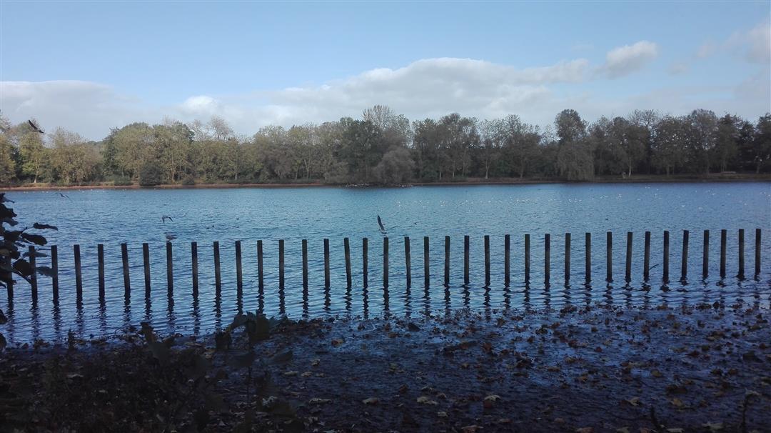
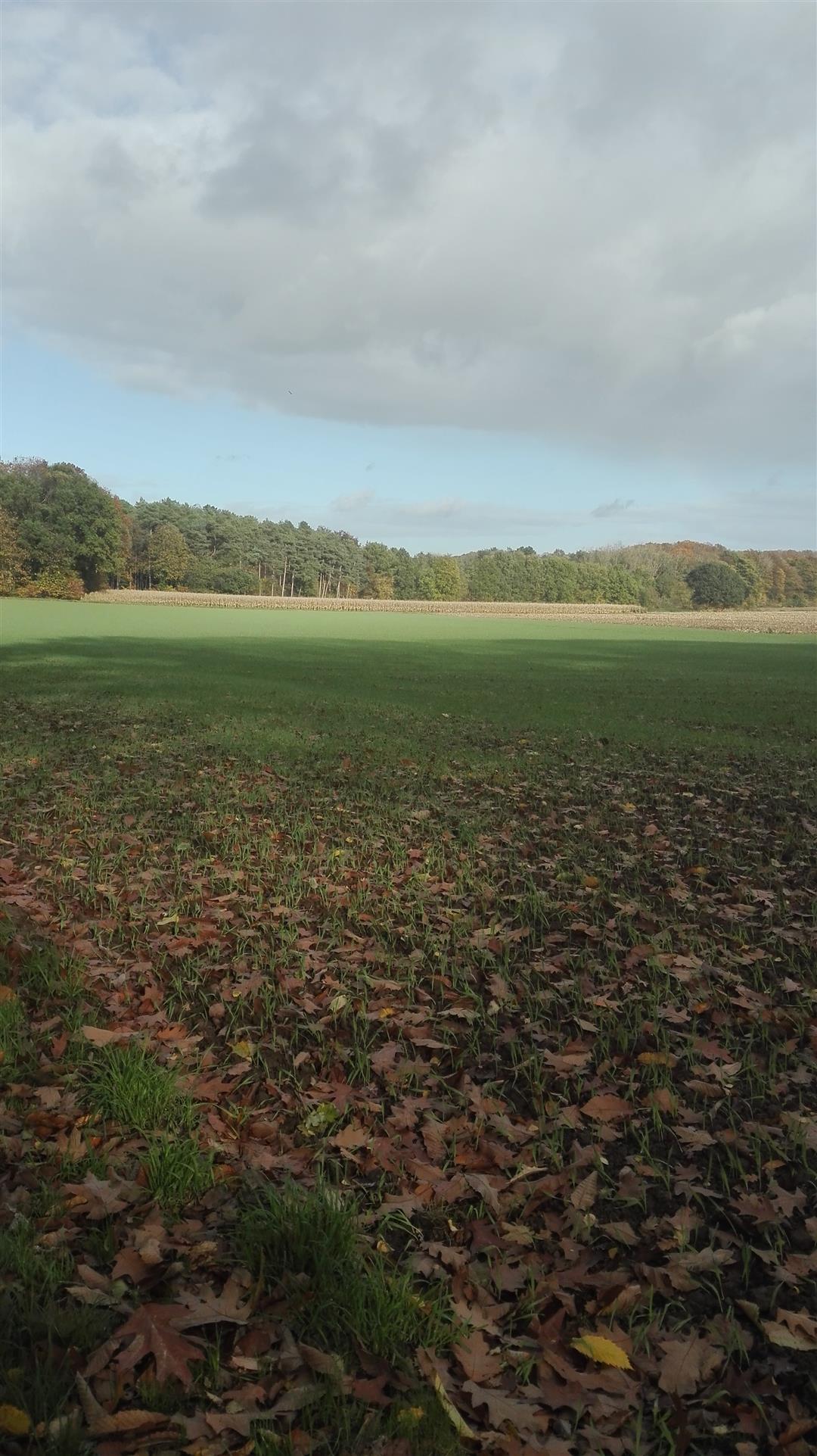
This walk starts near Vlierbeek Abbey in Kessel-Lo. For seven centuries, the abbey was the setting for the daily life of the Benedictine monks of Vlierbeek. This hike passes woods and meadows until you reach the Provincial Domain in Kessel-Lo. You pass through this beautiful domain which is a true paradise for children. In the domain you will also find eating and drinking facilities. On arrival you can enjoy a drink at the Abbey of Vlierbeek in tavern 'In Den Rozenkrans'.
automatic translation
 nodes to follow
0 km
0.4 km
0.8 km
1.7 km
3.8 km
5.2 km
5.5 km
5.6 km
6.2 km
7.5 km
7.8 km
8.8 km
9.1 km
10 km
11 km
Saturday, July 5, 2025 by Ornella CBFine and brisk walk
automatic translation
Monday, May 27, 2024 by P.P.All the starting point is wrong: there is a parking in the provincial estate, better anyway than along the road. No views and actually boring, through Kessel-Lo and through the woods (one sees nothing). Only the abbey and the domain are worthwhile.
automatic translation
Sunday, February 13, 2022 by E.W.Nice walk, beginning between the houses is a bit disappointing but was quiet. Nice walk through the forest , through the provincial domain . End of the walk we did have a few km more . But with the beautiful weather this was not a problem.
automatic translation
Saturday, October 9, 2021 by Frank Van CampVery nice hike, with spectacular views. Lots of variation, even in the built-up area pleasant. Very heavy climbing sometimes with unsafe paths. So definitely not suitable for everyone. But recommended for the trained adventurous hiker.
automatic translation
Monday, May 31, 2021 by M.V.Was a nice walk in the end. The beginning between houses and in neighborhoods was a little less, but once away from the "inhabited world" in the green was quite pleasant. Even better after a longer dry period. The finish at the abbey was satisfying.
automatic translation
Sunday, December 6, 2020 by J.G.Some write this, others write that, ..., I walked a wonderful corona walk today. JG.
automatic translation
Saturday, November 14, 2020 by L.V.Beautiful hike, lots through the forest. Frequent climbing though, so not suitable for everyone.
automatic translation
Tuesday, July 28, 2020 by M.J.Large stretches are along the backyards of houses, or through streets.
automatic translation
Wednesday, July 22, 2020 by Lut DelvauxNot recommended.
At the starting point node 42 there is no map towards 41.
So tried to do the hike in the opposite direction and lost 5 km.
Thanks to helpful local resident we ended up in the right direction after all.
At one point the route is interrupted with a roadblock because the stairs are broken.
A lot of climbing and descending and certainly not suitable for people who are less agile but this is nowhere indicated in the info.
Not worth repeating.
automatic translation
Monday, January 27, 2020 by J.V.Start and end of the hike are ok, for the rest NO RECOMMENDATION !
Along concrete paths we went to "admire" the clutter in the numerous backyards of the urbanized municipalities, hoping to enjoy the once beautiful nature reserve "De Kesselse Bergen" a bit later. What a setback: dozens of cabinets of villas with driveways of a hundred meters. In this time of so-called "concrete stop" people are NOG diligently working there! Poor nature and also poor hikers, who are hugely disappointed here! It seems that wolves are being spotted again! Indeed, on the last open space in the village we saw some money wolves: project developers.
This is, after more than a hundred walks, the FIRST time I MUST comment. By the way, also fully agree with the review dated 2-3-2019.
automatic translation
Saturday, March 2, 2019 by G.M.About half is nice and OK. Rest is disappointing.
Regrettable points:
- from Vlierbeek Abbey: no indication of departure junction, no overview map. Abbey courtyard is a starting point but apparently not included the trail.
- Many sections (42/43/45-400/401/43/41) run through built-up areas with fairly heavy traffic.
- The climb to 45 is very steep, impractical for less mobile hikers, and is not signposted anywhere.
In my opinion, a much nicer trail is possible.
GM
automatic translation
Tuesday, January 8, 2019 by L.V.We would like to do this Vlierbeek hike with our association on a Sunday afternoon. But with all our walks we always foresee a stop about halfway to get something to drink and to go to the toilet. Do you know of a pub somewhere along the way, possibly a bit different from the trail ?
automatic translation
Monday, January 7, 2019 by P.V.Nice hike on kesselberg and surrounding area.
We started at junction 401 towards 44 and thus immediately with a steep climb along the Kesselse Dagzoom! :-)
automatic translation
Monday, December 31, 2018 by denise van weldesuper nice hike, with some inclines, but very varied! will definitely do again!!! Perfect to follow!
automatic translation
Saturday, May 5, 2018 by S.K.When hiking from node 45 to 46, do not choose the narrow path that branches off to the left but stay on the path that goes down quite steeply and branches off to the right at the bottom.
automatic translation
Sunday, March 18, 2018 by W.V.Strange ?
on junction 44 you walk back to 45 and then 43 ?
if you turn on 44 to 43 (difference 200 meters) you come along THE most beautiful view of the whole region (you can even see the atomium)
and there is a plateau with what to see where
automatic translation


 Upgrade to Premium Plus
