 Hiking
 Login
Login
 More
More
 EN
EN
 Premium
Enjoying with Elsschot
automatic translation
9.4 km • Herselt
 official route
4.1841 8 3.8/5
route offered by
 Addresse starting point (approximate)
Kerkplein Blauberg 1, 2230 Herselt
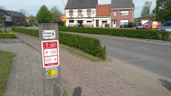
 signage
The route is fully signposted with nodes.
 Description
During his youth, Alfons de Ridder spent many vacations with his family in Blauberg, a hamlet of Herselt. Bowler hat on his head and walking stick in hand, he enjoyed the beautiful nature of nearby Helschot. The writer had found his pseudonym! Discover the Merode, the landscape that inspired Willem Elsschot to the full.
automatic translation
 nodes to follow
0 km
0.3 km
0.9 km
1.8 km
2.1 km
3.2 km
3.5 km
3.9 km
5.4 km
6 km
6.4 km
6.4 km
6.7 km
7.1 km
7.4 km
7.6 km
7.9 km
8.2 km
8.6 km
8.9 km
9.2 km
Friday, May 1, 2026 by Carine JaekenA walk out of the 1000! We saw some beautiful scenery. It’s the perfect walk for warm weather. There’s plenty of shade, and luckily, De Hulst tavern is along the way. For those who want to do the section between waypoints 150 and 165 without risking wet feet: now’s the time. :)
automatic translation
Sunday, July 23, 2023 by V.V.Beautiful walk pure nature good stop Mie maan and the Holly
automatic translation
Monday, September 6, 2021 by N.D.Change the starting point to Kerkplein 1, 2230 Blauberg instead of Herselt. Auto-gps does not find this, confusing so you can not find the node numbers. Walk itself is often on horse trail which is difficult because of deep sand, not suitable for strollers. A lot in woods, boring, also a lot of mud despite the last few days being dry.
automatic translation
Monday, February 22, 2021 by D.V.In the footsteps of Willem Elsschot, this walk leads through a varied landscape: meadows, fields, pristine woodlands and winding forest roads alternate.
automatic translation
Thursday, January 30, 2020 by J.P.Quiet walk through forest, grass fields and quiet streets. I always regret it when I have to walk on streets with cars, but the many long stretches make up for those few streets. One long very muddy stretch to get to 165 though, next time wear boots or wait until it has been dry for a while.
automatic translation
Thursday, January 23, 2020 by F.H.nice quiet walk
now currently in some parts a little too wet, boots definitely recommended
but am sure,that it is a wonderful walk in the ear and autumn
definitely going to do them again !!!
automatic translation
Thursday, March 22, 2018 by R.V.Very pleasant walk, very varied route (very wooded area, beautiful country roads and possibility to take a drinking break in the area) Easy walk on flat trail. Highly recommended!
automatic translation
Tuesday, December 26, 2017 by B.R.wonderful hike lots of nature definitely one to do again
automatic translation


 Upgrade to Premium Plus
