Loading...

Water Mill Path

automatic translation

15.6 km • Hoogstraten

Icon official route official route

15.6 km 0.0 km 0.0 km

route offered by

Badge of official route

more info

Icon starting point Addresse starting point (approximate)

Centrum Hoogstraten, Vrijheid of Dorpsplein Minderhout aan de Sint-Clemenskerk 149, 2320 Hoogstraten en Minderhout

Icon type signage of route signage

The route is fully signposted with nodes.

5m 5m 5m 5m
Atmosphere image 1 of route Water Mill Path Atmosphere image 2 of route Water Mill Path
© Toerisme Provincie Antwerpen

Icon description route Description

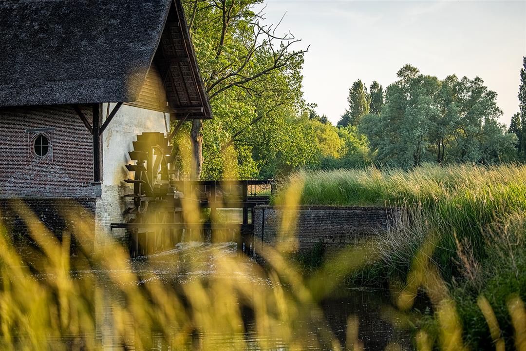
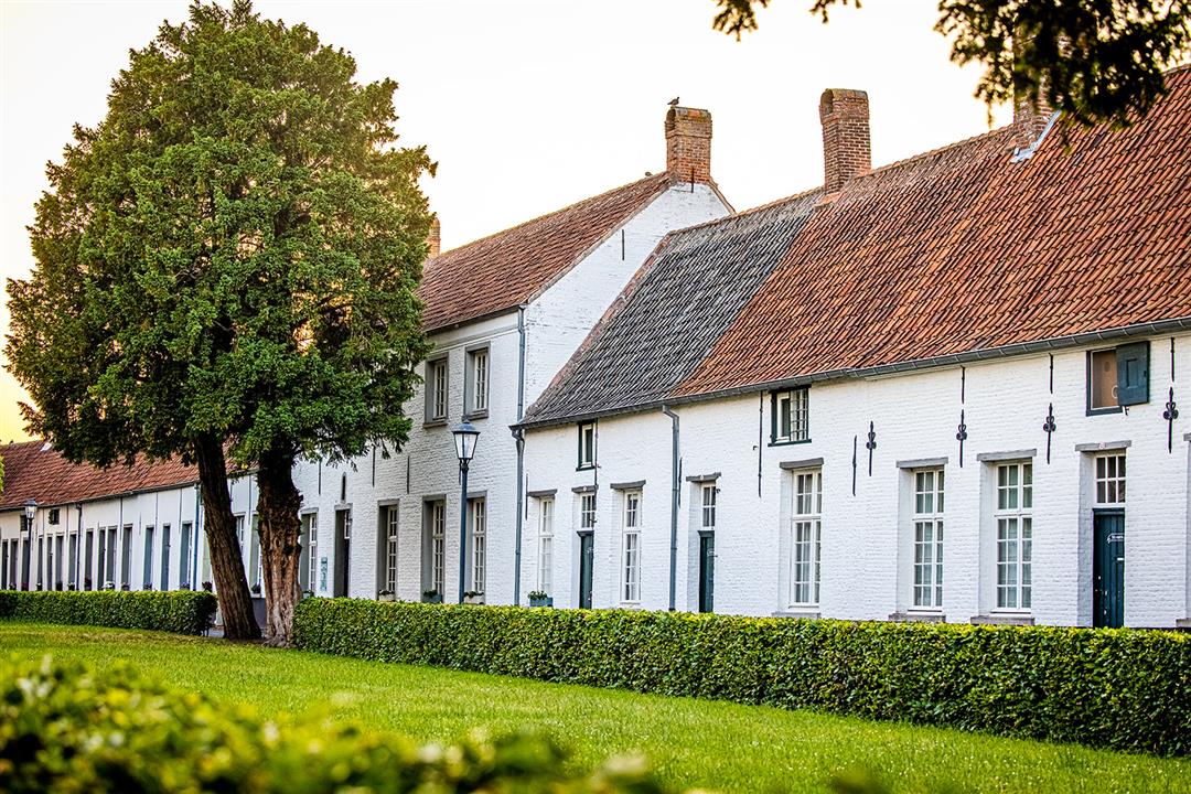
The Watermolenpad is a particularly beautiful hiking trail along a varied landscape of forests and fields. The walk takes you to authentic villages such as Minderhout, Hoogstraten, Castelré (part of BaarleNassau) and Wortel. You walk from heritage to heritage along the way (Sint-Katharinakerk, Begijnhof, Laermolen, Wortel-Kolonie) - you discover two Unesco World Heritage Sites and enjoy the green backyard of Hoogstraten. This walk offers you a mix of all the beauty Hoogstraten has to offer.

automatic translation

Icon nodes to follow nodes to follow

Image node 86
0 km
Image node 84
0.3 km
Image node 81
0.4 km
Image node 50
1.3 km
Image node 52
1.8 km
Image node 53
2.1 km
Image node 55
2.4 km
Image node 28
3 km
Image node 30
3.4 km
Image node 7
4.3 km
Image node 7
4.4 km
Image node 6
5.4 km
Image node 6
5.4 km
Image node 89
5.6 km
Image node 2
6 km
Image node 3
6.5 km
Image node 4
6.7 km
Image node 5
7 km
Image node 57
7.5 km
Image node 62
7.8 km
Image node 6
8.9 km
Image node 6
8.9 km
Image node 76
9.1 km
Image node 69
10.2 km
Image node 68
11.1 km
Image node 67
11.5 km
Image node 66
12.9 km
Image node 47
13.4 km
Image node 49
13.8 km
Image node 50
14.5 km
Image node 81
15.4 km
Image node 84
15.5 km
Image node 86
15.8 km
This route has 1 review(s).
Rate route!

Sunday, February 26, 2023 by Braeckmans LucVery nice varied walk: varied meadows, forests, fens, heathland, etc. The mentioned 9.5km is wrong. Provided, at the end of the hike, we already reached 15.8km. The fully indicated hike is at least 17km.
automatic translation

Which POI do you want to show on the map?

Experimental hiking network
Unsigned icon

The route you have chosen runs (partly) along an experimental virtual hiking node network (the blue-coloured nodes and sections on the map).

You must be logged in to plan routes here.

Experimental hiking network
Unsigned icon

The route you have chosen runs (partly) along an experimental virtual hiking node network (the blue-coloured nodes and sections on the map).

These routes are not controlled in the field. Before you start hiking here, take a minute to read what an experimental hiking node network is and what rules you should follow when hiking here.