 Hiking
 Login
Login
 More
More
 EN
EN
 Premium
The Colony Walk - stroller friendly
automatic translation
5 km • Hoogstraten
2.2661 1 4/5
route offered by
Toerisme Provincie Antwerpen
 Addresse starting point (approximate)
Kolonie 41, 2323 Hoogstraten
 signage
The route is fully signposted with nodes.
 Description
Together with the Valley of the Merkske and the Castelreesche Heide, the Kolonie forms about a 2000 ha nature reserve. Visitor Center De Klapekster is the base for biking and hiking tours. The colony of Wortel was known throughout Europe for taking in the poor and vagrants. Here and there you can find traces of it. We are happy to take you on a journey of discovery.
Wortel Colony is recognized as a UNESCO World Heritage Site, as part of the series of Colonies of Weldadigheid in the Netherlands and Belgium. These areas were set up in the 19th century in the north of the Netherlands and in the Antwerp Kempen region as agricultural colonies for a social purpose of poverty alleviation and gained international acclaim as social experiments. The entire landscape was designed, the buildings were carefully planned with an eye to efficiency and to maintain good overview and control. The area worked as one closed entity.
The starting point
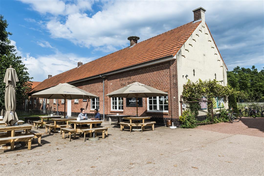
The starting and ending point of the colony walk is BC De Klapekster (Kolonie 41 in Wortel). The visitor center is also the place to go for more mapped walks. There is ample parking. In visitor center De Klapekster you can also visit the toilet, get more information or just have a drink.
Visitor Center De Klapekster is open Tuesday through Saturday between 1 and 5 p.m., and Sunday from 10 a.m. to 6 p.m.
The main attractions on the route.
-The tramp farm with Visitor Center De Klapekster
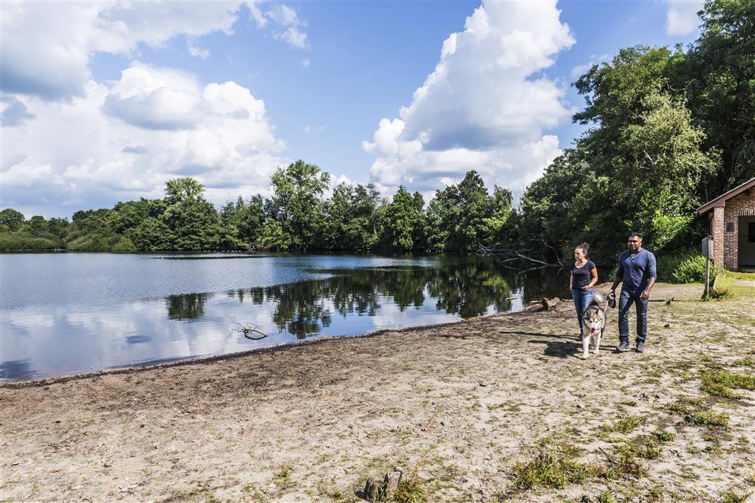
-The Bootjesven
-The geometric mosaic of long, austere avenues interspersed with farmland and fens, all laid out and maintained by former residents.
automatic translation
 nodes to follow
0 km
0.2 km
0.5 km
0.8 km
1.6 km
1.9 km
2.2 km
2.6 km
2.9 km
3.7 km
4 km
4.3 km
4.4 km
4.7 km
5.1 km
5.3 km
Sunday, September 5, 2021 by Y.V.Good starting point, plenty of parking even on Sundays. The walk starts nicely in the woods via a long lane on a forest path. From node 2 to 4 on a gravel road, takes a long time and many cyclists. Afterwards fortunately back into the woods. Between Junctions 2 and 3 there is a loose-leash area for dogs. A little further a beautiful lake, nice stopover.
automatic translation


 Upgrade to Premium Plus
