 Hiking
 Login
Login
 More
More
 EN
EN
 Premium
Kraaiven Walk
automatic translation
7.3 km • Keerbergen
4.3291 1 3/5
route offered by
Toerisme Keerbergen
 Addresse starting point (approximate)
Emiel Opdebeecklaan 33, 3140 Keerbergen
 signage
The route is not signposted. Use a GPS device or our app to follow the route.
 Description
Explore the west of Keerbergen and hike along the border with Rijmenam. With the Kraaiven Walk, you'll also hike past Kraaiberg, one of the highest points in Keerbergen.
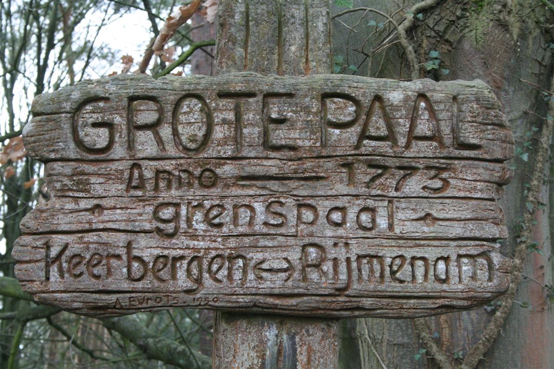
Did you see the border posts along the way? These were erected in 1774 to settle border disputes between Keerbergen and Rijmenam over logging on the heath. Experience the vastness of the Dijle valley between Rijmenam and Keerbergen, walk through the beautiful Zeept and finish the walk at the starting point in the Emiel Opdebeecklaan.
The streets you walk through on this route are: Emiel Opdebeecklaan, Zandstraat, Egelweg, Domien Liekenslaan, Grote Paallaan, Kraaiven, Zandstraat, Mechelsebaan, Watermolenstraat, Taboralaan, Dennenlaan, Kleine Paalstraat, De Selliers de Moranvillelaan, Grote Paallaan, Kraaivenstraat, Oude Keerbergse Baan, Eekhoornlaan, Brughoevestraat, Dijledijk, Zeeptstraat and back to Emiel Opdebeecklaan.
This route was worked out by the Keerberg Environmental Council and is not signposted.
automatic translation


 Upgrade to Premium Plus
