 Hiking
 Login
Login More
More EN
EN Premium
Cow Forest Walk - Red
automatic translation
11.8 km • Lubbeek
 official route
1.8981 4 4.2/5
route offered by
 Addresse starting point (approximate)
Parking site UZ Pellenberg, Weligerveld, 3212 Pellenberg (Lubbeek)
 signage
The route is not signposted. Use a GPS device or our app to follow the route through the virtual nodes.
 Description
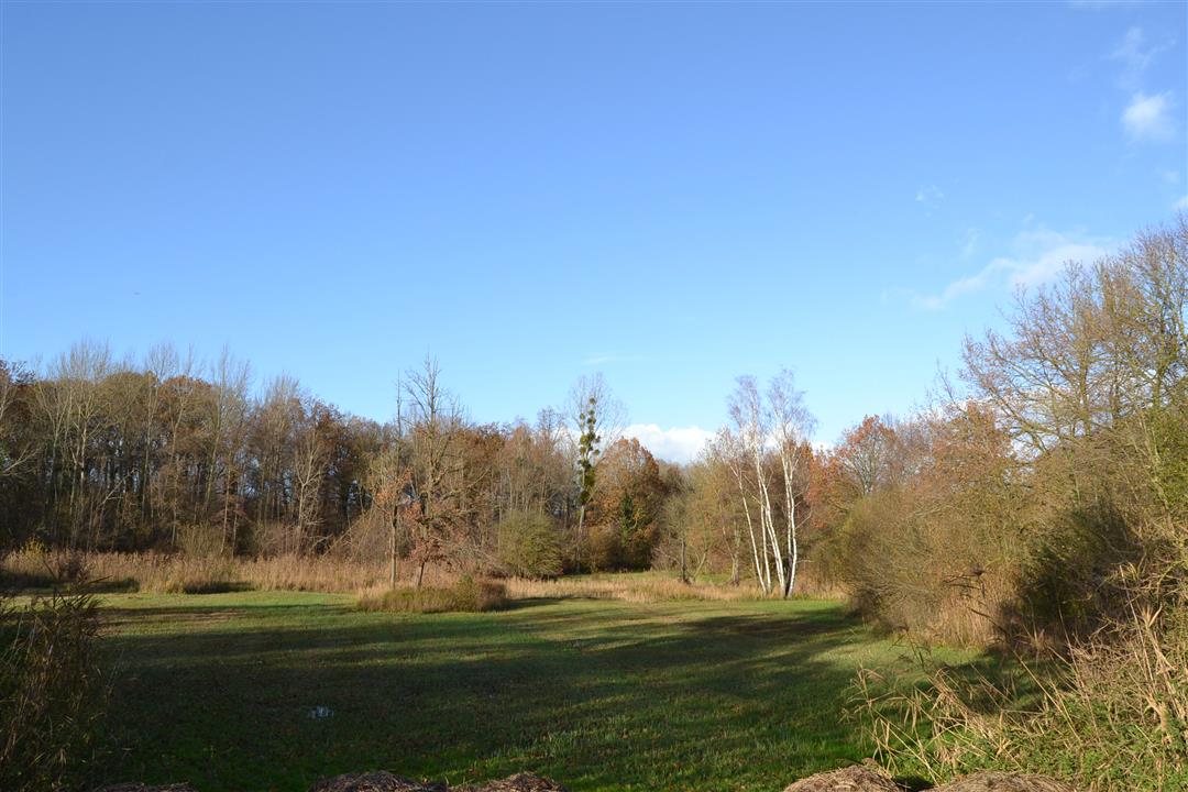
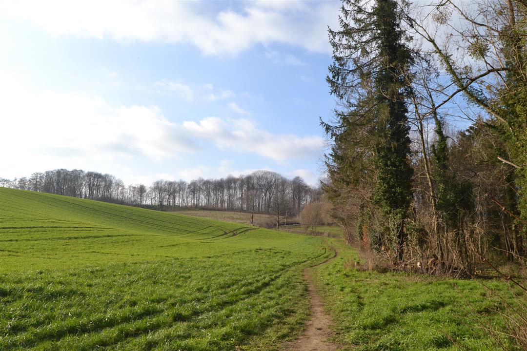
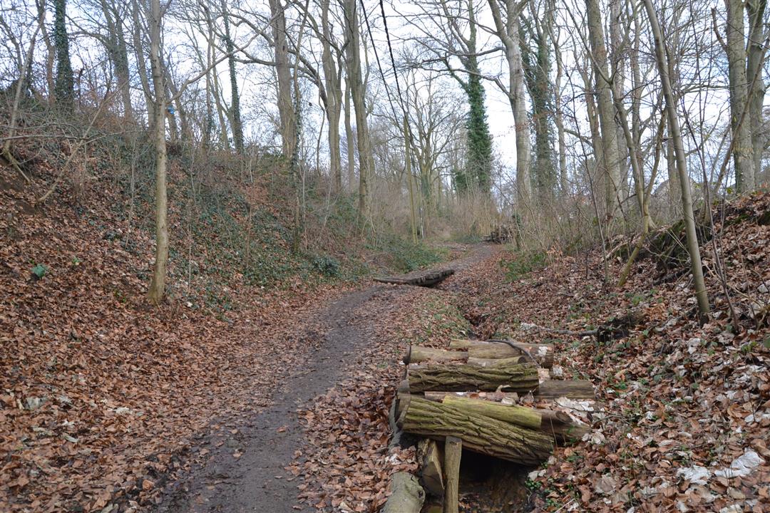
Between Bierbeek and Lubbeek is the Koebos, a beautiful old oak forest with lovely spring flora. Mineral-rich seepage zones in the valley provide remarkable plants. In addition, you can take lovely walks here in the impressive castle park. Since the Koebos acquired the status of a nature reserve, species diversity increased enormously. Meadows of meadowsweet, cuckoo flower and cuckoo flower appeared. In the spring, spearweed and wood anemone color the forest, followed later by salomon's seal, beetle orchid and broad-leaved wasp orchid. In addition to the Koebos, on this hike you will also become extensively acquainted with the much higher Gasthuisbos where the dead wood provides plenty of forest life, and you will walk between the two forests through a centuries-old hollow road.
NOTE: This is a walk on a virtual walking network. The nodes are not signposted on the site.The walk is signposted in 2 directions with red triangle.
This hike is offered by Tourism Flemish Brabant.
automatic translation
 nodes to follow
0 km
0.5 km
1.1 km
1.2 km
2.7 km
3.1 km
3.8 km
5.2 km
5.9 km
6.3 km
6.6 km
7.4 km
7.5 km
9.5 km
10.8 km
11.2 km
11.8 km
Thursday, June 20, 2024 by R.D.beautiful route , really a surprise , castle , green , woods , trails , ponds , very varied and as icing on the cake , a large beaver dam seen , beautiful .......met navigation perfect !
automatic translation
Saturday, May 11, 2024 by Wilfried Van RompaeyBeautiful hike indeed! Maybe this is a silly question, but armed with the numbers of the hiking nodes we went looking for the posts with those numbers ... but nope: only the "old" signs with the red triangles were found! Is this generally the case in Flemish Brabant or only here in Pellenberg? Thanks for asking.
automatic translation
Tuesday, January 26, 2021 by N.D.Beautiful walk along unpaved and paved roads with beautiful views with clear signage. 19 beautiful km s. With thanks to tourism Flemish Brabant and wandelelknooppunt
automatic translation
Friday, December 25, 2020 by Edwin MoonsThis is a nice walk partly in the woods, fields and small streets. However, the description is incorrect. The walk is 11 km and not 19.5 km. The walk is indicated by red triangles on hexagonal plate. I did not find the plates with linden forest walk anywhere.
automatic translation


 Upgrade to Premium Plus
