 Hiking
 Login
Login
 More
More
 EN
EN
 Premium
Pereboomsgat hiking trail
automatic translation
11.1 km • Lokeren
 official route
4.4137 11 3.7/5
 Addresse starting point (approximate)
Kruisstraat 74, 9180 Lokeren
 signage
The route is fully signposted with nodes.
 Description
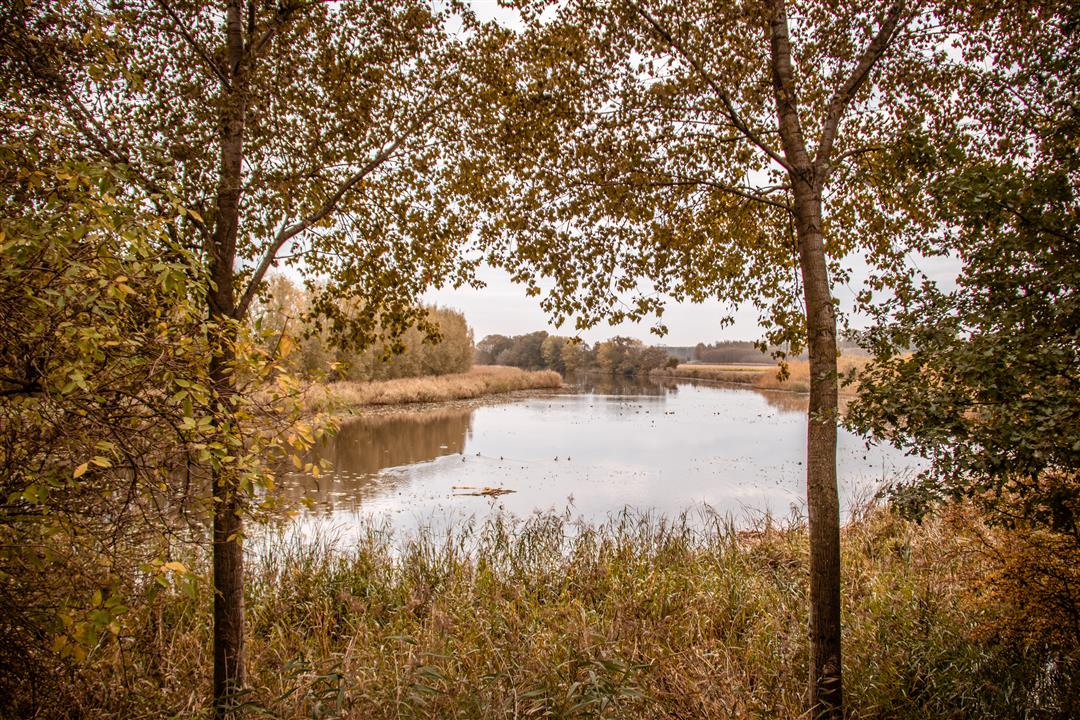
Pereboomsgat and Grote Kreek are remnants of floods in earlier times. During the Eighty Years' War, they were used by the Spaniards as transport arteries to their forts. Today the creeks are oases of calm where it is especially pleasant to walk.
automatic translation
 nodes to follow
0 km
0.3 km
0.4 km
0.9 km
1.8 km
2 km
3.5 km
3.6 km
5 km
6.1 km
6.4 km
7.3 km
7.5 km
7.9 km
8.2 km
8.7 km
9.1 km
9.5 km
9.6 km
9.9 km
10.8 km
Sunday, June 1, 2025 by Andy Van mellaertnice walk and beautiful pieces of nature
automatic translation
Sunday, December 29, 2024 by Sven Van Landeghem Beautiful hike! Start and finish at a tavern. First kilometers are on a track through the polders. Then into nature until almost the end. Highly recommended!
automatic translation
Friday, May 27, 2022 by Luc DhontFantastic hiking trail !
automatic translation
Thursday, May 26, 2022 by L.D.A great hiking trail, with beautiful scenery and scenic views. Also great for walking.
automatic translation
Monday, May 3, 2021 by L.D.Beautiful walk in a wide area. The hiking nodes on Dutch territory are with other rather miniscule signs (green Yellow) and very sparsely indicated That was a bit searching.
automatic translation
Sunday, March 28, 2021 by J.V.The starting node 89 is not in the Kruisstraat in Moerbeke but in the Polderstraat at the Rode Sluis. Have found that the junctions in the Netherlands do not connect perfectly with the junctions in Belgium At junction 85 (Ned.) there is no direction to 86. A large part of the route is more suitable as a bicycle route (too long boring polder roads)
automatic translation
Saturday, November 28, 2020 by Hilde SegersFirst part along the track but between the fields so quiet from 5km you go through nature and it becomes really beautiful. 1 bench about halfway before you enter the forest. We were satisfied
automatic translation
Saturday, November 21, 2020 by F.L.Quiet nature walk but on the boring side. I personally did not find the second part more engaging than the first.
automatic translation
Tuesday, November 17, 2020 by Dirk Van esbroeckThe first 4.5 km is downright boring, just concrete, along long straight concrete lanes and vast polders. Then only the first little road and then it gets more and more beautiful. Nice quiet slow roads on the GR122/GR5A among others along Pereboomsgat, lying on the border and on towards Grote Kreek.
automatic translation
Sunday, November 8, 2020 by H.C.First part is ordinary and run up to, which is hard to avoid with loops. In itself you then still have nice views of the area but is more via ordinary roads. From km5 you get into a more nature environment and it is a beautiful walk. Otherwise ideal hiking trail.
automatic translation
Sunday, November 8, 2020 by M.P.Beautiful natural area with plenty of variety.
automatic translation


 Upgrade to Premium Plus
