 Hiking
 Login
Login
 More
More
 EN
EN
 Premium
Saleghem hiking trail
automatic translation
7.8 km • Sint-Gillis-Waas
 official route
6.43426 16 4.1/5
 Addresse starting point (approximate)
Groenendijkstraat 11, 9170 Meerdonk
 signage
The route is fully signposted with nodes.
 Description
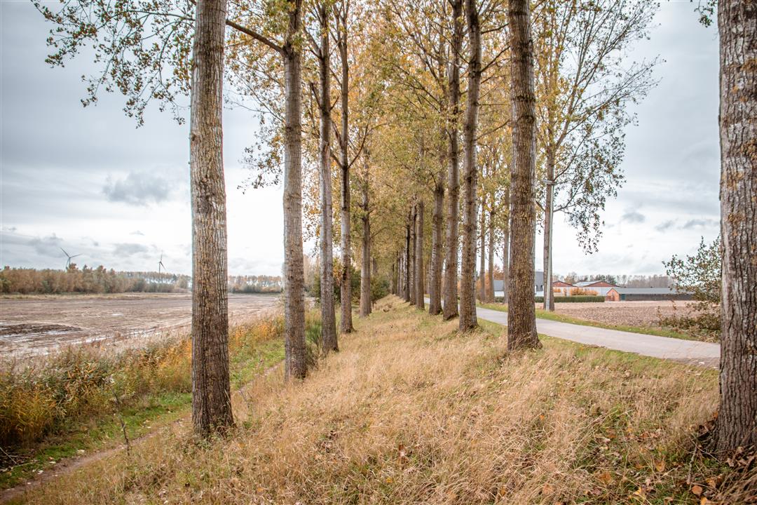
Water is never far away along this route. Polder roads and dikes lead us through a landscape that was partly sculpted by the sea, even if man did lend a hand. The clay soil that was brought in hides a lot of history, of which the creeks and wheels are silent witnesses.
TheSaleghem walking routeis offered to you byRouten, an initiative of Tourism East Flanders.
automatic translation
 nodes to follow
0 km
0.6 km
1.3 km
1.9 km
2.5 km
3.7 km
5.2 km
6 km
7.5 km
7.7 km
Sunday, April 12, 2026 by Kris Van de Vena lovely walk through the polders
automatic translation
Thursday, April 2, 2026 by Diane Van StrijdonckA lovely walk, with tulip fields partly in bloom—beautiful! I recommend wearing appropriate footwear. The walk starts and ends at De Boey ice cream farm; finish with an ice cream in the dining room—highly recommended!!
automatic translation
Friday, December 27, 2024 by Sven Van Landeghem Parked at den ouden hof between 94 and 95 where you can also get something to eat and drink. The ice cream shop on the way is also a must.
automatic translation
Tuesday, December 27, 2022 by Philip VerbertBeautiful hike, good footwear recommended, suitable with dog. Worth repeating. Parked along the side at indicated address.
automatic translation
Saturday, January 29, 2022 by L.C.Nice route - You can park at the church of Meerdonk, about 500m from node 94.
automatic translation
Sunday, January 9, 2022 by P.D.Quiet walk in flat area. Good walking shoes are recommended, especially in wet weather.
automatic translation
Friday, December 24, 2021 by Ingrid Waumanvery nice walk, done with gray weather but still you could see the vast polders. We started at the Turfbanken at Den Ouden hof, so that halfway we could enjoy a coffee at the Ijshoeve De Boey. Lots of little paths, which were not yet muddy.
automatic translation
Sunday, March 7, 2021 by bert rouckhoutnice quiet walk with a delicious ice cream shop and take away
automatic translation
Tuesday, January 26, 2021 by Frank Van rietBeautiful walking route with variety. You can park your car at the large Saleghemgeul (junction 88 on the groendijk) is less than 500 m from the starting point. Best to wear appropriate footwear after or in rainy weather!
automatic translation
Monday, January 4, 2021 by M.V.hike done on 3/1/2021 nice hike,nice unpaved trails,nice views.70% unpaved.
automatic translation
Sunday, December 20, 2020 by D.B.Walked today, placed car at node 95.Walk was beautiful especially since it is in the polders and along the dikes. Stopped along the way at the take away for a drink and a hot gluhwijn.
automatic translation
Tuesday, December 15, 2020 by Marc BouillonWhere is the best place to park your car in the perimeter?
automatic translation
Sunday, December 13, 2020 by Sonja van DongenDid this hike today and we enjoyed it. Beautiful views, nice roads and as icing on the cake a take away along the way where we had a delicious coffee and a jeneverke. Away from reality and cleared our heads.
automatic translation
Sunday, November 29, 2020 by Peter Van De WeyerVery nice route, sometimes on enclosed beautiful trails, sometimes with sweeping vistas. Halfway through a nice and tasty stop.
automatic translation
Tuesday, November 24, 2020 by Lieve SaquetVery nice route, beautiful views! We did it with 2 baby carriages, which is not recommended although you can also follow the route mostly on the track. ;) In my opinion you do miss the most beautiful parts.
automatic translation
Thursday, November 12, 2020 by K.V.Nice hike along the fields and dikes...quiet...and a little over halfway you pass ice cream farm the boey...always a hit
automatic translation


 Upgrade to Premium Plus
