 Hiking
 Login
Login
 More
More
 EN
EN
 Premium
Poacher forest hiking trail
automatic translation
7 km • Sint-Gillis-Waas
 official route
10.51816 11 4/5
 Addresse starting point (approximate)
Buitenstraat, 9170 De Klinge
 signage
The route is fully signposted with nodes.
 Description
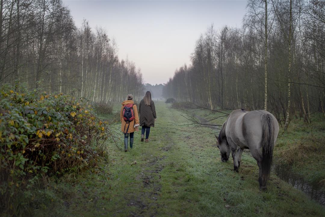
The Stropersbos, one of the great Wase kleppers, accounts for nearly 500 hectares of impressive fauna and flora, flanking the Dutch border. Large grazers ensure that the heathland can grow here sustainably. Across the area runs the Bedmarlinie, an important defensive wall against our northern neighbors during the War of the Spanish Succession.
ThePoachers forest walking routeis offered to you byRouten, an initiative of Tourism East Flanders.
automatic translation
 nodes to follow
0 km
1 km
1.4 km
1.7 km
2.2 km
3.4 km
4.2 km
5.1 km
5.8 km
6.3 km
6.4 km
7.1 km
Sunday, April 24, 2022 by Danny HoskensBeautiful wooded hike. For photos copy the link below and paste into your browser, if not clickable: https://dmek1960.blogspot.com/2022/04/wandeling-in-sint-gillis-waas-be-en-de.html
automatic translation
Saturday, April 23, 2022 by Guido De SchutterNode 94 instead of node 93.
automatic translation
Saturday, April 23, 2022 by Guido De SchutterBeautiful hike. 95% forest. Good roads and trails. Better to start at node 93. Then you have parking at the soccer field. At the end of the hike in taverne De (ou)de statie something to drink, maybe also something to eat.
automatic translation
Sunday, November 14, 2021 by Sarah VermeulenSetback. The 7km route consists only of forest, not much else to see. Definitely not recommended for someone who likes variety. Also very crowded on a beautiful autumn afternoon.
automatic translation
Sunday, November 29, 2020 by Kimberley StrijbosNice walk! The bit along the street (93) didn't need to be included. Parking is indeed best along Koningstraat. Although it was Saturday, we did not encounter too many people. Highly recommended! With the dog you are not allowed in the reserve, but you pass it and don't necessarily have to go through.
automatic translation
Saturday, November 28, 2020 by M.B.Nice hike, but the idea of doing this on a Saturday afternoon did not prove unique. Very crowded, keeping distance at crosses in these Corona times does not appear to have caught on to this area. Parking easiest here: Buitenstraat 7, 9170 Sint-Gillis-Waas, or along the poacher's road as several hundred fellow hikers did.
automatic translation
Saturday, November 14, 2020 by B.N.Nice forest walk on well trodden paths although I found the start point not clearly locatable. It says Buitenstraat but it is actually Koningstraat at the little station. At junction 78 you have to turn right where the barrier customs is because that is not very clear there either. Beautiful scenery. I enjoyed it 👍
automatic translation
Tuesday, November 3, 2020 by Frank Van rietBeautiful route, hats off to those that mapped out the route, beautiful nature and especially at this time of year, fall colors, mushrooms.... and lots of benches to rest! From Pole 81 to 73 just pay attention, if you come to the cross path you must turn right, there is no pole! Otherwise, everything is clearly marked!
automatic translation
Sunday, November 1, 2020 by G.W.Beautiful hike in a beautiful area. Lots of mushrooms in this season and beautiful fall colors.
automatic translation
Sunday, November 1, 2020 by Carine De cockBeautiful route. Saw many horses , fun for the kids.
automatic translation
Saturday, October 31, 2020 by Ronan Van LaereBeautiful area, nice walks. Only the reserve where the animals run free is forbidden to dogs
automatic translation


 Upgrade to Premium Plus
