 Hiking
 Login
Login More
More EN
EN Premium
Demer shorts walk - Red
automatic translation
8.9 km • Scherpenheuvel-Zichem
 official route
2.1560 10 4.6/5
route offered by
 Addresse starting point (approximate)
Watermolen van Testelt, Dorp 34, 3272 Testelt (Scherpenheuvel-Zichem)
 signage
The route is fully signposted with nodes.
 Description
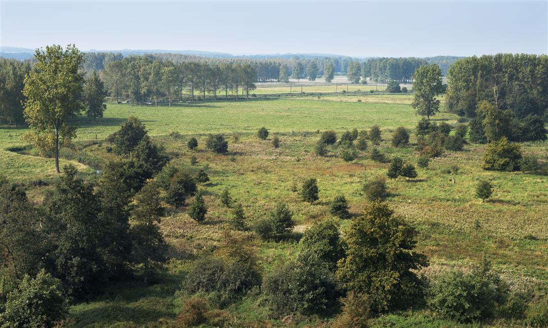
The Demerbroeken form a vast chunk of nature in the wide valley of the Demer, between Testelt, Zichem, Averbode and Diest. You cross a pristine flood plain there. The Agency for Nature and Forest is working with Natuurpunt to develop a vast nature reserve with reed thickets, alternating with species-rich hay meadows and native deciduous forest. On the Voortberg you can enjoy a magnificent panorama.
Follow the junctions of the Wandelnetwerk de Merode or the signposts with the red triangle.
This walk is offered by Tourism Flemish Brabant.
automatic translation
 nodes to follow
0 km
0.1 km
0.2 km
1.8 km
2 km
3.1 km
3.6 km
3.9 km
4 km
4.3 km
5.2 km
6.3 km
6.6 km
8.6 km
8.8 km
Monday, August 22, 2022 by A.J.Very nice hike. Hiked for the second time. The first time was in winter, where the pants took all the credit with the necessary mud. Now brilliant dry weather and unlike other trails still beautiful green nature. Will definitely explore it in fall and spring as well.
automatic translation
Wednesday, May 11, 2022 by T.G.By far one of the most beautiful walks I have done: small roads, beautiful paths, sometimes in the forest, sometimes in open fields with really beautiful views, a place to have a drink/ice-cream, a short walk through a meadow between nibbling cows and horses, ... I did it on a warm spring day, so dry trails everywhere. I will do this one again!
automatic translation
Wednesday, January 26, 2022 by B.G.Did the hike today. Lots of mud and difficult roads. The signage is perfect
automatic translation
Thursday, May 6, 2021 by Luc WullaertBeautiful and pleasant hike with lots of nature. The Demerbroeken in Zichem are beautiful as a nature reserve. In zichem a small piece along the road to make a crossing from the Demer to the brooks. This hike is definitely recommended. If desired, you can also deviate from the route to the Maagdentoren.
automatic translation
Sunday, February 28, 2021 by P.N.Blessed hike in a beautiful natural area. Beautiful view also from the hill. This hike is highly recommended!
automatic translation
Sunday, February 28, 2021 by T.L.Very nice hike, we will definitely do it again. Beautiful weather today too
automatic translation
Sunday, January 10, 2021 by B.C.very nice and quiet walk, appropriate shoes or boots may be necessary in the demerbroek in wet weather, very nice views in nature
automatic translation
Monday, December 28, 2020 by E.B.Thoroughly enjoyed this walk
automatic translation
Monday, December 21, 2020 by bert rouckhoutnice quiet walk do take appropriate shoes because in the demerbroek there was a lot of mud but nature was very beautiful
automatic translation
Saturday, November 14, 2020 by JOS BOESMANSBlessed hike that you can also start at Hemmekes hall in Zichem (node 342). A minimum of paved roads and beautiful views of the wooded hill in Testelt. Absolutely recommended. (Not a hike for buggies).
automatic translation


 Upgrade to Premium Plus
