 Hiking
 Login
Login
 More
More
 EN
EN
 Premium
Knotwilgenwandeling
10.4 km • Ternat
 official route
4.3325 10 4.2/5
route offered by
 Addresse starting point (approximate)
Cultuurcentrum De Ploter, Kerkstraat 4, 1742 Sint-Katherina-Lombeek
 signage
The route is signposted with thematic signs (no nodes). You can use a GPS device or our app to follow the route through the virtual nodes.
 Description
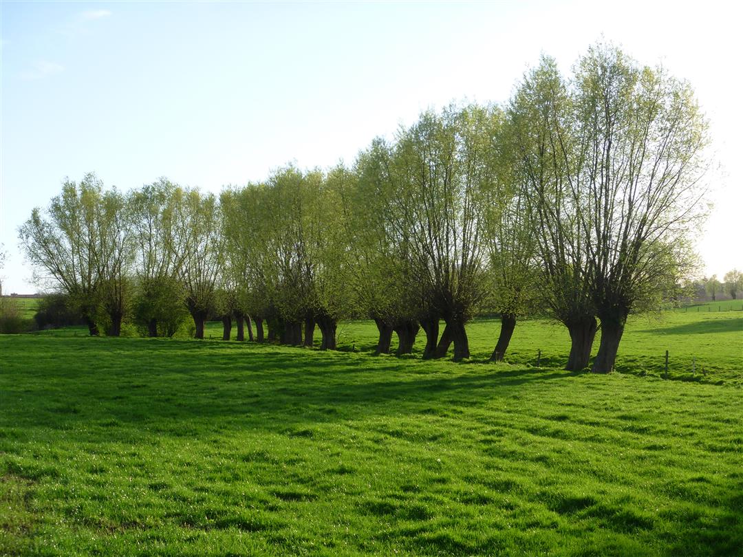
It’s such a peaceful and quintessentially Flemish scene: the pollarded willows lining the edge of a stream that marks the boundary of the meadow. You’ll find plenty of scenes like this on this beautiful nature walk in the Sint-Katherina-Lombeek area. You’ll pass by little chapels and farmhouses, and here and there you’ll come across a beautiful view of the Pajottenland. For a moment, you’ll venture into the young Hertigembos, which, together with the Liedekerkebos, forms a 200-hectare forest area.
automatic translation
 nodes to follow
0 km
0 km
0.6 km
1.4 km
1.6 km
2.4 km
3 km
3.2 km
3.7 km
4.5 km
5.2 km
5.7 km
6.6 km
7.1 km
7.9 km
8.6 km
9 km
10.3 km
10.3 km
10.3 km
10.3 km
Sunday, March 15, 2026 by N.V.The route truly lives up to its name. Lots of pollarded willows and beautiful scenery. Be warned, though—the trail gets very muddy after it rains.
automatic translation
Monday, August 25, 2025 by J.V.very nice walk, changing environment, forest, meadow, fields. beautifully maintained. now bone-dry paths, well marked. cleverly selected! easy parking, and a finish in the local cafe. in short, beautiful morning.
automatic translation
Thursday, August 7, 2025 by Ine De CouckNice hike along many footpaths and well marked. Worth repeating.
automatic translation
Saturday, August 7, 2021 by Freddy LeclercqNice hiking trail, lots of nature, I hadn't noticed so many pollard willows in my neighborhood.
automatic translation
Sunday, December 13, 2020 by S.D.Fun hike, but better done in good weather. T was a famous mud hike anyway!
automatic translation
Monday, November 23, 2020 by Antoine HerreboutToday in beautiful autumn weather we did this wonderful walk in a very beautiful region. Most of the walk is through nature with changing scenery of woods, meadows and fields all fringed with lots of pollard willows.Worth repeating!
automatic translation
Sunday, November 15, 2020 by M.D.Beautiful route !
automatic translation
Monday, October 26, 2020 by B.K.nice walk through forest and flat landscapes
automatic translation
Saturday, October 17, 2020 by A.V.Very nice hike. When returning to St. K. Lombeek, you have to go up the roundabout to the left and a little further there is a sign (low to the ground) on the right side of the street to turn into the path there.
automatic translation
Saturday, October 3, 2020 by C.V.very nice route, lots of greenery, piece of forest, mostly flat
automatic translation


 Upgrade to Premium Plus
