 Hiking
 Login
Login
 More
More
 EN
EN
 Premium
The Pink March: Averbode
automatic translation
7.6 km • Scherpenheuvel-Zichem
 official route
8.22414 14 4.7/5
route offered by
 Addresse starting point (approximate)
Abdijstraat 1, 3271 Averbode
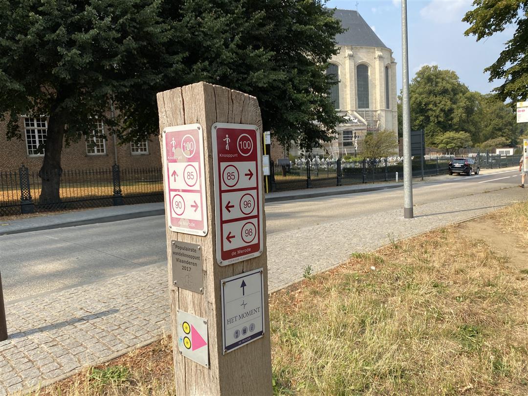
 signage
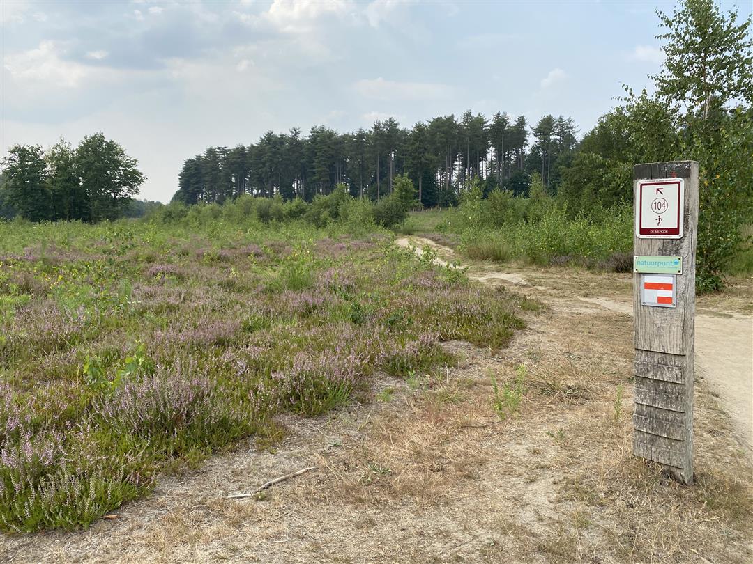
The route is fully signposted with nodes.
 Description
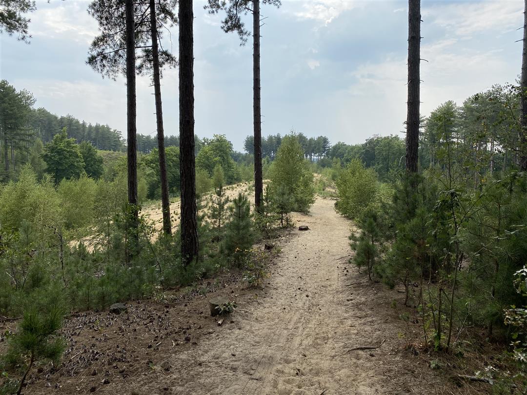
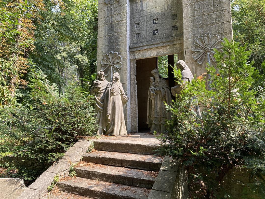
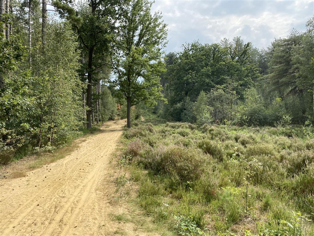
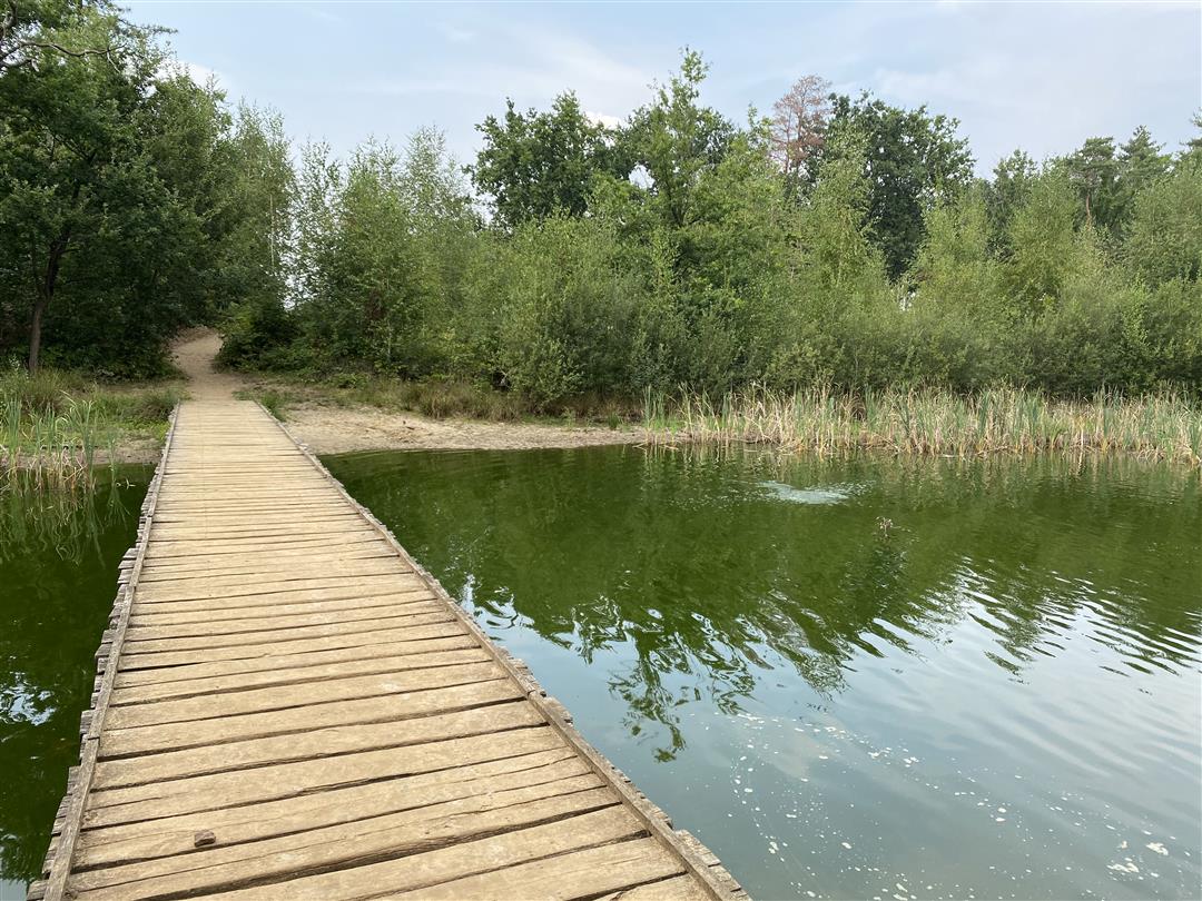
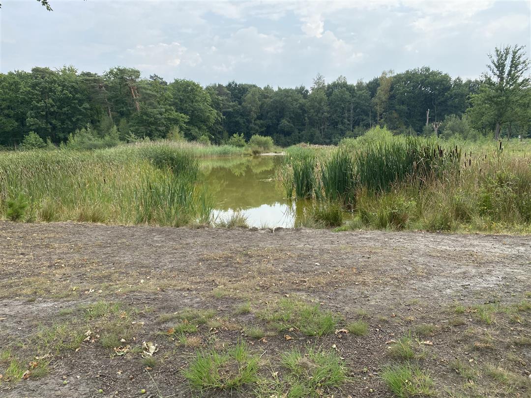
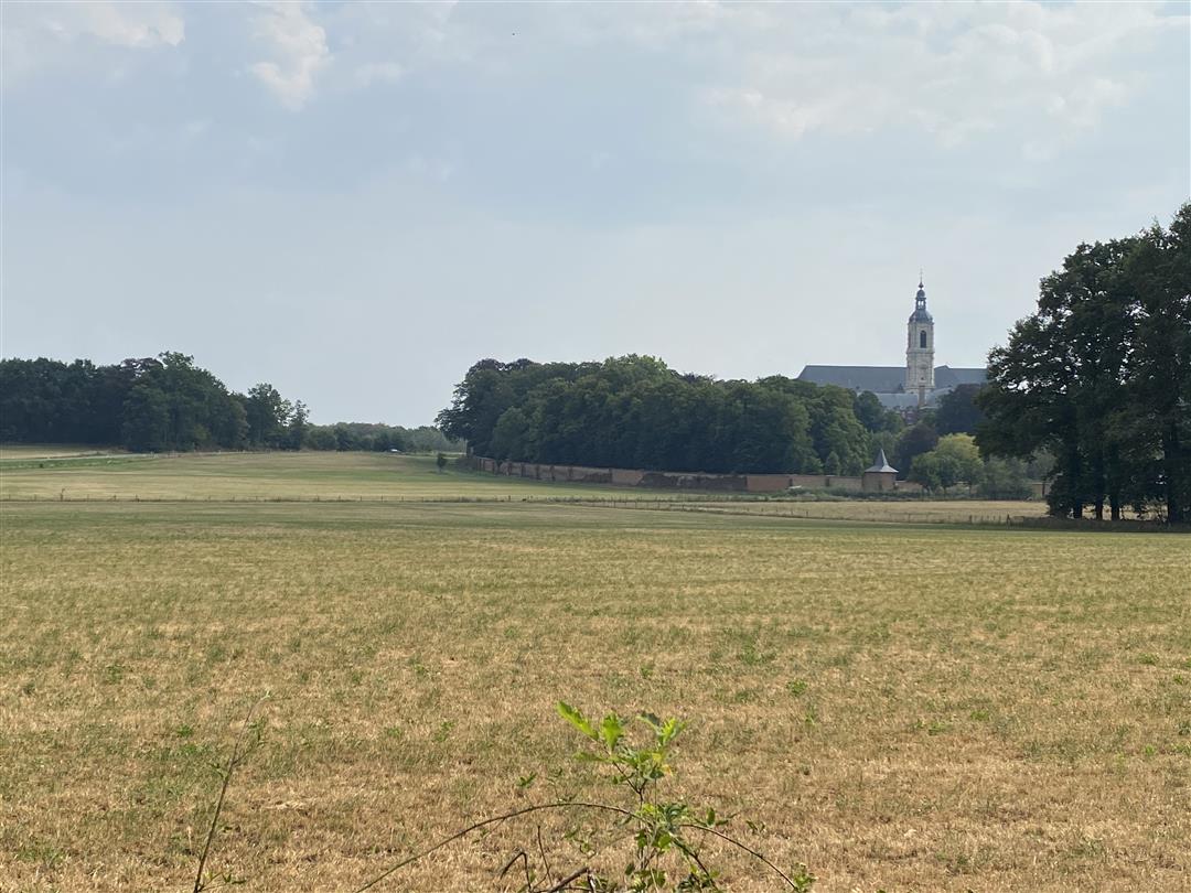
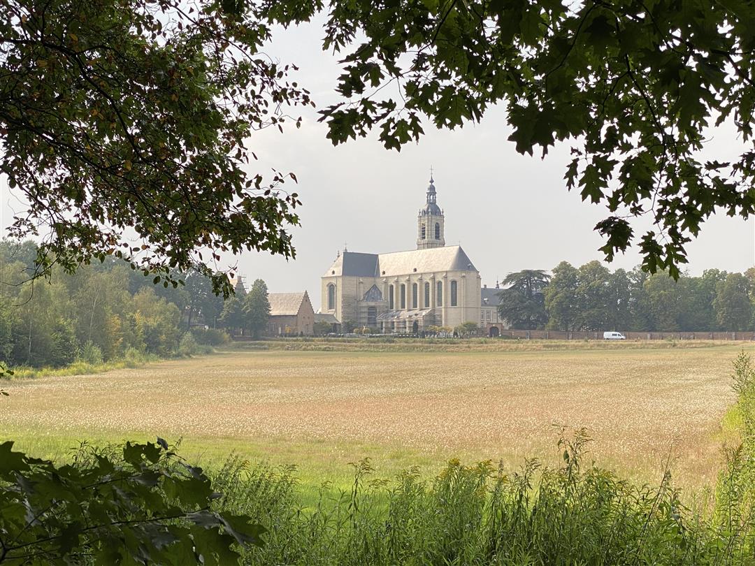
This route starts at the Averbode Abbey, a beautiful structure on the border point between the provinces of Flemish Brabant, Antwerp and Limburg. Via Maria Park you walk through the Averbode Bos en Heide nature reserve. You will discover vast forests along fens and marshes. The paths here meander through a unique landscape in Flanders. If you like peace and nature you will feel right at home here.
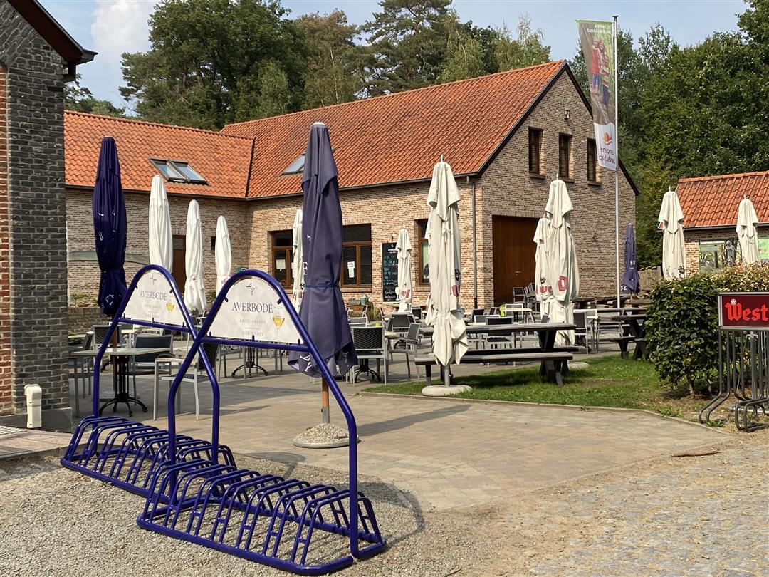
After about 5 km walk you arrive at the tavern Den Eik where you can make a nice stop in this beautiful Merode area. A bit further you come along a walking path with on the right side a nice view of the abbey. When you almost reach the end of this route you come to the so-called 'Lekdreef' where you can enjoy a well-deserved ice cream in the shadow of the abbey. Tip: be sure to visit the Abbey Café of Het Moment (behind the abbey). In this special place, most dishes are prepared with at least one Averbode product: beer, cheese, bread, gingerbread or speculoos.
automatic translation
 nodes to follow
0 km
0 km
0.5 km
0.7 km
1.2 km
1.2 km
2.1 km
2.7 km
3.1 km
3.4 km
3.4 km
4 km
4.2 km
4.5 km
5.1 km
5.1 km
5.9 km
6.3 km
6.4 km
6.9 km
7.3 km
7.7 km
Sunday, June 28, 2026 by Cy ThijsA really nice walk, but the distance doesn't seem to add up. A stop at the inn is definitely recommended.
automatic translation
Saturday, May 16, 2026 by Shaury VdbA really nice walk!
automatic translation
Saturday, October 18, 2025 by Bult Bootone of the most beautiful hikes we have already done
automatic translation
Sunday, July 13, 2025 by David Brockenvery nice route in warm weather, a lot in forest, shade....and the oak, is a nice and tasty stopover
automatic translation
Wednesday, May 7, 2025 by Sabrina Stormsvery nice walk for myself and my 3 dogs. plenty of variety , only on the way to node 87 the road was interrupted by a mud puddle, you could go up a little further and then jump over it . a challenge with 3 dogs on leash :D worth repeating !
automatic translation
Sunday, November 10, 2024 by Eddy & RitaBeautiful route, highly recommended. We have often hiked at Averbode but had not yet been to the dunes. There were no ice cream stalls in the Lekdreef (10/11/20..). those are only there in the summer months.
automatic translation
Wednesday, August 25, 2021 by Luc WullaertNice and pleasant walk in the woods and along the fens around the abbey. Definitely a plus this period : the heather is in bloom. Recommended
automatic translation
Saturday, August 21, 2021 by Michel GallettiNice hike, reasonable amount of inclines and descents (not too big), sandy ground in most parts of the trail. Largest part also through fairly wooded area so for landscapes I wouldn't recommend it. Also quite busy because of the abbey in the area which is worth seeing. The abbey terrace is a nice ending.
automatic translation
Tuesday, June 22, 2021 by I.V.Beautiful composition with historical sites at the beginning, almost only unpaved paths and roadways, diverse biotopes and still passable even after heavy rain.
automatic translation
Sunday, January 3, 2021 by Andy LuytenNice walk - leaving at point 100 is a bit more difficult now that all the parking there is gone. Easier to leave at point 96, large parking lot there, or at afspanning den eik, also large parking available.
automatic translation
Wednesday, October 14, 2020 by Marclline-frieda PeetersA surprisingly beautiful and varied hike.
automatic translation
Thursday, September 17, 2020 by B.M.Beautiful, surprising hike through a varied landscape. Highly recommended!
automatic translation
Sunday, August 30, 2020 by F.V.Fantastic hike. Perhaps best during the week if possible, as around the abbey it is quite busy on weekends
automatic translation
Sunday, August 30, 2020 by Ria VerachtertWas already somewhat familiar with the nodes there, but now followed that route once and still saw new surprises. Beautiful walk and now especially with the heather in bloom. HIGHLY RECOMMENDED!
automatic translation


 Upgrade to Premium Plus
