Loading...

The Pink March: Gaasbeek

automatic translation

8.4 km • Lennik

Icon official route official route

8.4 km 0.0 km 0.0 km

route offered by

Badge of official route

Icon starting point Addresse starting point (approximate)

Kasteelstraat 38, 1750 Lennik

Icon type signage of route signage

The route is fully signposted with nodes.

5m 5m 5m 5m
Atmosphere image 1 of route The Pink March: Gaasbeek Atmosphere image 2 of route The Pink March: Gaasbeek Atmosphere image 3 of route The Pink March: Gaasbeek
© Pink Ribbon

Icon description route Description

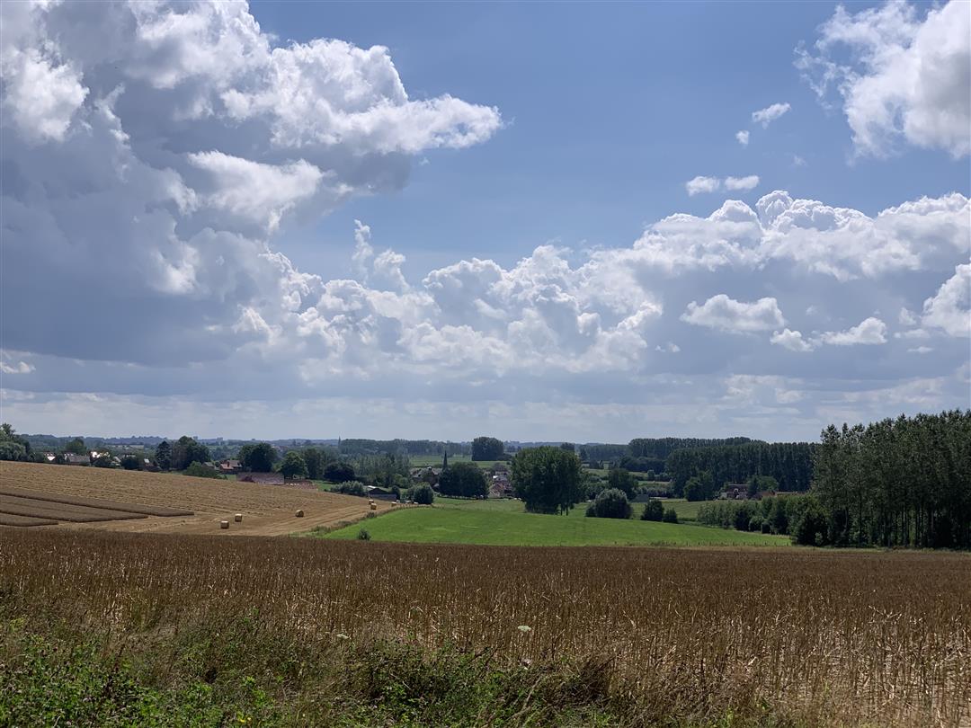
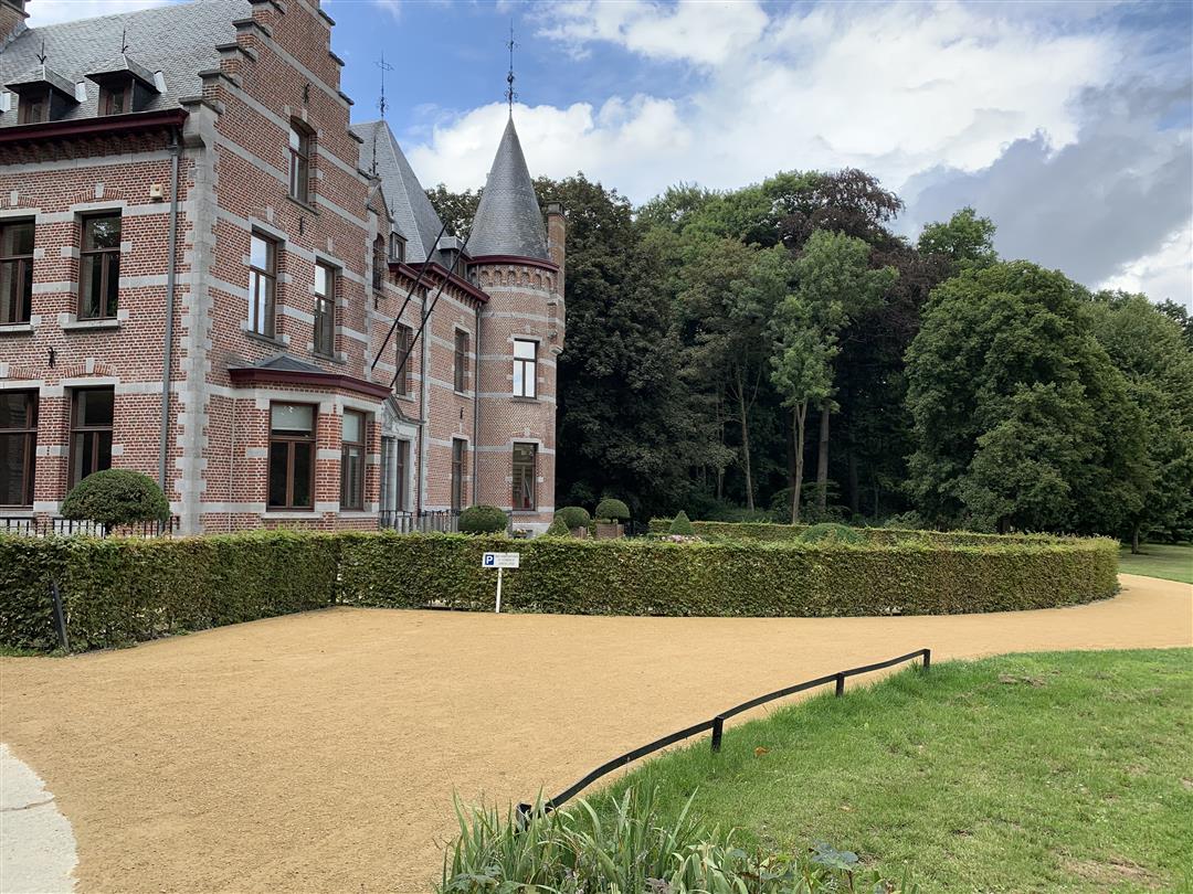
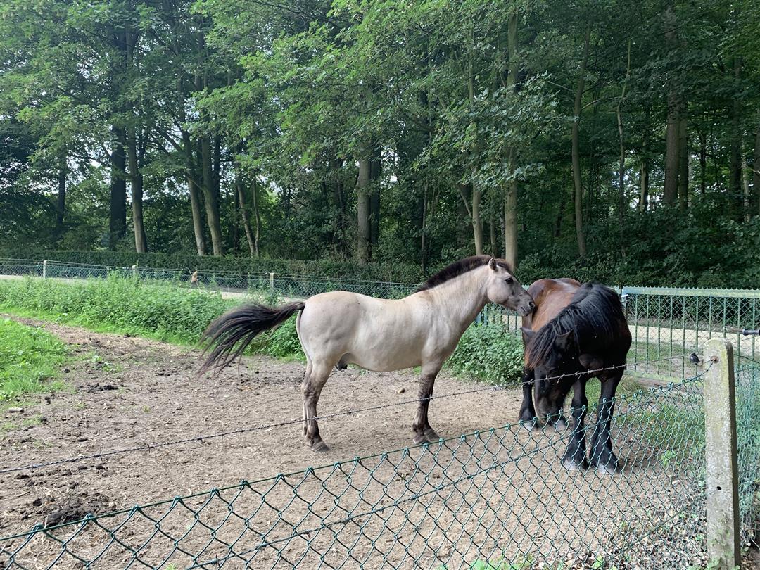
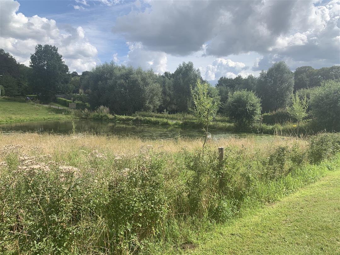
Depart from the parking lot of Gaasbeek Castle for a walk through the beautiful Pajottenland, a stone's throw from Brussels. You will also cross the beautiful Groenenberg domain. A rolling green landscape, pleasant forest paths, a babbling brook and grand castles. During this hike, you will encounter pearl after pearl. If you're lucky you'll even spot farm horses. At Gaasbeek Castle, you will discover the untouched beauty of the Pajottenland.

automatic translation

Icon nodes to follow nodes to follow

Image node 126
0 km
Image node 730
0.3 km
Image node 129
0.8 km
Image node 129
0.8 km
Image node 127
1.4 km
Image node 128
2.2 km
Image node 196
3.3 km
Image node 125
3.6 km
Image node 129
4.8 km
Image node 129
4.9 km
Image node 122
5.3 km
Image node 121
5.8 km
Image node 111
6.6 km
Image node 124
6.9 km
Image node TP
7.7 km
Image node TP
7.8 km
Image node 126
8.4 km
This route has 2 review(s).
Rate route!

Friday, November 13, 2020 by N.N.Very nice hike. Good for beginners or with children. All field roads, no paved roads.
automatic translation

Friday, November 6, 2020 by F.M.Beautiful region and very nice views
automatic translation

Which POI do you want to show on the map?

Experimental hiking network
Unsigned icon

The route you have chosen runs (partly) along an experimental virtual hiking node network (the blue-coloured nodes and sections on the map).

You must be logged in to plan routes here.

Experimental hiking network
Unsigned icon

The route you have chosen runs (partly) along an experimental virtual hiking node network (the blue-coloured nodes and sections on the map).

These routes are not controlled in the field. Before you start hiking here, take a minute to read what an experimental hiking node network is and what rules you should follow when hiking here.