 Hiking
 Login
Login
 More
More
 EN
EN
 Premium
Aronst Hoekwandeling
10.6 km • Geetbets
 official route
2.7272 6 3.8/5
route offered by
 Addresse starting point (approximate)
Stationsplein, Drinkteilstraat, 3450 Geetbets
 signage
The route is fully signposted with nodes.
 Description
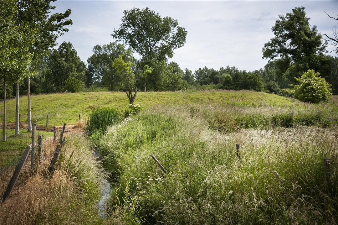
As you leave Geetbets, you’ll immediately pass a motte and a watermill on your way into the Aronst Hoek nature reserve. Waterproof shoes or boots will come in handy in this beautiful floodplain area with reed beds, sedge meadows, and willow groves. In the neighboring village of Rummen, you’ll walk through the Warandebos, once the magnificent castle estate of Count Arnold van Rummen, the last Count of Loon. Past the Terlenen castle farm, you’ll catch sight of St. Paul’s Church. The oldest Ginkgo biloba (Japanese nut tree) in Europe stands proudly in the rectory garden.
automatic translation
 nodes to follow
0 km
1.1 km
1.5 km
3.8 km
3.9 km
4.1 km
4.8 km
5.5 km
5.6 km
6.2 km
7 km
8.5 km
8.8 km
9.5 km
9.9 km
10.2 km
10.2 km
10.6 km
Friday, June 20, 2025 by L.V.In June '25 it was doable with sandals and the effort.... The start, junction 44, is on Railroad Street. There you can park at the Palace. If you enter Drinkteilstraat as published, follow it in order to get to the center of Geetbets. Where it crosses Steenstraat and Ijzerwegstraat, you will find the pole. That was quite a search!
automatic translation
Thursday, September 26, 2024 by S.L.I really enjoyed the first part of the hike,until I walked from node 415 to 45,until over the little bridge everything was still ok,but then,had to turn around halfway because there was no getting through,the path was completely under water and mud,tried to continue but "Unfortunately".Very unfortunate.
automatic translation
Sunday, August 28, 2022 by D.C.Beautiful hike, really nice scenery and views. The anonymous user criticizing this hike is either an idiot with no taste or legally blind.
automatic translation
Tuesday, November 23, 2021 by Kim FransenBeautiful walk through many vast green fields, few paved roads. In rainy season does require good walking shoes. Highly recommended!
automatic translation
Wednesday, August 5, 2020 by Geert CoenenBeautiful walk among fields and meadows, in the middle of a nature reserve! Recommended.
automatic translation
Sunday, August 2, 2020 by A.V.Hike had little variety. You hike much of the time between bushes, among other things, so you don't see anything of the surroundings/natural area. You also hike along major roads several times and there is no signpost.
automatic translation


 Upgrade to Premium Plus
