Loading...

Great Tide Walk

automatic translation

12.8 km • Linter

Icon official route official route

12.8 km 0.0 km 0.0 km

route offered by

Badge of official route

Icon starting point Addresse starting point (approximate)

Sint-Pancratiuskerk, Dorpstraat, 3350 Melkwezer (Linter)

Icon type signage of route signage

The route is fully signposted with nodes.

5m 5m 5m 5m
Atmosphere image 1 of route Great Tide Walk Atmosphere image 2 of route Great Tide Walk Atmosphere image 3 of route Great Tide Walk
© Lander Loeckx

Icon description route Description

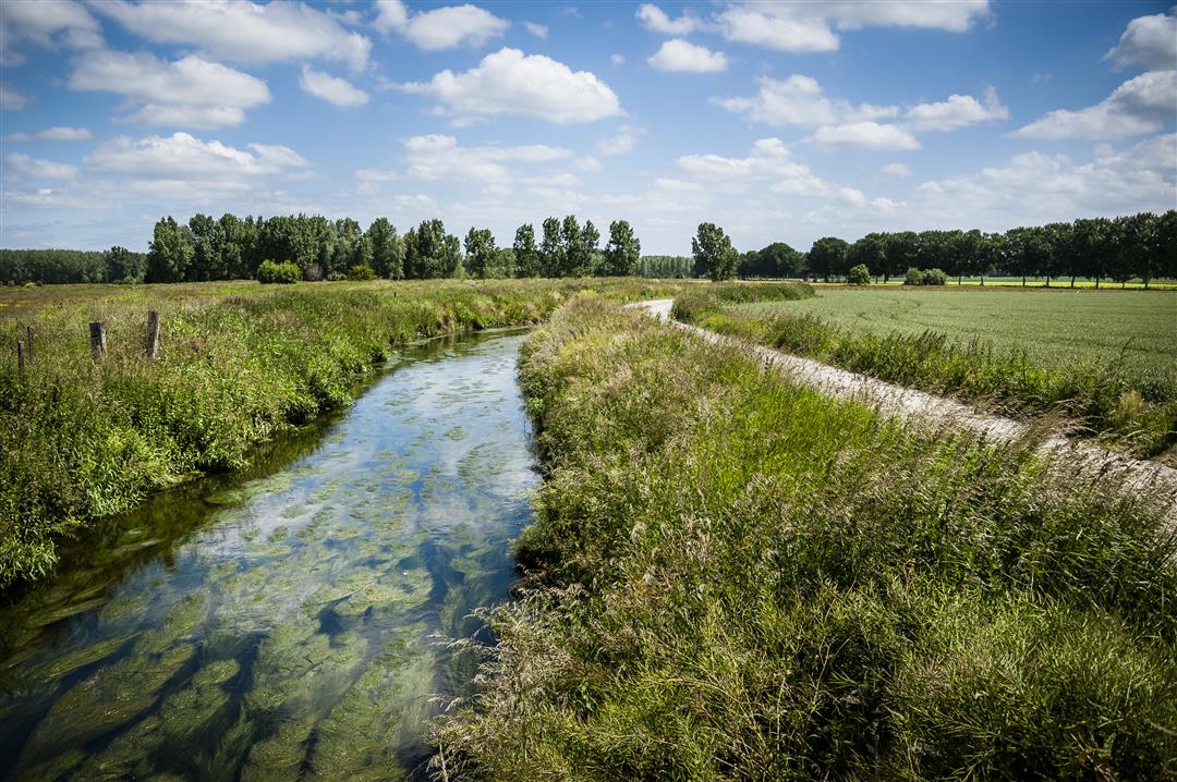
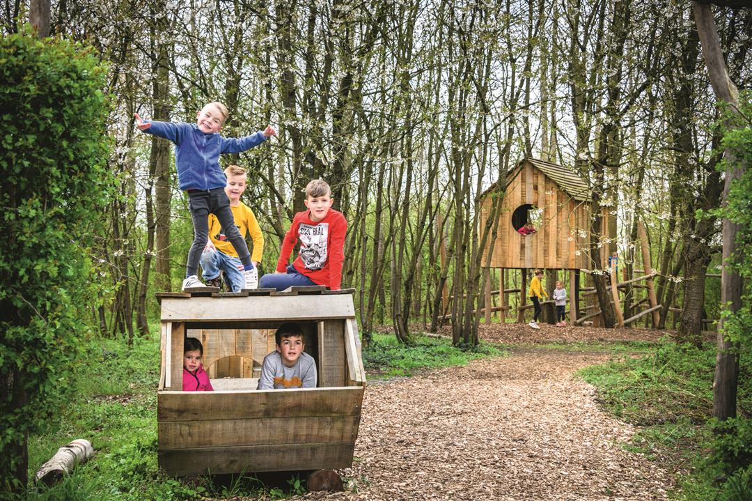
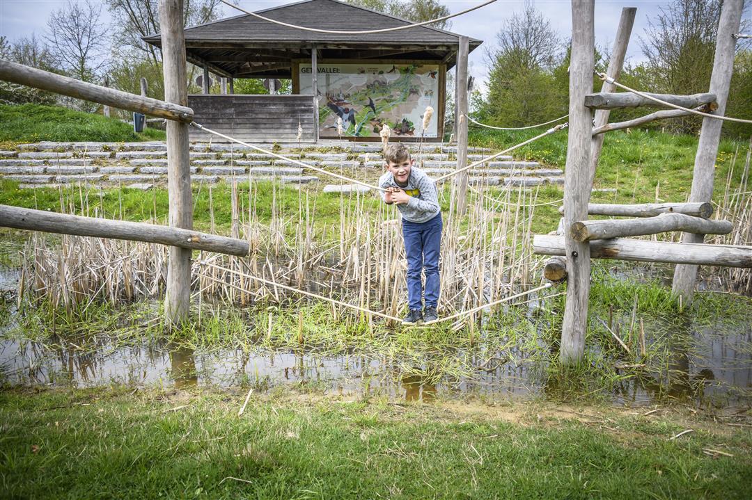
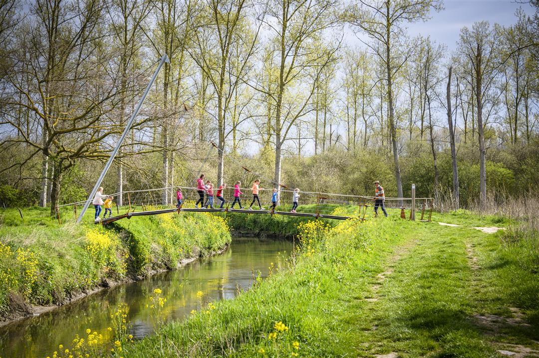
A beautiful walk into the heart of the Gete Valley through a patchwork of meadows, woods, hedgerows and fruit orchards, between Melkwezer and Drieslinter. In some places you can look as far as you like without detecting a house. This hike takes in the adventure trail in Drieslinter. Children have fun on the playful climbing equipment, with the wobbly Golden Geet suspension bridge as an eye-catcher. At the resting point and bivouac area the Getedraak you can picnic. An ecological toilet is available. On the way back you follow the banks of the Gete and pass the Castle of Wommersom.

This walk is offered by Tourism Flemish Brabant.

automatic translation

Icon nodes to follow nodes to follow

Image node TP
0 km
Image node 131
0.2 km
Image node 130
0.9 km
Image node 129
1.7 km
Image node 100
2.3 km
Image node 19
2.9 km
Image node 19
2.9 km
Image node 19
2.9 km
Image node 140
3.1 km
Image node 1
3.9 km
Image node 10
4.5 km
Image node 138
5.2 km
Image node 101
6.1 km
Image node 102
7.2 km
Image node 103
7.3 km
Image node 122
8.8 km
Image node 123
10.2 km
Image node 124
11.2 km
Image node 136
11.6 km
Image node 135
11.8 km
Image node 131
12.5 km
Image node TP
12.8 km
This route has 1 review(s).
Rate route!

Sunday, August 2, 2020 by Eef VerschuerenVery nice hike, mostly in nature. I hiked on Sunday and there were a fair number of other hikers. I suspect it is pleasantly quiet throughout the week.
automatic translation

Which POI do you want to show on the map?

Experimental hiking network
Unsigned icon

The route you have chosen runs (partly) along an experimental virtual hiking node network (the blue-coloured nodes and sections on the map).

You must be logged in to plan routes here.

Experimental hiking network
Unsigned icon

The route you have chosen runs (partly) along an experimental virtual hiking node network (the blue-coloured nodes and sections on the map).

These routes are not controlled in the field. Before you start hiking here, take a minute to read what an experimental hiking node network is and what rules you should follow when hiking here.