 Hiking
 Login
Login More
More EN
EN Premium
Bootwalk
automatic translation
11.7 km • Landen
 official route
route offered by
 Addresse starting point (approximate)
Station Ezemaal, Kraanbeekstraat, 3400 Ezemaal (Landen)
 signage
The route is not signposted. Use a GPS device or our app to follow the route through the virtual nodes.
 Description
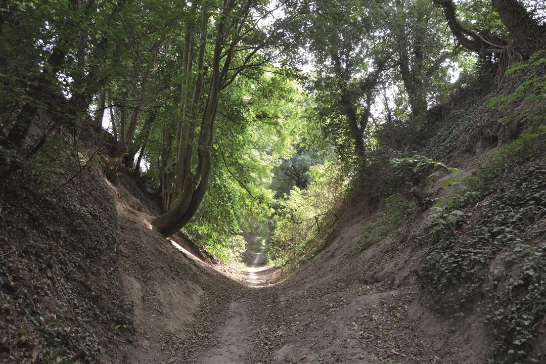
A brisk walk takes you from the village of Ezemaal to Laar and back, along beautiful hollow roads and the banks of the Gete. The most beautiful hollow road in Brabant Haspengouw is definitely the Via de Longa, with flanks up to ten meters high.
NOTE: This is a hike on a virtual hiking network. The nodes are not signposted on the property. Follow the 6-sided red and white signs with the name of the hike.
This hike is offered by Tourism Flemish Brabant.
automatic translation
 nodes to follow
0 km
0.4 km
2.3 km
4.4 km
5.5 km
7.2 km
9.7 km
10 km
10.6 km
11.3 km
11.7 km
Tuesday, August 8, 2023 by D.B.Beautiful walk with lots of variety, forests, fields, vistas, animals. In short we love it!!! Also a big plus: lots of benches and bins along the way, so ideal for walking with the dog. For us a big 10!
automatic translation
Wednesday, March 15, 2023 by P.P.Nice quiet hike with views, especially the first part, and it will be even more beautiful in a few weeks. Perfectly marked, too. But. I chose that hike for a quick walk without boggy roads, and it hit me right away, due to work in the first stretch. It was plodding, even on some paved roads.
automatic translation
Sunday, July 10, 2022 by N.R.Starting point ? 50/50 paved roads, is too much. In this area you can make up nicer walks without the paved roads.Otherwise beautiful views and open fields. Better hiking with GPS.
automatic translation
Friday, June 25, 2021 by Luc VancampNice quiet walk, views over fields, varied nevertheless, of everything. The misleading photo, from the previous review is indeed at the end, in a very nice hollow road. Highly recommended !
automatic translation
Saturday, November 14, 2020 by N.C.This hike does have signage with 6-sided signs labeled "Laar" hiking trail.
automatic translation
Monday, September 28, 2020 by R.B.nice, quiet walk , long roads .... photo is a little misleading :)
automatic translation


 Upgrade to Premium Plus
