 Hiking
 Login
Login More
More EN
EN Premium
Demerville Walk
automatic translation
14.6 km • Aarschot
 official route
2.0651 8 3.8/5
route offered by
 Addresse starting point (approximate)
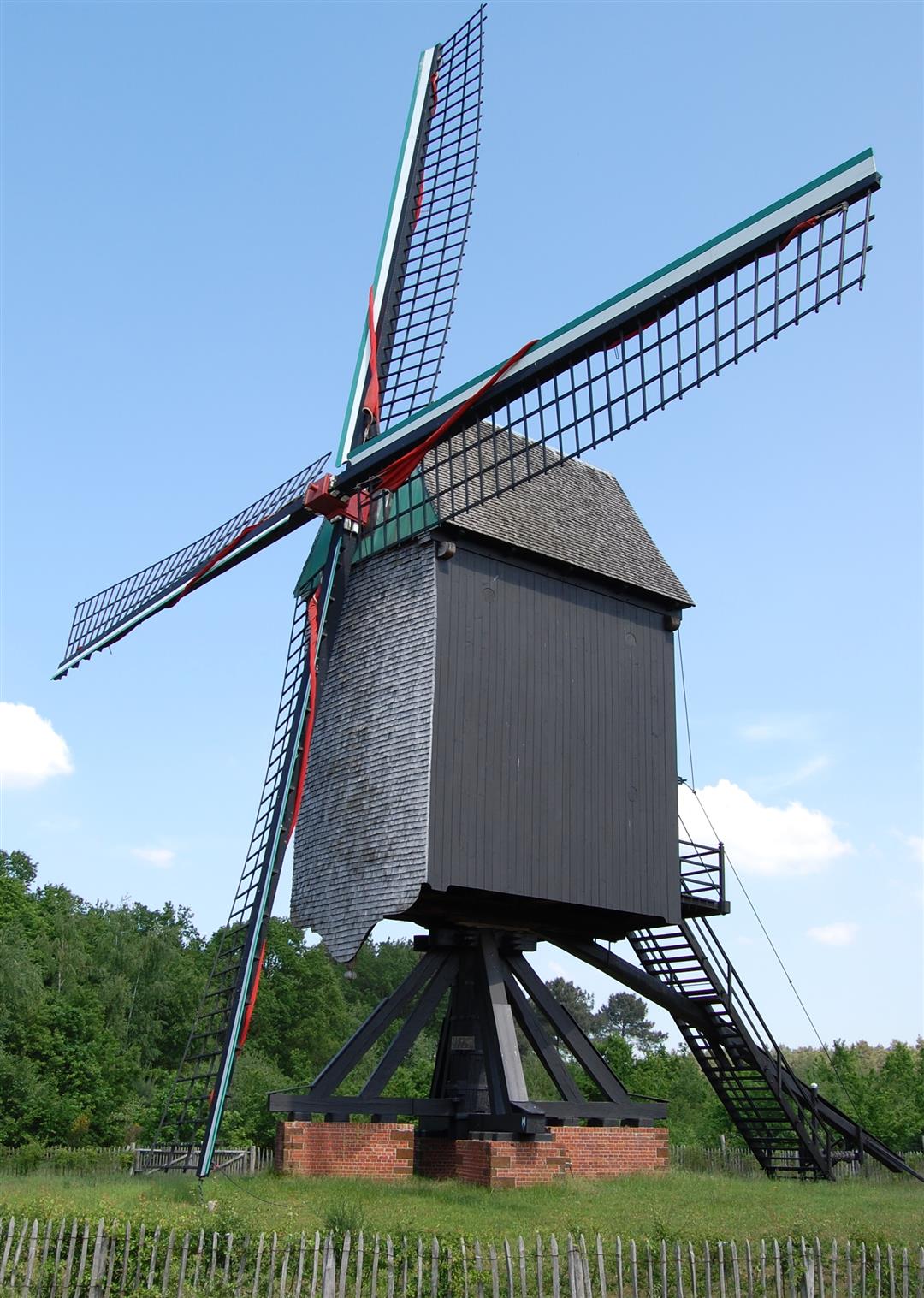
Heimolen, Windmolenstraat, 3201 Langdorp (Aarschot)
 signage
The route is fully signposted with nodes.
 Description
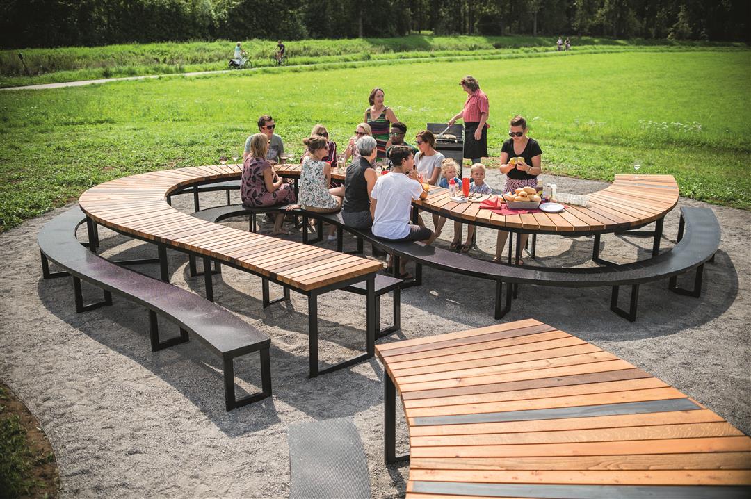
Start at the heimolen and discover the small-scale park landscape of oak-birch coppice forests, interspersed with open heaths, meadows, fields and fens. You might even encounter a hare or deer along the way. You'll pass by the picturesque village center of Langdorp, where you can take a break at the Demertrefplaats: a meandering table of no less than 35 meters long with a view of the Demer Landscape.
This walk is offered by Tourism Flemish Brabant.
automatic translation
 nodes to follow
0 km
0.4 km
2 km
3.6 km
4.2 km
5.7 km
6.9 km
7.9 km
9 km
10.1 km
10.3 km
11.7 km
13.5 km
14.4 km
14.6 km
Thursday, August 15, 2024 by P.P.Very quiet, it is sometimes surprising how such a densely populated Flanders still has so much nature. Forests, heaths, Demer valley, beautiful. No problem with the junctions. Only to 121, through a meadow one should not turn right along a hedge but right. It does go about 100 m and there is another sign. Lots of shade, welcome in summer.
automatic translation
Tuesday, June 20, 2023 by J.D.Too bad about the missing numbers. So the route is not maintained. It was nice and beautiful until between 252 and 719, with quiet forest trails.... Then long search,.... I didn't have a good map with me and on hikes, I like to leave my cell phone at home for once. So I had to retrace my steps. I think a nice hike if you find them.
automatic translation
Wednesday, June 1, 2022 by L.E.The signs between 410 and 121 are still missing(see review 11/2021 by other hiker). Several signs are also missing at the beginning of the hike between 262 and 719. Mail has been sent and hope the problem is solved. It is a nice hike though, very quiet, lots of nature and nice picnic area along the way.
automatic translation
Monday, November 1, 2021 by Roger Schoetersbetween point 410 and 121 are missing 2 poles to easily follow the correct route. a very nice hike with lots of nature of which a lot of forest. almost always good passable roads.
automatic translation
Monday, August 23, 2021 by L.N.21-08-2021 - Definitely a nice hike but quickly interrupted by the numerous mosquitoes. We will redo that hike in another season without mosquitoes.
automatic translation
Saturday, April 17, 2021 by T.G.Particularly beautiful and peaceful hike! Absolutely recommended. You can also easily shorten in 2 places if you want (to about 6 or to 10 km). Possibly it's busy on weekends, I also saw many tire tracks of MTBs. However, I did the hike on a Tuesday afternoon, which was obviously a particularly quiet time. One to repeat.
automatic translation
Friday, February 19, 2021 by M.V.Very nice hike, definitely recommended. Lots of mountain bikers on trail though.
automatic translation
Sunday, January 10, 2021 by L.C.At the start at the mill it is like entering another world, sandy soil, coniferous trees, in short beautiful quiet surroundings. Farm trails, forests, endless vistas. The (frozen) fog did make for beautiful natural scenery. Swampy sections so make sure you have appropriate footwear! Looking forward to hiking this again in another season.
automatic translation


 Upgrade to Premium Plus
