 Hiking
 Login
Login
 More
More
 EN
EN
 Premium
Rupelmond creek hiking trail
automatic translation
7.8 km • Kruibeke
 official route
6.11715 9 4.4/5
 Addresse starting point (approximate)
Kerk , 9150 Rupelmonde
 signage
The route is fully signposted with thematic signs (no nodes).
 Description
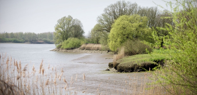
Start in the center of Rupelmonde, near the Scheldt. Stroll through the southern part of the Polders of Kruibeke through alder thickets and meadow bird habitat. Keep your eyes open and ears tuned: beavers and roe deer are not easy to spot!
The Rupelmond Creek walking route is offered to you by Routen, an initiative of Tourism East Flanders.
automatic translation
Sunday, February 1, 2026 by Hilde Vanthuyne hildeBeautiful route, can be soggy at the beginning
automatic translation
Thursday, July 31, 2025 by V.G.Beautiful hike. Ideal for birdwatching. Only downside is that the signage at the starting point is hard to see so we lost half an hour looking for the right route.
automatic translation
Sunday, June 6, 2021 by S.W.Wonderful hike through beautiful natural area! Highly recommended. At start and finish there is catering. Along the way not
automatic translation
Sunday, June 6, 2021 by J.D.nice walk,until about halfway very nice but the 2nd part quite monotonous,also very badly signposted,signs disappeared or invisible
automatic translation
Monday, May 31, 2021 by M.S.Very beautiful and varied hike. Absolute must (we made this hike end of May ) A tip ! When leaving " Het Beverpad" go directly right, there's no direction indicated (we didn't find it at all).
automatic translation
Monday, May 24, 2021 by K.D.Hilde VdV is right! Highly recommended hike.
automatic translation
Sunday, March 21, 2021 by Hilde VdVCar-free hike through beautiful natural area. Sturdy footwear is a must because of the many unpaved roads through bushes, woods and reeds. Discovered some nice buildings along the way that you can admire from nearby. Rupelmonde center seems like a nice village, just a pity we couldn't visit a place to eat or drink because of Corona.
automatic translation
Friday, January 29, 2021 by Peter Van der HaegenVaried hike with a very nice stretch along the creeks.
automatic translation
Tuesday, December 15, 2020 by M.B.Nice hike with good variation between paved and non-paved sections. Especially the part in the creeks is super.
automatic translation


 Upgrade to Premium Plus
