 Hiking
 Login
Login
 More
More
 EN
EN
 Premium
Liezele, a ghost village around the fort
automatic translation
8.3 km • Puurs-Sint-Amands
4.5209 3 1.7/5
route offered by
Toerisme Provincie Antwerpen
 Addresse starting point (approximate)
Fortbaan 29, 2870 Liezele-Puurs
 signage
The route is not signposted. Use a GPS device or our app to follow the route.
 Description
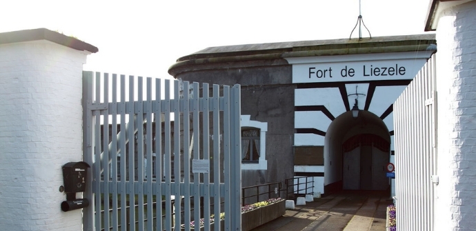
About the burning down of Liezele, the battle for the fort and the bitter war years in total poverty. The fort of Liezele is one of the best preserved forts of the Defence Line of Antwerp, a double belt of forts and entrenchments built to defend the National Reduit. From the fort you can walk to the village center, the Schemelbert Mill, the Wolf Chapel, Hof ter Bollen and the place where the emergency church of Liezele used to be. Especially for 100 years of the Great War you can also walk in the Fort of Liezele with an audio guide.
automatic translation
Sunday, October 20, 2024 by M.V.Positives: fairly nice route with lots of variety. Negatives: much of the trail goes on the roadway with quite a bit of traffic and no real footpath. As on most hikes, again, there is no opportunity along the way to get something to drink and/or visit the restroom.
automatic translation
Monday, July 27, 2020 by GILBERTE DE BLOCKBeen to Liezele for the third time in a row , and haven't seen our own signage either. But occasionally walking nodes, 115, 125,126,127,128,121,122,123 Too bad, have therefore only done their own walk. Which walking route do these nodes belong to? There were even some in the nature reserve domain " Tekbroek", which was really worthwhile.
automatic translation
Tuesday, July 21, 2020 by E.T.the walk, according to you, did not find its own signage, too bad, therefore mapped out its own walk!
automatic translation


 Upgrade to Premium Plus
