 Hiking
 Login
Login
 More
More
 EN
EN
 Premium
Roosenberg hiking trail (red)
automatic translation
6.6 km • Waasmunster
 official route
5.0515 3 4.3/5
 Addresse starting point (approximate)
Gentstraat 13, 9250 Waasmunster
 signage
The route is fully signposted with thematic signs (no nodes).
 Description
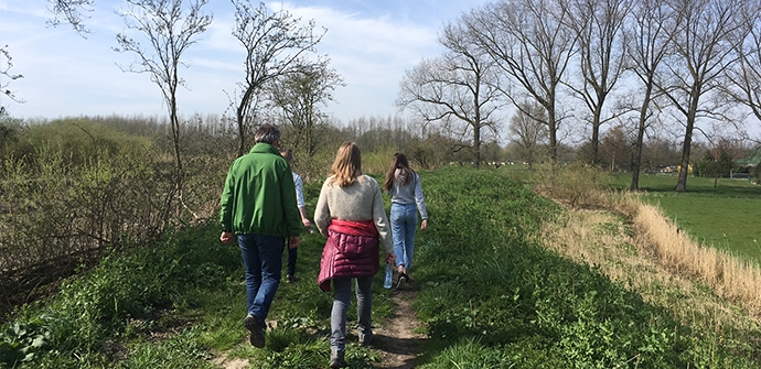
The walking route "Roosenberg" consists of two walking loops, red (6.6km) and blue (7.3km), which introduce you to the surroundings of Waasmunster. Discover the landscape along the Durme where lakes, forests and heaths alternate. Historic slow roads, an old railroad bed, and several castles and abbeys make this a very varied walk.
The Roosenberg hiking trail red is offered to you by Routen, an initiative of Tourism East Flanders.
automatic translation
Sunday, March 7, 2021 by E.D.Beautiful route, beautiful nature, good clear signage, not too long. On dike next to the Durme it can be a bit boggy. Difficult with baby carriages.
automatic translation
Monday, December 14, 2020 by F.S.Nice hiking trail, good walking shoes or boots are a must, especially in wet weather. Many mountain bikes ride on the dike, so it is quite muddy. The route is perfectly signposted. If you like absolute silence, you must take into account that the E17 is always present. But definitely recommended, nice piece of nature close to the city.
automatic translation
Tuesday, November 10, 2020 by P.M.Beautiful,well marked hike, lots of nature and wooded area. Fun to do,and to redo. Combines well with the green walk.
automatic translation


 Upgrade to Premium Plus
