 Hiking
 Login
Login
 More
More
 EN
EN
 Premium
Peat pit hiking trail
automatic translation
10.2 km • Berlare
 official route
8.28224 8 3.9/5
 Addresse starting point (approximate)
Donklaan 123, 9290 Berlare
 signage
The route is fully signposted with nodes.
 Description
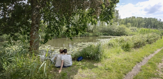
Lake Donk in Berlare is one of the oldest tourist attractions in Berlare, thanks to the diligent labor of local peat cutters, without whom this lake would never have been there. We follow their trail through Berlare Broek, a gem of a nature reserve along a forgotten meander from thousands of years ago.
ThePeat pit hiking trailis offered to you byRouten, an initiative of Tourism East Flanders.
automatic translation
 nodes to follow
0 km
1.6 km
1.8 km
2.7 km
3 km
3.2 km
4 km
4.5 km
5.8 km
6.6 km
7.7 km
9.3 km
10.2 km
Tuesday, January 20, 2026 by K.D.Very beautiful walking route! Lots of nature and mud... everywhere. Tip: wear waterproof walking shoes instead of white sneakers :)
automatic translation
Sunday, November 9, 2025 by Sylvia Van Der Lindenbeautiful route
automatic translation
Sunday, June 1, 2025 by I.D.Beautiful natural area! Good trails with lots of forest and nature.
automatic translation
Sunday, August 11, 2024 by K.S.beautiful route, varied, no difficult paths , do take a drink for the road, hiked on 8/'24
automatic translation
Tuesday, January 24, 2023 by pierre vlerickbeautiful,flat route/good signage/in this period (January)waterproof walking shoes recommended to wade through 2% muddy paths . Much unpaved and away from king car .
automatic translation
Saturday, April 17, 2021 by Jo MarceloBeautiful varied hike. Just had to search a bit at the start, kp 9 is not signposted. Apart from a small stretch of muddy path, it was well walkable everywhere. At the end of the hike we were able to eat some smoutebollen at a stall at the lake, which completed a beautiful day. We enjoyed it.
automatic translation
Thursday, April 1, 2021 by C.V.only around the lake is beautiful! the truf wells around it gene vette .
automatic translation
Wednesday, March 18, 2020 by J.D.Note: There are works at the Duck Decoy so you cannot go from node 7 to node 1.
Alternative: 7 - 6 - 5 - 4 - 3 - 2 - 9 (starting point).
Is about three kilometers more though.
automatic translation


 Upgrade to Premium Plus
