 Hiking
 Login
Login
 More
More
 EN
EN
 Premium
Welle and Kapellemeersen hiking trail
automatic translation
11.8 km • Denderleeuw
 official route
4.1357 6 2.2/5
 Addresse starting point (approximate)
Stationsstraat 7, 9470 Denderleeuw
 signage
The route is fully signposted with thematic signs (no nodes).
 Description
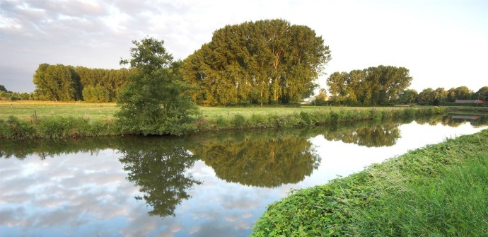
Walk through the greenery around Denderleeuw, such as the Wellemeersen and Kapellemeersen nature reserves. These are intact flood plains of the Dender, with unique fauna and flora. Boardwalks have been constructed on swampy stretches. Highly recommended for nature lovers!
automatic translation
Monday, August 29, 2022 by Yves VlasselaerPoor in all areas, unworthy of a hiking trail. Steps on a boardwalk that looks dangerous (unstable and missing planks), then a stretch along a railroad, the next stretch runs through the center of Erembodegem (watch out here several signs are missing), and then back to the start along an endless towpath with numerous cyclists.
automatic translation
Friday, February 26, 2021 by B.D.Hike with lots of mud and barely 1 decking path (of only a few meters). Once out of the mud it was walking along either railroad or highway. The noise of the highway was present almost half the time. We really could not enjoy the tranquility of nature. So we also cut off a section to finish faster....
automatic translation
Sunday, January 31, 2021 by A.D.Lovely hike with lots of mud and water. Without boots guaranteed wet feet. Didn't miss a sign anywhere. Gpx file along as backup but not needed.
automatic translation
Wednesday, January 6, 2021 by A.V.Beautiful route, but only 1 deck trail. We also occasionally helped ourselves with the gpx file because a sign is missing here and there.
automatic translation
Wednesday, September 2, 2020 by Hubert Van rossemA major frustration. One the starting point is the search for a directional sign. One in the park of the castle and then nothing. Finally after talking to some locals I ended up in the Wellemeersen with the arrows. Hooray found .... until after a few kilometers there are no more signs.
automatic translation
Sunday, July 12, 2020 by T.V.Not highly recommended, listed on routen.be under boardwalks, barely 1 walked on entire route!
automatic translation


 Upgrade to Premium Plus
