 Hiking
 Login
Login
 More
More
 EN
EN
 Premium
Afsnee-Choice hiking trail
automatic translation
9.2 km • Ghent
 official route
7.29210 5 2.8/5
 Addresse starting point (approximate)
Afsneedorp, 9051 Afsnee
 signage
The route is fully signposted with thematic signs (no nodes).
 Description
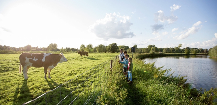
2 walking loops with the Goedinge bridge as a node. The bridge connects the kouter of Afsnee with the Keuzemeersen nature reserve. Walk through open farmland and beautiful nature. Highly recommended for nature lovers!
The Afsnee-Keuzemeersen walking route is offered to you by Routen, an initiative of Tourism East Flanders.
automatic translation
Tuesday, May 25, 2021 by Frank Van ackerBeautiful, quiet walk. We used the ferry in Afsnee to combine this hike with the Assel hike. This brings you to about 16 kilometers. The Assel hike is just a little more beautiful.
automatic translation
Friday, May 21, 2021 by Chris VerborgtVery nice hike but one section is not walkable. We had to crawl under the barbed wire to a neighboring meadow to continue hiking. It is, of course, a very wet spring.
automatic translation
Sunday, April 18, 2021 by J.V.Very nice walk, in the beginning a bit along houses, but then you are rewarded with beautiful views of the Lys and its surroundings, back along fields. The Goedinge bridge is also definitely worthwhile and especially with those stairs to go under the E40. It is muddy, actually quite wet in the Keuzemeersen. We enjoyed it. Jos and Rita
automatic translation
Monday, February 1, 2021 by Y.S.The start in Afsnee is picturesque, then you stay in built-up areas for a while. Closer to the E40 the noise becomes disturbing. Once past the bridge you enter the Keuzemeersen. You can't walk closer to the Lys! But freeway noise remains. Also pay attention during heavy rainfall. Then certain parts of the path can be flooded and inaccessible.
automatic translation
Saturday, November 14, 2020 by H.S.Too little nature. Mainly through built-up streets. Then through fields, but with the constant noise of the E40 in the background. Disappointing.
automatic translation


 Upgrade to Premium Plus
