 Hiking
 Login
Login More
More EN
EN Premium
In the green of Bassevelde hiking trail
automatic translation
12.9 km • Assenede
 official route
5680 3 3/5
 Addresse starting point (approximate)
Landsdijk, 9968 Bassevelde
 signage
The route is fully signposted with nodes.
 Description
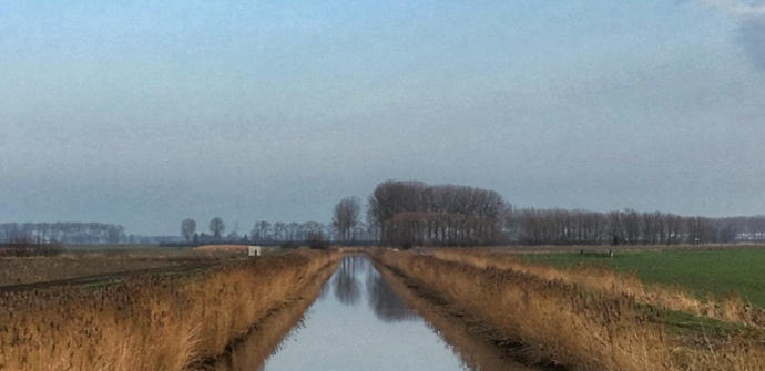
From the protected village kiosk in Bassevelde, set course toward the vast Isabella polder. The name pays tribute to Archduchess Isabella of Austria, under whose reign this watery area took its present form. The dikes bear witness to the fierce battle with the sea, which left no opportunity to strike back. Walking here, one has a constant view of the beautiful little church of Landsdijk, and in the distance the imposing fellow churches of Bassevelde and Watervliet.
automatic translation
 nodes to follow
0 km
1.4 km
3.1 km
4.7 km
6.2 km
8.2 km
8.5 km
9.8 km
10.8 km
12.9 km
Saturday, April 17, 2021 by B.P.Not a nice route. Many long straight stretches with no variation. In addition, several times you walk on a two-lane road with no room for pedestrians. Not recommended for hiking with children!
automatic translation
Wednesday, April 14, 2021 by Frans Van avermaettoday 14/04 hiked the trail,a well mapped out route along quiet roads.i would say this is good both for recreational walking and for those who want to get through,the whole route are paved roads ( so in rain no problem )and they are also car free.it is agricultural area so wherever you walk,only nature around you.
automatic translation
Wednesday, November 11, 2020 by F.L.Ideal route for those who love peace and quiet and the countryside. Almost 100% car-free roads. Also very suitable after days of rain because the route consists only of paved roads for a few hundred meters.
automatic translation


 Upgrade to Premium Plus
