 Hiking
 Login
Login
 More
More
 EN
EN
 Premium
Four Extremes hiking trail loop 2
automatic translation
12.5 km • Lede
 official route
3.8794 4 2.6/5
 Addresse starting point (approximate)
Smetlededorp, 9340 Smetlede
 signage
The route is fully signposted with thematic signs (no nodes).
 Description
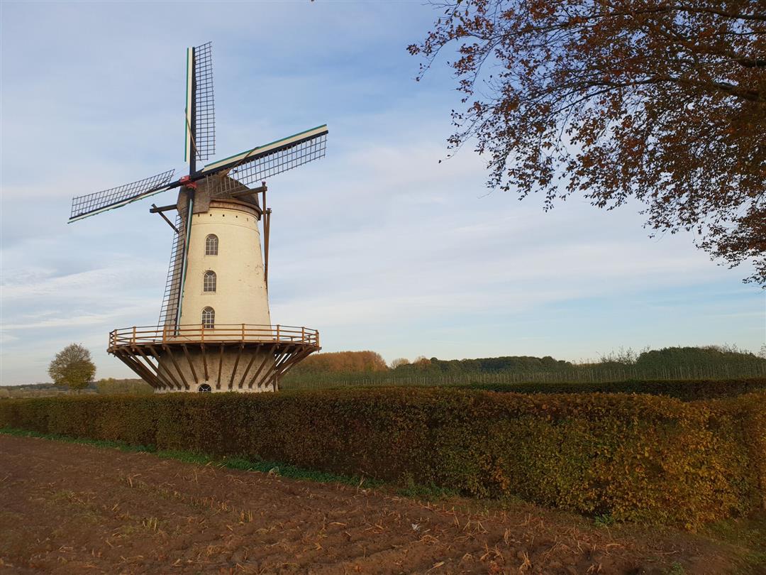
Walk along the "Four Extremes" of Scheldeland: the parishes of Impe, Wanzele, Smetlede-Oordegem and Serskamp. Go through a rural area with some small forests and valuable green areas. The eye-catcher: the stately Fauconniersmolen windmill which dominates the wide surroundings.
automatic translation
Sunday, November 6, 2022 by Greta CoolsVery rural, quiet, good alternation of hard and soft surfaces, discovery of new natural points and places to walk, a nice variation among the local walks. For the moment 2 signs too short: 1st when you arrive at the top of the fields - turn left, 2nd when you come to the Guchtstraat, then you have to turn right.
automatic translation
Saturday, July 3, 2021 by Danny Van clapdurpbeginning of the route is particularly beautiful. Unfortunately, many of the markings have disappeared. Probably as a result of renovations they made to the roads in Lede. As a result, we had to walk a long stretch along the busy road back to starting point. Too bad!
automatic translation
Monday, January 25, 2021 by Willy De Regge-HeysePretty nice hike, with occasional field roads and otherwise paved roads. Despite parts ordinary road, still predominant silence. One minus, three road signs disappeared: the first after 500 meters (just go straight on) the second and third at the exit of the forest (turn left and 100m further right and you are on the right road)
automatic translation
Sunday, May 3, 2020 by I.C.nice and quiet walk along mostly paved roads.
However, I did not see a mill. Eventually it turned out to be about 4 km away.
automatic translation


 Upgrade to Premium Plus
