 Hiking
 Login
Login
 More
More
 EN
EN
 Premium
Four Extremes hiking trail loop 1
automatic translation
9.7 km • Lede
 official route
3.9094 3 2.5/5
 Addresse starting point (approximate)
Smetlededorp, 9340 Smetlede
 signage
The route is fully signposted with thematic signs (no nodes).
 Description
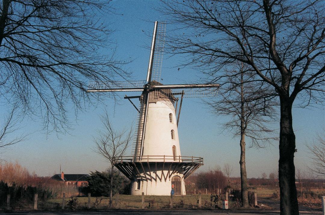
Walk along the 'Four Extremes' of Scheldeland: the parishes of Impe, Wanzele, Smetlede-Oordegem and Serskamp. Go through a rural area with some small woods and valuable green areas. The eye-catcher: the stately Fauconniersmolen windmill that dominates the wide surroundings.
automatic translation
Saturday, November 27, 2021 by C.P.Pleasant, fairly quiet route. You do hear the traffic from the E40 in the background. After a rainy period, the trail does get quite boggy. Adapted footwear required. Oud-Smetleedse bossen or Serskampse bossen: trail is unclear because of fallen leaves. On some sections I walked parallel to the route, thanks to GPX.
automatic translation
Sunday, January 24, 2021 by Jean-pierre BedinImpossible. Mud up to the knees
automatic translation
Monday, July 20, 2020 by Marie De rhoFrom the chapel in the woods, the path to smetlede road was impassable almost . That urgently needs to be done
automatic translation


 Upgrade to Premium Plus
