 Hiking
 Login
Login
 More
More
 EN
EN
 Premium
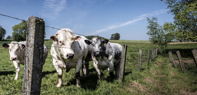
Between Parike and Deftinge hiking trail
automatic translation
10.9 km • Lierde
 official route
4.8567 9 3.4/5
 Addresse starting point (approximate)
Kruisstraat 1, 9570 Lierde
 signage
The route is fully signposted with nodes.
 Description
The Flemish Ardennes has invested heavily in its hiking infrastructure and now has more than 850 kilometers of interconnected hiking trails. This hike introduces you to Flanders' Most Beautiful Landscape via our hiking nodes. You can choose to walk the full route or explore one of the shorter loops. Have fun!
TheTussen Parike en Deftinge hiking trailis offered to you byRouten, an initiative of Tourism East Flanders.
automatic translation
 nodes to follow
0 km
1.7 km
2.5 km
3.6 km
4.3 km
5 km
5.8 km
7.3 km
8.8 km
9.7 km
11 km
Sunday, February 8, 2026 by Bert Vanden HerrewegenWe thought it was a nice walk. Not boring or dangerous at all, as some people here suggest.
automatic translation
Sunday, February 1, 2026 by Kurt Van LaereNot recommended. Between Parike & Deftinge it is fairly quiet, but also quite boring. And almost everything is paved. Between Deftinge and Parike, it is slightly nicer walking, but occasionally there are busier roads. And there is an irresponsibly dangerous section that is extremely narrow between barbed wire. There are also often damaged sections or surfaces with lots of potholes.
automatic translation
Sunday, April 25, 2021 by M.G.Based on the reviews we expected this to be a beautiful trail but alas. About half of the walk is through streets with houses, you also walk a lot on stone roads, the noise of the stone road is always nearby. Only the kilometers between Deftinge and Parike are worthwhile.
automatic translation
Tuesday, February 16, 2021 by Caroline De CockPretty nice walk. More than half are hiking trails and field roads. Not too crowded on a winter Saturday, either. Nice views, but nothing overwhelming
automatic translation
Sunday, December 6, 2020 by Willy De Regge-HeyseBeautiful varied route, but due to the rain of the past few days , a lot of mud and difficult strips. Also, some paths are partly or completely taken by farmers. For the starting place, best enter Deftinge in gps instead of Lierde, both have a cross street and this one of Lierde is not on the trail at all.
automatic translation
Saturday, July 11, 2020 by Caroline Van Parys Very nice hike , yet more concrete than we are used to , but highly recommended
automatic translation
Wednesday, June 3, 2020 by M.S.Beautiful and quiet walk,
Signposts are numerous and very clear, and above all, they're in the right place, no matter which turn or curve you come from, you don't have to look for them. Little concrete, lots of little roads and paths with beautiful views. Definitely recommended!
automatic translation
Sunday, May 24, 2020 by Tanja Van wesemaelBeautiful hiking trail along the beautiful Flemish Ardennes , wonderful views and beautiful pieces of nature .
automatic translation
Monday, May 4, 2020 by T.D.the pats were overgrown and some had been worked in by the farmer
otherwise it was a very nice course
automatic translation


 Upgrade to Premium Plus
